Download
1 / 19
190 likes | 208 Vues
Explore the dynamics of thunderstorms and tornadoes, discussing vertical velocities, potential instability, and storm complexities. Learn about airmass thunderstorms, severe weather conditions, and more. Envelope calculations and atmospheric phenomena are explained.

E N D
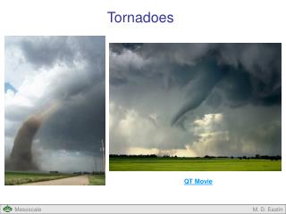
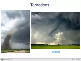
Lecture 23: Map discussion + Thunder & Tornadoes (Ch 11) • brief map discussion and/or storm video • cloud buoyancy & order-of-magnitude estimate for vertical velocity • potential instability • airmass thunderstorm • severe thunderstorm & thunderstorm complexes
warming aloft since Wed • saturated, stable lower troposphere • low-level SE, W aloft
12Z Fri 3 Nov., 2006 • the more zonal current and associated increase in thickness, anticipated by Wednesday’s GEM 48 hr prog, has appeared • warm thickness adv. at 500 mb • warm adv. from SE at 850 (lifting over cold dome of surface air?
12Z Fri 3 Nov., 2006 • noise problem with sfc isobars on preliminary CMC sfc chart (result on newly refined resolution of global forecast runs, used in the analysis which blends obs + fcst) • easterlies in C. Ab… upslope • weak sfc low in SW Ab.
Buoyant acceleration of an air parcel Let W be the vertical velocity of an air parcel, and let W be the change in W over time interval t. Then W/t is the parcel’s acceleration. Let T0(z) be the height-varying temperature of the environment, and let T’ be the difference between the parcel’s temperature and the environment at the same level (z). Newton’s law can be written: (again, this is an approximation) The pressure gradient force and gravity almost balance each other (they do so exactly in a well-mixed, hydrostatic atmosphere); but the parcel’s temperature deviation T’ gives rise to the “reduced gravity” force gT’/ T0which may have either sign.
Back-of-envelope calculation for vertical velocity in a deep convective cloud W depth h Envir. T0 Cloud TC T’ = Tc – T0 • note: TC(z) folllows moist adiabat • accel’n: g (TC – T0) / T0 ~ 10 * 5 / 300 • rise time: h / W • accel’n * time: W = g (TC – T0 ) / T0 * h / W • W 2 = g (TC – T0 ) / T0 * h
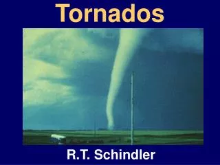
Thunderstorm: organised (coherent) 3-d atmospheric motion • takes place in an atmosphere that is in a “conducive” state, and locally modifies that state • “organised” implies some sort of a co-ordinated, self-perpetuating pattern of winds (U,V,W), pressure (P), temperature (T) and humidity (Q) that can persist for many minutes and perhaps even for hours • energy for the motion derives from a pre-existing store of energy (gravitational potential energy & latent heat)
Airmass thunderstorm: short-lived, isolated, scattered within warm humid airmass, self-extinguishing • Severe thunderstorm: winds exceed nearly 100 kph or hailstones exceed nearly 2 cm or storm spawns tornado For this to occur updrafts and downdrafts must remain separated and reinforce each other to intensify and prolong the storm. Require very warm, humid surface air, conditional instability, wind shear + trigger
Thunderstorm - occurs in conditionally unstable atmosphere - why? • To get energetic cloud, must release stored potential energy (warm, moist near-ground air) in a small region - “concentration” or “focusing” of energy release • In conditionally-unstable atmosphere most unsaturated parcels rising will experience a restoring force… but those few that rise high enough to saturate, will result in deep, energetic clouds whose updraft causes surface convergence - sucking in the energy (warm, moist air) to this “focal point” • “Trigger” selects the storms which “succeed” - unequal surface heating, or terrain slopes or irregularities, or (in case of “severe thunderstorm”) frontal lifting • An elevated temperature inversion may suppress deep convection for a time, but the “potential instability” (Sec. 11-3) is such that an eventual storm that does develop is likely to be more explosive
Potential Instability Warm & dry Warm & moist Sec. 11-3, Fig 1 • dewpoint lapse rate 2oC per kilometer • imagine both parcels lifted 500 m… lower parcel (T,Td)=21,21 but upper (22,18) • lift a further 500 m… lower (18.5,18,5) but upper (17,17) • column has been destabilized • elevated inversion common • in lee of Rockies due to • subsidence • (“capping inversion”)
Airmass thunderstorm • weight of rain and/or graupel initiates downdraft; if precip falls into unsaturated air (eg. mixed in by entrainment), its evaporation chills the downdraft • storm consists of several such cells (updraft + downdraft) of differing ages T0(z) Ice crystals • downdraft kills off the updraft • most of the precip particles (water & ice) evaporate again • successive surges of warm moist air form light Cu whose evaporation humidifies the column; progressively deeper Cu • cloud grows above freezing level – Bergeron process initiated Fig 11-7
Severe thunderstorm • favourable conditions over large area causes clusters of storms that interact (mesoscale convective system) – organized linearly (“squall line” along front) or not (“MCC”) • favourable mesoscale pattern permits prolonged separation of updraft & downdraft • wind shear is the key (low level SE or S + mid level SW or W) Fig 11-14 The shear is better seen in the animation/video
Mesoscale Convective Complex (MCC) • downdraft from individual cell moving to ENE drives under warm moist SE stream (“outflow boundary”) initiating a new cell on the south flank of the complex. Thus cluster as a whole moves in a direction deviating from individual storms older cells on N flank cut off from the low-level warm, humid SE Warm humid low-level SE SW or W or NW flow in mid-troposphere Fig 11-11
Downdraft produces gust front, associated with which may see shelf cloud (“arcus”) and occasionally roll cloud Fig 11-16
Shelf cloud… Photo by Tom Eklund
Downburst Particularly intense downdraft over small area (diameter < 5 km) spreads out at ground… many larger airports now protected by warning system based on “Doppler acoustic radar” (dopplerized “sodar”… sound detection and ranging) Fig 11-20
Supercell Storm • isolated, single powerful cell with diameter 20-50 km, ie. smaller than MCC, life 2-4 hours • setting for most large tornados • large scale rotation in the cloud, not seen in other types of severe storm • often radar reveals a “hook echo” • doppler radar may reveal the rotation Fig 11-18
Fig 11-19 Small droplets in the warm updraft do not reflect probing radar waves