Download
1 / 58
600 likes | 813 Vues
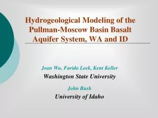
Hydrogeological Modeling of the Pullman-Moscow Basin Basalt Aquifer System, WA and ID. Joan Wu, Farida Leek, Kent Keller Washington State University John Bush University of Idaho. OUTLINE. Introduction Hydrogeologic Setting Methodology GIS database development Ground-water flow modeling

E N D
Hydrogeological Modeling of the Pullman-Moscow Basin Basalt Aquifer System, WA and ID Joan Wu, Farida Leek, Kent Keller Washington State University John Bush University of Idaho
OUTLINE • Introduction • Hydrogeologic Setting • Methodology • GIS database development • Ground-water flow modeling • Results and Discussions • Summary • Position Announcement
INTRODUCTION • The aquifer system in the CRBG is the sole water supply source for the Palouse Basin • The continuous water-level decline and the projected future development have led to serious public concerns • PBAC: a multi-stakeholder, multi-agency (city, county, university) organization promoting conservation and sound ground-water management • The 2003 MOA with PBAC: GIS database
INTRODUCTION(cont’d) Past Studies on Hydrogeological Characterization • Crosby and Cavin (1960) • Foxworthy and Washburn (1963); Jones and Ross (1972) • Bush and colleagues (1998, 2000, 2001, 2003) Past Studies on Groundwater Modeling • Barker (1979), overly conservative • Lum et al. (1990), overly optimistic • Both models proved inadequate by year 2000
INTRODUCTION(cont’d) Goal • To develop a foundation for improved and informed Palouse Basin groundwater resources assessment and management Objectives • To develop a hydrogeology GIS database for the Palouse Basin to improve data accessibility and data processing and analysis efficiency • To develop a groundwater flow model for the basaltic aquifer system of the Pullman-Moscow area based on new spatial and temporal data
HYDROGEOLOGIC SETTING • Palouse loess • Saddle Mts. • Wanapum basalt • Grande Ronde basalt • Imnaha basalt • Pre-basalt CRBG
HYDROGEOLOGIC SETTING (cont’d) • Palouse loess: rural domestic use • Wanapum basalt: major aquifer for Moscow till 1960’s • Grande Ronde basalt: source for more than 90% of water supply, with a recent construction of WSU #8
Occurred during late Miocene and early Pliocene (17–6 mya BP) • Engulfing ~ 1.6×10⁵ km2 of the Pacific Northwest between Cascade Range and Rocky Mt., covering parts of ID, WA, and OR • Over 300 high-volume individual lava flows identified, along with countless smaller flows, with vents up to 150 km long • Eventually accumulating to more than 1,800 m thick • Tectonic origin (Hooper, 1997) • Yellowstone hot spot • Thinning of continental lithosphere due to spreading behind Cascade arc • Proximity of fissure vents to tectonic boundary between accreted terranes and lithospheres of old N. Am. Plate Source: USGS, http://vulcan.wr.usgs.gov/
METHODOLOGY:I. GIS DATABASE DEVELOPMENT • Data Collection • Well log • Groundwater level • Pumpage • Precipitation • Geochemistry • Data Compilation • Digitizing into ArcGIS • Processing existing and new coverages: • Topography • Township and range to UTM conversion of well coordinates • Stream network • Land use • Soil • Watershed boundary
Digitizing & Processing Well Data cont’d A a Well 15/46-31J1 Well 39N/5W-7ad2
Data Analysis Plot long-term hydrographs Separate vs composite Their relations with precipitation and pumpage Build structural contour maps To depict the shape of stratigraphic horizons Construct aquifer contour maps Wanapum Grande Ronde Develop hydrogeological cross-sections Across most of the basin In various directions METHODOLOGY:I. GIS DATABASE DEVELOPMENT
Long-term Hydrographs • Each aquifer has a distinct pattern of water-level fluctuations in relation to pumping, climate, recharge • Wanapum saw its groundwater level recovery since 1960’s when pumping shifted to the Grande Ronde • Relatively more consistent pattern of fluctuation in Grande Ronde wells in Pullman than in Moscow • 0.3–0.6 m/yr groundwater level decline observed at both pumping centers
Structural Contour Maps Wanapum • Wanapum basalt is to the NW controlled by NW trending folds, and dips and thickens E and W away from Pullman Grande Ronde • The top of GR drops in elevation E towards Moscow and W and NW away from Pullman • Substantial lateral changes in the occurrence and nature of sediments exist between Pullman and Moscow
Potentiometric surface contour map of the Wanapum aquifer (1960s)
Potentiometric surface contour map of the G. Ronde aquifer (1990s)
Potentiometric Surface Contour Maps Wanapum • Hydraulic connection between Pullman and Moscow is weak • General groundwater movement is to W and NW Grande Ronde • Piezometric surface shows two cones of depression as a result of heavy pumping • The open shape of cones of depression to the W and NW is possibly controlled by structural features
Water Release from a Confined Aquifer: Water Expansion + Aquifer Compression Source: http://www.bae.uky.edu/sworkman/AEN438G/theiseq/theiseq.html
Unsteady-State Flow in “Ideal” Aquifer: Theis (1935) Equation “The flow of ground water has many analogies to the flow of heat by conduction. We have exact analogies … for thermal gradient, thermal conductivity, and specific heat…solution of some of our problems is probably already worked out in the theory of heat conduction…” Source: http://www.olemiss.edu/sciencenet/saltnet/theisbio.html
Unsteady-State Flow in “Ideal” Aquifer: The Solution “Actually derived by a mathematician friend of Theis, C.I. Lubin. Reportedly, Lubin declined co-authorship of the paper because he regarded his contribution as mathematically trivial.” [Fetter, 1994]
Groundwater Flow Model Development • Industry standard MODFLOW • MODular 3-d finite-difference groundwater FLOW model • Free source codes from the USGS and GUI versions available • PEST (nonlinear parameter estimator) can be used with MODFLOW for optimal parameterization Source: http://water.usgs.gov/nrp/gwsoftware/modflow2000/modflow2000.html
Comparison of Hydraulic Parameterization Comparison of Hydraulic Parameterization
Management Alternatives Given: pumpage needs 2,400 MGY = 9.1×10⁶ m3, basin area 660 km2
SUMMARY AND CONCLUSIONS • GIS database has in the first time brought together the various scattered data pertinent to PBA hydrogeology and placed it in uniform and easily accessible form • Such database facilitates efficient data retrieval and analysis and allows continuous updating and refinement, forming a solid foundation for future trans-boundary hydrogeolocial investigation • A great deal has been learned from this newly available digital temporal and spatial data • Development of an improve basin-scale groundwater flow model is underway