Download
1 / 49
500 likes | 786 Vues
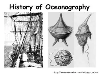
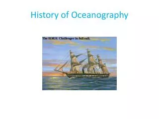
History of Oceanography. Why study historic oceanography? . Connected to the world’s overall history Commerce, warfare, resources, weather The oceans have shaped humanity’s past. Why study Oceanographic History?. Understand how and why people apply marine sciences today

E N D
Why study historic oceanography? • Connected to the world’s overall history • Commerce, warfare, resources, weather • The oceans have shaped humanity’s past
Why study Oceanographic History? • Understand how and why people apply marine sciences today • Oceanography’s history is about people, not just oceans and test tubes.
Ancient Uses and Explorations (5000 B.C. to 800 A.D.) • Not sure when ocean voyages actually began • Fish hooks and spears dated approximately 5000 B.C. • Earliest recorded sea voyage – Egyptians about 3200 B.C.
Phoenician Explorations • Most important early Western seafarers • Motivated by trade, Phoenicians traveled incredible distances • Established first trade routes throughout the Mediterranean and as far north as Great Britain
Phoenician Navigation • Stayed within sight of land • Traveled at night – steered by observing constellations and the North Star. • In the ancient world, the North Star was called the Phoenician Star
Polynesian Exploration • Between 2000 and 500 B.C. • Often traveled thousands of kilometers across open ocean • Open canoes cut from tree trunks • Developed stick maps with ocean currents • Settled most of the islands in the Pacific Ocean hundreds of years before Europeans reached Pacific Ocean
Polynesian Significance • Earliest known regular, long-distance, open-ocean seafaring beyond sight of land
Greek Exploration • First who used mathematical principles and developed sophisticated maps for seafaring • Pytheas – Greek explorer, noted that he could predict tides in Atlantic based on phases of moon • He also measured angle between horizon and the North Star to determine position – improved navigation
Eratosthenes (264-194 B.C) • 2 major contributions that furthered Pytheas’ work • Calculated Earth’s Circumference ~40,000 km • Invented first latitude/longitude system
Ptolemy (100-168 A.D.) • Created map of Earth that showed a portion of the Earth as a sphere on flat paper. • Produced first world atlas Improved longitude/latitude system • System still used today
Vikings (790 A.D. to 1100) • Vikings of Scandinavia were active explorers during The 9th century • Discovered Iceland and Greenland • Leif Eriksson – son of Eric The Red, set off in search of timber for Greenland Colony and discovered North America (Newfoundland, Canada)
Chinese Exploration • The Chinese Ming Dynasty sent large convoys of ships out on missions in which seven voyages were made • There ships were more technologically advanced than anything in Europe, consisting of five masts and magnetic compasses and navigational charts • The Ming Dynasty reached as far as Africa
European Exploration and the Renaissance • Prince Henry the navigator, (1420’s) founded first school of navigation • Christopher Columbus (1490’s) was attempting to find a west-ward route to India when he reached the Bahama Islands • Ferdinand Magellan (1520) led the expedition that first circumnavigated the word; he was killed in the Philippines
18th Century • Previous exploration driven by military, trade, or conquest objectives • Royal Navy of Britain launched voyages with objectives of exploration, mapping and projecting British presence around the world
Cook’s Expedition(1768 – 1779) • Made 1st accurate maps of many regions in the ocean w/ new invention • Chronometer invented by John Harrison • Chronometer is a time piece capable of keeping accurate time aboard ship at sea
Ben Franklin and the Gulf Stream (1777) • Noted northerly routed ship from Europe took longer than ships that came by a longer more southerly route • Learned about gulf stream from nephew, who gave his uncle a chart • Franklin had the chart printed and distributed to the captains of mail ships. • They shortened their inbound voyages by avoiding the current and they shortened their outbound voyages by using the current.
Father of Oceanography… Matthew Maury • Matthew Maury, in charge of the Depot of Naval charts and instruments. • Organized first international meteorological conference to establish uniform methods • Published a summarized version of data in first Oceanographic textbook in 1855
Darwin, Coral Reefs and Biological Evolution • From 1831 to 1836 a naturalist for the HMS Beagle circumnavigated the southern oceans and oceanic islands. • Darwin observed birds and other organisms on isolated islands, most of his research took place in the Galapagos Islands. • In 1859, his observations were published in the book “On the origin of Species”.
The Rosses, Edward Forbes, and life in the deep sea • John Ross took samples and animals in Baffin bay (Canada) Later James Ross took samples from Antarctic ocean bottom at 4.3 Miles • John Ross and James Ross found that there are some bottom dwelling creatures in Baffin Bay and Antarctic Ocean. They discovered that deep Atlantic is uniformly cold. • Forbes – Oceans divided into life-depth zones; concluded that ocean life decrease as depth increases. This contrasted with Rosses finings and created dispute for decades in Britain.
The Ocean as Laboratory : The Challenger Expedition (1872-1876) • The expedition covered 79,178 miles. • Directed by C. Wyville Thompson • 2 contributions: • Discovery and classification of 4,717 new marine species • Measurement of record water depth at the Mariana Trench of 26,847 feet.
Alexander Agassiz(1836-1919) • multimillionaire benefactor to oceanography, especially in the U.S. • 1st to use steel cables for deep sea dredging
Victor Henson and Marine Ecology • Victor Henson solved the problem about population fluctuations in commercial fish. • Coined the term plankton • He found that cold water is more nutrient rich, leading to more plankton, and a larger fish population.
Polar oceanography begins with the voyage of the Fram • Fridtjof Nansen set out with a crew of 13 on a boat called Fram to explore the Artic sea. • His boat became frozen in ice and drifted for 3 years • His drift proved that there was no continent in the Artic sea.
Voyage of the Meteor • First drilling ship • Ship came from Germany • Set the standard for multidisciplinary studies of the Ocean • Mapped the ocean bottom by echo sounding • Meteor sailed for 25 months
Oceanography gets institutionalized • Musée océanographic – Europe • Scripps institution of Oceanography (1st institute in U.S.) – California • Woods Hole Ocean. Inst. (Boston) • Lamont Geological Observatory - New York • Rosenstiel school of Marine & Atmosphere Sciences - Miami • Texas A&M University administered The Ocean Drilling Program
The expansion of oceanography • German U-boat led to the invention of the echo sounder to detect submarines • WW2_military performed and supported many studies on transmission of sound in the ocean waves, currents, and ocean- floor topography. • After WW2 U.S. government established a Sea Grant program to fund ocean research
Large-scale and international oceanographic research • The Deep Sea Drilling Project (DSDP) was the 1st large-scale cooperative effort in academic ocean research • The Glomar Challenger began 1st leg of deep sea drilling • The deep sea drilling project became the ocean drilling program (ODP) • The ODP drill ship JOIDES Resolution, which is a lot larger than the Glomar Challenger, conducted its first scientific cruise and the JOIDES program continues today.
The history behind plate tectonic theory • In 1915, Alfred Wegener developed the theory of continental drift. • He conceived of a single ancient landmass called Pangaea that began to break 180 million years ago. • Fredrick Vine and Drummond Matthews provided evidence for sea floor spreading in 1963 • They mapped magnetic patterns of the ocean floor, which showed parallel bands of similarly magnetized reaches on either side of oceanic mountain ranges. Which were records of changes in Earth’s magnetic field over time
Humans invade the deep ocean • Increased pressure on body cavities and gases dissolved in body tissues limits duration of dives. • Decompressing is necessary at greater depths because rapid ascending turns dissolved gases in tissues into nitrogen. These nitrogen bubbles can stop blood flow. This is know as the bends and is extremely painful illness which can be fatal. • To protect oneself, a strict decompression schedule which includes stopping at different depths • Jim suit allows a person to repair machinery at the ocean floor at surface pressure
Submersibles • William Beebe- descended to a depth of 923 meters off Bermuda in a tethered bathysphere to observe deep-sea life. • Jacques Piccard- designed untethered vessel Trieste - 1960 • Alvin, Sea Cliff- 2 most widely used submersibles • Japan’s Shinkai- to study microbes in the deep sea
Trieste (1960) • The bathyscaphe, Trieste, descends to 10,915 meters • Into Marianas Trench • Deepest depth in the ocean
Submersibles • Factors of manned sub: • Risk to human life • High cost of the systems required • Relatively short time that can be spent making observations • Advantages of ROVs (remotely operated vehicles) • No risk to humans • Can make computer-assisted maps (based on sonar) • Stay down in water for a long time • Autonomous Underwater Vehicles • Programmed to carry out specific data gatherings missions of long durations without human life
Living under the sea • Jacques Cousteau- began designing and testing the underwater living chamber in the 1950s • In the 1970s teams lived undersea chambers for up to 60 days • May be placed on ocean floor or suspended • Can respond and equalize to any pressure
Remote sensing • Sometimes ocean is observed from space; they can measure temp., ice cover, color, etc. • Seasat A - 1st dedicated oceanographic satellite. • Nimbus 7- mapped phyto-plankton populations • TOPEX/ Poseidon- mapped global sea level and got data on ocean –atmosphere interaction. • Global Positioning system- allows ship to determine positions with in a meter
Terms & Equipment • Secchi disk- Determines how transparency of the water • Core Sampler- takes samples of core sediments • Hydrometer- Determines the density of the water • Dredge- scoops up marine life • Alvin- famous submarine that explored deep sea
Terms & Equipment • Side-scan sonar- sonar that can scan in all directions • Current meter- determines the speed and direction of the current • Underwater camera camera that can work underwater • Flip- a bottle like vessel that can flip sideways in the water • Purse seine net- used to capture schools of fish