Download
1 / 20
200 likes | 421 Vues
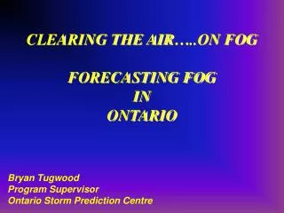
CLEARING THE AIR…..ON FOG FORECASTING FOG IN ONTARIO. Bryan Tugwood Program Supervisor Ontario Storm Prediction Centre. FOG Now-casting Tools. Observations Surface Observing Network (METAR’s) Upper Air (00Z & 12Z) Web-cams Satellite Imagery Day: Visible Imagery

E N D
CLEARING THE AIR…..ON FOGFORECASTING FOG IN ONTARIO Bryan Tugwood Program Supervisor Ontario Storm Prediction Centre
FOGNow-casting Tools Observations Surface Observing Network (METAR’s) Upper Air (00Z & 12Z) Web-cams Satellite Imagery Day: Visible Imagery Night: Fog Imagery
FOGPrognostic Tools Numerical Model Data: Inference from Sounding data BUFKIT Fog algorithm GEM BUFR profiles Fog Nomograms Forecaster Experience Synoptic correlation (persistence) Pattern recognition Climatology
Nowcasting: Observations surface obs actual upper air webcams
Nowcasting: Fog Imagery • The "Fog Image" IR (10.7 um) – NIR (3.9 um)
Tonight 1020 Last Night H 1024 H Forecasting: • Synoptic correlation • Pattern recognition
Model Data: SCRIBE Primary forecast generation tool.Does not have built in algorithm to forecast fog
Fog Formation Nomogram Tmax=25C Td = 18C Tmin = 15C TXover = 17C Fog formation ~ 07Z
Fog Nomogram Cooling blo Td required for Fog formation (Td at Tmax) TXover = Td (at Tmax) – Cooling Blo Td Note: (BUFKIT TXover does not use “cooling blo Td” adjustment. ex. If Td at Tmax = 5, TXover = 1 meanwhile if Td (at Tmax) = 21, TXover = 20.
RADIATION FOG: UPS AIRLINES CONCEPTUAL MODELS AND FORECAST METHODSRandy Baker UPS Airlines, Louisville, KY., Jim Cramer, and Jeff Peters. 10th Conference on Aviation, Range, and Aerospace Meteorology BUFKIT FOG Nomogram
HYDROLAPSE HL If HL decreases with height (ΔHL<0), then the transport of water vapor is an upward-directed humidity sink away from the surface. • As long as ΔHL<0, Fog usually does not form (except in still air) and often results in only dew or rime on the ground. This likely explains many of the situations involving surface saturation with no fog development.
TXOver = the minimum dew point temperature observed during the warmest daytime hours (most representative airmass dewpoint). 2. CROSSOVER TEMPERATURE (TXOver) If Tmin ~ TXover, generally forecast 1-3 miles visibilities in mist, with a risk for lower visibilities, especially in onshore/upslope. If Tmin <= (TXover- 3oF), generally forecast 1/2 mile visibility or lower, unless turbulent mixing will prevent fog or favour stratus (check mRi)
Tmin ~ TXover Tmin > TXover Tmin < TXover - 3 TXover>Tmin > TXover - 3
MRi <= 0.025 is "mixy". Turbulent boundary layer suppresses cooling and favours stratus rather than fog, if saturation occurs. • MRi between 0.025 and 0.040 is "marginal". • MRi >= 0.040 is "decoupled".Low-level winds decoupled fromwinds aloft. Unmixed boundary layer supports strong cooling and favours fog rather than stratus, if saturation occurs. • For the turbulent dispersal of an existing fog, MRi must decrease to 0.008 or lower. 3. BOUNDARY LAYER TURBULENCE (mRi)