Chicago Heights Environmental Site Assessment Report
Detailed report assessing potential presence of RECs at the Dodge property in Chicago Heights, IL. Includes physical settings, historical use, and limitations of the study.


Chicago Heights Environmental Site Assessment Report
E N D
Presentation Transcript
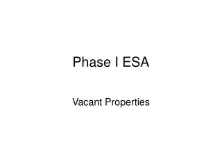
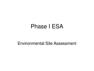
Phase I ESA Environmental Site Assessment
Purpose • Dodge property 20937 to provide a professional opinion on the potential current presence of RECs at the subject property , including potential impacts from known problems in the surrounding area.
Detailed Scope-of-Service • Conducted a regulatory database search of known underground storage tanks. (USTs) • Reviewed geologic maps and literature on file in URS local office and from the EDR report.
Significant Assumptions • No significant assumptions other than those described below in the following section to this phase I ESA
Limitations and Exceptions • The work conducted by URS is limited to the services agreed to with the city of Chicago heights and no other services beyond those explicitly stated should be inferred or are implied.
Special Terms and Conditions • URS objectives is in perform our work in a professional manner, exercising the customary thoroughness and competence of environmental and engineering consulting professionals.
Location and Legal Description • The subject property consist of one parcel that is owned by the City of Chicago Heights. • The City of Chicago Heights has owned the property since January 2006.
Subject Property and Vicinity Characteristics • The subject property is currently vacant situated in a commercial area of Chicago Heights IL.
Physical Settings • According to the Illinois state Geological survey (ISGS), Surficial Geology if the Chicago Region (1970), the surficial geology in the area is comprised of glacial soils indentified as the Wadsworth Member of the Wedron Formation.
Descriptions of Structures, Roads, and Other Improvements • The subject property consists of an irregularly shaped parcel which occupies an area approximately 8 acres in size located north of U.S. Route 30 east Western Ave. • The subject is vacant and improved with asphalt paving and light fixtures.
Current Adjoining Property Uses • The UST database indicated that six USTs had been removed from the site and the LUST database indicated that the site received an NFR letter on Dec. 6, 2001 in connection with a 1990 LUST incident.
Title Records • The title search indicated that the subject property was owned by the city of Chicago heights since April 2006. • Between 1959 and 1968 it changed hands between a number of finance companies and banks.
Environmental Liens Use Limitations • Ginocchio Enterprises’ search for recorded environmental cleanup lens yielded no records of any liens associated with the subject property
Specialized Knowledge • No specialized knowledge was conveyed to URS during the preparation of this report
Owner, Site Manager, and Occupant Information • According to information provided by Mr. Santori, the subject was obtained for back taxes and was historically used as an auto dealership.
Reason for ConductingPhase I ESA • The city of Chicago heights indicated that his Phase I ESA was requested in connection with a USEPA Brownfield's Assessment Grant.
Other Information • URS was not provided any other user provided information or previous environmental investigation reports for the subject property.
Standard Environmental Records • The subject was listed in the RCRA SQG database as South Oak Dodge and Town and Country Dodge and in the UST database as Town and Country Dodge. • Both of the RCRA SQG listing indicated that no violations were found.
Additional Environmental Records • URS conducted file reviews or interviews at applicable state, municipal and county offices and regulatory.
Historical Use • Copies of pertinent portions of historical research documents reviewed and discussed below are presented in Appendix F.
Aerial Photographs • 1952 adjacent properties were agricultural land. • 1967 adjacent properties to the north, east, and west as vacant vegetated land. • 1974 developed with a single elongated building that is similar in size shape and location. • 1988 no major changes were depicted. exception that the adjacent property to the east has been developed into a smaller commercial building. • 1994 no major changes were depicted to the subject property or adjacent. The north property is no longer their has been replace with a smaller square shaped building
Topographic Maps • 1901 adjacent properties were depicted as vacant land in a largely vacant area west of City of Chicago Heights. • 1929 adjacent properties were depicted as vacant land. • 1953 adjacent properties as compared to the 1948 topographic map. • 1963 a large building similar size shape and location as compared to the building observed there during the site reconnaissance, was depicted on the adjacent property to the south. • 1973 a T-shaped building is depicted on the adjacent property to the north and a building similar size and location. • 1993 no major changes to the subject property or adjacent properties as compared to the 1973 topographic map. • 1998 no individual structures or buildings are depicted on the subject property or adjacent properties on the 1998 topographic map.
Sanborn Fire Insurance Maps • URS ordered Sanborn Fire Insurance Maps (Sanborns) for the subject property from EDR. • EDR reported that there was no Sanborn Coverage for the location of the subject property.
City Directories • URS requested historical city directory information from EDR for the subject from EDR address. • EDR reported that there was no city directory coverage for the location of the subject property.
Methodology and Limiting Conditions • Mr. Ronald Short of URS conducted a site reconnaissance of the subject property on August 25, 2006. • Weather conditions at the time of the site reconnaissance were overcast and 80 degrees.
Interior and Exterior Observations • Four single-post and four double-post hydraulic car lifts were noted within the foundation of the auto dealership building. • One pad-mounted transformer with staining was observed on the north of the subject property and 3 pole-mounted transformer with non-PCB labels were noted on the western property boundary.
Hazardous Substances and Petroleum Products • No chemicals were observed on the subject property. • Evidence of staining on the ground on the north side of the former foundation.
Underground/ Aboveground Storage Tanks • No evidence of underground or above storage tanks was observed by URS during the site reconnaissance. • Mr. Ganser was not aware of USTs or ASTs on site during the time that he worked at the subject property.
PCB-Containing and Hydraulic Equipment • A pad-mounted electrical transformer with staining, and hydraulic car lifts were observed adjacent to and within the foundation of the former auto dealership on the subject property during the site reconnaissance.
Solid and Hazardous Wastes • No solid or hazardous wastes were being generated at the subject property at the time of site.
Drains and Sumps • Some drains were observed in the asphalt paved areas of the subject property and what appeared to be the remains of the floor drains were observed in the old building foundation.
Waste Water • No wastewater is currently generated on the subject property. • URS of storm water is on the subject property.
Utilities • The subject property is currently vacant and not connected to any active utilities.
Wells • No evidence of wells was observed on the subject property. • Mr. Ganser was not aware of wells located on the subject property during the time he worked there.
Pits, Ponds, Lagoons • No pits, ponds or lagoons were observed on the subject property during the property visit.
Other Physical Evidence of Contamination • URS did not observe any other physical evidence of contamination on the subject property or adjacent properties during the site reconnaissance.
Conclusions • URS has performed a Phase I ESA in conformance with the scope and limitations of ASTM Practice E 1527-05 of the former South Oak Dodge property located at 20937 South Western Ave in Chicago Hts, Cook County, IL
Environmental Professionals Involved • Professional developed and performed all the appropriate inquiries in conformance with the standards and practices set forth in 40 CFR part 312.