Download
1 / 16
160 likes | 183 Vues
Analyzing GeoScienceML for INSPIRE, drafting Implementing Rules, achieving data harmonization, and enhancing interoperability for European geosciences. Implementation based on standards, involving drafting teams for Spatial Data and Network Services. eContentplus program aims for digital content accessibility in Europe with multilingual aspects.

E N D
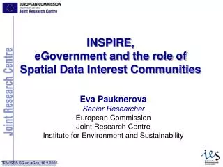
Contribution ofGeoScienceML to INSPIREand link with european R&D activities(eContentplus – FP7)François Robida - BRGM
Annex I Coordinate reference systems Geographical grid systems Geographical names Administrative units Transport networks Hydrography Protected sites INSPIRE Spatial data themes aregrouped into 3 annexes Annex II • Identifiers of Properties • Elevation (including terrestrial elevation, bathymetry and coastline) • Geology • Land cover • Cadastral parcels • Ortho-imagery
Annex III Statistical units Buildings Soil Land use Human health and safety Government service and environmental monitoring facilities Production and industrial facilities Agricultural and aquaculture facilities • Population distribution - demography • Area management/restriction/ regulation zones & reporting units • Natural risk zones • Atmospheric conditions • Meteorological spatial features • Sea regions • Bio-geographical regions • Habitats and biotopes • Species distribution • Oceanic spatial features • Energy and Mineral resources
Objectives Analyse and review reference material provided by the SDICs (Spatial Data Interest Communities); Write the draft Implementing Rules Provide recommendations and suggestions Identify issues which cannot be addressed Notes A drafting team is not expected to develop new specifications Implementing rules should be based on standards (when exist) Implementing Rules will be a part of the “law” applied to the Member States when the INSPIRE Directive is adopted Drafting teams
Metadata for spatial data and services Spatial data specification and harmonisation Network services and interoperability Data and service sharing Monitoring and reporting Drafting teams 5 Drafting teams installed by the EC Geological Survey representatives Norway Germany & France France UK
Objective Draft Implementing rules for harmonised data specifications and for data exchange Scope Definition of the basic conceptual model for the data themes Guidelines of the use of this model Generalization rules to treat different scales Encoding Activities Survey of existing initiatives Definition of annex themes and scope Draft generic conceptual model Draft Implementing rules for data exchange Drafting teams DT: Spatial data specification and harmonisation
Drafting teams DT: Network services Objective • Draft Implementing rules for network services • Scope • Define functional and non-functional requirements for the following services: • Activities • Clarification of definition and scope of services • Analysis of reference material • Select specifications for network services • Draft Implementing rules
to make digital content in Europe more accessible, usable and exploitable. The eContentplus programme will contribute to this initiative by “achieving interoperability between national digital collections and services (e.g. through common standards) and facilitating access and use of the material in a multilingual context Multicultural and multilingual aspects of accessing, exploiting, using, and re-using digital content in Europe will be integral to all the actions (but not through funding the translation of existing content). Actions in the programme will use proven state-of-the-art technical solutions, and will be geared towards innovation in organisation and in deployment, as opposed to purely technological innovation. Deadline for proposals : 19 October 2006 eContentplus Program
Projects to be launched in October 2006 (from previous call) eWater (leader TNO) GEOMIND (leader PGI) Some targeted projects in preparation VEGEOS (TNO) eHazard (BRGM) … ? Thematic projects delivering information to identified communities, with a participation of some geological surveys eContentplus 2006
A main objective : Build the European Geoscientific SDI (EGSDI) As part of INSPIRE And contribution to GEOSS at the global level REQUIRES more European geological surveys In the definition of INSPIRE themes (related to their respective missions) Involved in the development of GeoSciML standards (through CGI) Committed to deliver data according to international standards The obstacles : Lack of funding Lack of shared technical expertise Participation in projects limited to a small number of surveys Organisation of projects which only cover one theme (water, hazards,…) Some ideas for a broader scope
to develop an eContentplus Thematic Network including all interested surveys to develop awareness of GS on INSPIRE issues provide an instrument for the definition of INSPIRE data themes through consensus between GS finance sharing of knowledge and best practices for all the related themes contribute to the participation to GeoSciML development contribute to the realisation of European testbeds to implement the standards in the INSPIRE context A proposal
Thematic Networks (TN), which bring together relevant stakeholders, expertise and facilities with the objective of identifying best practices and coordinating the development of specific approaches for improving the availability and usability of digital content. They aim to achieve a broad consensus on methods and standards and to impact on a critical mass of digital content at European level. Activities may include coordination and assessment, the exchange of information between teams working around a common theme, improvement plans, the organisation of conferences and information brokerage. Thematic Networks should fulfil at least the following requirements: Coverage of the majority of EU Member States, including at least 3 new Member States. Involvement of major relevant digital data stakeholders from the countries covered. Being open and proactive in attracting new partners. eContentplus Thematic Networks
Funding : Up to 100% of a limited set of direct eligible costs for coordinating and implementing the network. Up to 36 months 13-25 countries € 0.4-1m eContentplus Thematic Networks
How to derive geological information on Geographical grid systems ? (Harmonised multi-resolution grid with a common point of origin and standardised location and size of grid cells) Use of Semantics (search, combination of services, multilinguality,…) Sensorweb : integration of sensors from ground through standard interfaces … FP7 : Some possible R&D topics