Download
1 / 43
430 likes | 459 Vues
Explore the importance of connectivity in communities, benefits of efficient networks, methods for measurement, and hurdles faced during implementation. Discover how street design influences connectivity and learn about practical approaches to improving access and efficiency in your area.

E N D
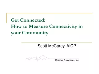
Get Connected: How to Measure Connectivity in your Community Scott McCarey, AICP
Outline • What is connectivity? • Benefits • How to measure • Real-world hurdles to implementation • Interactive
What is Connectivity? • Compact street network • Multiple ways to get to one place • Few dead ends • Direct routing
Street Capacity A network of small streets has greater capacity then a disconnected hierarchy of large streets Credit: Tim Jackson
Capacity 101 1200 1800 capacity Credit: Tim Jackson
Street Capacity 4-lane arterial @ 45mph = 2400 vph Two 2-lane streets @ 30mph = 3600 vph Credit: Tim Jackson
“Street Sewers” • All trips include travel on the arterials • Through traffic is mixed with local traffic • Traffic congestion is exacerbated in peak periods • No alternatives when • Accidents • Construction • Other closures (weather related, community events, etc)
Modal Bias • System dependent on arterials is auto-centric • Arterials have less capacity, but they have greater speeds • Speed differential between motor vehicles and bikes greater • Less pleasant • Higher chance of collision • Higher level of injury • Allows for land uses to be more spread out • Discourages transit and bike/ pedestrians
Design Improvements • Allows for skinny streets • Traffic Calming • Allows for alleys Benefits of alleys • No garage faces • Continuous pedestrian front (no curb cuts) • Utilities (trash collection, water mains, etc) • EMS access • Informal social space
Emergency Access/Evacuation Single- or limited-point access creates problems • Response time • Evacuation time • Route impediments • Safety
Shorter Trips • Increased connectivity creates shorter trips • Encourages non-motorized modes
Shorter Trips • Increased connectivity creates shorter trips • Encourages non-motorized modes
360’ 300’ 360’ 300’ Block length and perimeter • Set maximum block lengths • Set maximum block perimeters Block length: 360’ Block perimeter: 1200’
Maximum intersection length& maximum cul-de-sac length • Max intersection spacing: 530 feet (Portland) – 1,500 feet (Cary, NC) (Fort Collins 660 feet to 1,320 feet) • Max cul-de-sac length: 200 feet – 600 feet (Fort Collins and Boulder 660 feet)
Links/ Nodes • Nodes are intersections and dead ends/ cul-de-sacs • Links are the segments between nodes • Divide links by nodes
= 1.0 9 / 9
40 / 20 = 2.0
Links/ Nodes • Need clarity on method of calculation Source: Handy, et al. Planning for Connectivity. PAS Report Number 515
Intersections/ Square Mile • Links/ nodes does not measure scale 2.0 2.0 • Minimum 200 intersections/ square mile
Route Directness Index Straight line distance (as the crow flies) Street network
2100 feet 300 feet Path Index: 0.14
Problems with incremental improvements in connectivity • Unfair burden on connectivity pioneer • Traffic will increase on this street
Problems with incremental improvements in connectivity • Unfair burden on connectivity pioneer • Traffic will increase on this street • Politically difficult • Meeting attendees
Connection Access • Local governments (developers) often have to receive permission to connect to state roads • Adjacent developments not interested in connecting
Private Sector Perspective (Developer) • Too costly • Often means loss of most expensive cul-de-sac lots • Is increased connectivity site-specific or of regional benefit? Who pays? • Fears of cut-through traffic from other developments • Destroys “exclusivity” of project – marketing, lot values • Unfair, unnecessary delays in project review/approval process • “Plans can’t be changed” • “I’ll never get my building permits”
Resident Perspective • Fears of cut-through traffic from other developments • Safety, noise, quality of life • Neighborhood character and preservation • Property values • Increased mobility may be “unwanted benefit”
Public Sector Perspective (Planner) • Difficult role of balancing community/ individual benefits • How to fairly compare costs/benefits with other strategies? • Difficult to apply to existing neighborhoods (retrofit)
Interactive Exercise • Does your community have connectivity standards? • If not, do you think this would a good idea? • Personal experiences with implementation? • 20 minute exercise, 10 minute discussion