Download
1 / 34
360 likes | 508 Vues
This tutorial provides an introduction to GPS technology, exploring how it works through satellite communication, and demonstrating the capabilities of the eTrex H GPS unit. Participants will learn to navigate menus, manage waypoints, and utilize resources like Easy GPS and Geocaching.com. Additionally, we will discuss GPS accuracy enhancement through WAAS and how to set devices for optimal performance. Engage with sample lessons on geocaching to put your skills into practice and enjoy the benefits of GPS navigation in any environment.

E N D
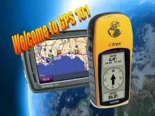
Agenda • How does GPS work? • Introduction to the etrex H GPS unit • Buttons/menus • Main pages • Waypoints • Resource: Easy GPS • Sample Lessons • Resource: Geocaching.com • What is geo-caching? • Just do it!
The (GPS) is a satellite-based navigation system made up of a network of 24 satellites placed into orbit by the U.S. Dept. of Defense. • Originally intended for military applications, the government made the system available for civilian use in 1983. • GPS works in any weather conditions, anywhere in the world, 24 hours a day. There are no subscription fees or setup charges to use GPS.
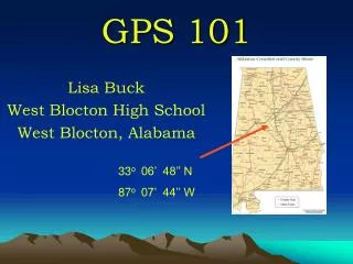
GPS satellites circle the earth twice a day in a very precise orbit and transmit signal information to earth. GPS receivers take this information and use trilateration to calculate the user's exact location. Essentially, the GPS receiver compares the time a signal was transmitted by a satellite with the time it was received. The time difference tells the GPS receiver how far away the satellite is. Now, with distance measurements from a few more satellites, the receiver can determine the user's position and display it on the unit's electronic map.
A GPS receiver must be locked on to the signal of at least three satellites to calculate latitude and longitude and track movement. • With four or more satellites in view, the receiver can determine the user's 3D position (latitude, longitude and altitude). • Once the user's position has been determined, the GPS unit can calculate other information, such as speed, bearing, track, trip distance, sunrise and sunset, distance to destination, time and more. You are here.
How does GPS work?
Setting your GPS to DEMO mode: Press PAGE to switch to the MENU page Scroll down to SETUP > ENTER Scroll down to SYSTEM > ENTER MODE > ENTER Scroll down to DEMO > ENTER When outside, you will need to set the mode to WAAS. WAAS stands for the "Wide Area Augmentation System". Basically, it's a system of satellites and ground stations that provide GPS signal corrections, giving you even better position accuracy. A WAAS-capable receiver can give you a position accuracy of better than three meters 95 percent of the time. And you don't have to purchase additional receiving equipment or pay service fees to utilize WAAS.
GPS Terminology Waypoint Bearing Track Route SkyView Page Map Page Pointer Page Trip Computer
Easy GPS software http://www.easygps.com/
Easy GPS is a free download program that allows you to transfer waypoints, geo-caches, routes, tracks to and from GPS units. Make certain that the coordinate format matches that of your GPS unit. The default map datum setting is WGS 84 on the etrexH.
To check, select Edit – Preferences – select the correct GPSr – select My Coordinate Formats – scroll down and select format which matches.
With your GPS on, connect cable to the computer. Select the receive icon on top of the screen. This will transfer points into Easy GPS as well as create a simple plot of the points.
Transferring points from Easy GPS to other GPS units is just as easy. All you do is connect the next unit and select the send icon at the top of the screen! It is just that easy.
Geocaching.com http://www.geocaching.com/
DNR Garmin Downloading Your Waypoints to:
Travel Bugs A Travel Bug is a trackable item that moves from place to place, picking up stories along the way. Here you can add your own story, or live vicariously through each bug's adventures. Items attached to the bugs are called hitchhikers.
Bug Hitchhiker