Interpolation
Interpolation. Objectives. To give a definition of Interpolation as it relates to GIS and mapping/surveying To explain How Interpolation Works Discuss Spatial Autocorrelation, Sample Size, and Interpolation Barriers

Interpolation
E N D
Presentation Transcript
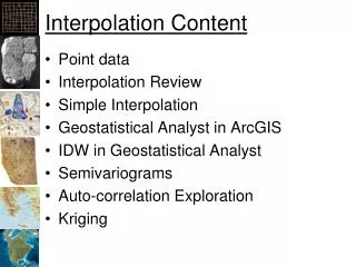
Objectives • To give a definition of Interpolation as it relates to GIS and mapping/surveying • To explain How Interpolation Works • Discuss Spatial Autocorrelation, Sample Size, and Interpolation Barriers • Describe Different Types of Interpolation: 1) Inverse Distance Weighted; 2) Spline; 3) Natural Neighbors; and 4) Kriging • Give Examples of how a GIS technician can use IDW to increase a surface model’s accuracy
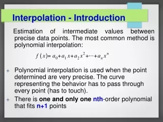
Definition Interpolation is the process of estimating unknown values that fall between known values.
Interpolation The unknown value of the cell is based on the values of the sample points as well as the cell's relative distance from those sample points.
Interpolation • A surface can be created from a small number of sample points • More sample points are better for a detailed surface • Sample points should be well distributed throughout the study area • Some areas may require a clustering of sample points (phenomena may be transitioning or concentrating in that area)
Spatial Autocorrelation • Principle underlying spatial interpolation is the First Law of Geography • Formulated by Waldo Tobler, this law states that everything is related to everything else, but near things are more related than distant things • The formal property that measures the degree to which near and distant things are related is spatial autocorrelation
Spatial Autocorrelation In this graphic, the darkest triangles indicate the most influential sample points.
Sample Size • Most interpolation methods allow you to control the number of sample points used to estimate cell values • The distance to each sample point will vary depending on the distribution of the points • Reducing the size of the sample you use will speed up the interpolation process because a smaller set of numbers will be used to estimate each cell value
Sample Size When the sample size is limited to five sample points, as in this case, only the five nearest points are used in the calculation of the estimated cell value. All other points are disregarded.
Sample Size If the search radius in this sample were fixed, only the values of the sample points within the radius would be used to calculate the estimated cell value. If the search radius were variable and the minimum sample size were 8, the search radius would expand until it contained eight sample points.
Interpolation Barriers • The physical, geographic barriers that exist in the landscape, like cliffs or rivers, present a particular challenge when trying to model a surface using interpolation; the values on either side of a barrier that represents a sudden interruption in the landscape are drastically different • Most interpolators attempt to smooth over these differences by incorporating and averaging values on both sides of the barrier. The Inverse Distance Weighted (IDW) method allows you to include barriers in the analysis • The barrier prevents the interpolator from using sample points on one side of it
Interpolation Barriers Elevation values change suddenly and radically near the edge of a cliff. When you interpolate a surface with this type of barrier, you can't use known values at the bottom of the cliff to accurately estimate values at the top of the cliff.
Interpolation Barriers When you use a barrier with interpolation, the estimated cell value is calculated from sample points on one side of the barrier.
Inverse Distance Weighted • IDW interpolation considers the values of the sample points and the distance separating them from the estimated cell. Sample points closer to the cell have a greater influence on the cell's estimated value than sample points that are further away • IDW works best for dense, evenly spaced sample point sets. It does not consider any trends in the data, so, for example, if actual surface values change more in the north-south direction than they do in the east-west direction (because of slope, wind, or some other factor), the interpolated surface will average out this bias rather than preserve it. • The Inverse Distance Weighted method is the practical, easy-to-understand interpolator. When you use IDW, you are applying a "one size fits all" assumption to your sample points.
Spline • Instead of averaging values, like IDW does, the Spline interpolation method fits a flexible surface, as if it were stretching a rubber sheet across all the known point values. • This stretching effect is useful if you want estimated values that are below the minimum or above the maximum values found in the sample data. This makes the Spline interpolation method good for estimating lows and highs where they are not included in the sample data. • However, when the sample points are close together and have extreme differences in value, Spline interpolation doesn't work as well. This is because Spline uses slope calculations (change over distance) to figure out the shape of the flexible rubber sheet. • There are two types of Spline: Regularized and Tension. A Tension Spline is flatter than a Regularized Spline of the same sample points, forcing the estimates to stay closer to the sample data. You might say that the Tension Spline method produces a surface more rigid in character, while the Regularized Spline method creates one that's more elastic.
Nearest Neighbor • In Natural Neighbors interpolation, the value of an estimated location is a weighted average of the values of the natural neighbors. The weighting is proportional to the area in the estimation location’s Voronoi polygon that was contributed by each natural neighbor’s polygon. • Since the output is a raster, the estimation locations are a regularly spaced array equal to the number of raster cells.
Kriging • Like IDW, Kriging is a weighted average technique, except that the weighting formula in Kriging uses much more sophisticated math. Kriging measures distances between all possible pairs of sample points and uses this information to model the spatial autocorrelation for the particular surface you're interpolating. • Krigingtailors its calculations to your data by analyzing all the data points to find out how much autocorrelation they exhibit and then factors that information into the weighted average estimation. • Two general and widely used kriging methods are Ordinary and Universal Kriging. Universal Kriging assumes that there is an overriding trend in the data. For example, you may know that there is a prevailing wind or a gently sloping hillside across your study area. Ordinary Kriging assumes there is no trend in the data, which should be your standard operating assumption. When you interpolate a surface using Kriging, the distance and direction of every point pair is quantified to provide information on the spatial autocorrelation of the sample point set. Next, a best-fit model is automatically applied to the data and the unknown values are predicted.
Example: Shivwits Plateau, Arizona DRG (Digital Raster Graphic) + 30 meter DEM
Example: Shivwits Plateau, Arizona Initial sample points input by GIS user (black dots shown on the left).
Example: Shivwits Plateau, Arizona More sample points refine the model on the right.
Example: Shivwits Plateau, Arizona Adding even more sample points results in a more accurate surface model.
Summary • Interpolation = process of estimating unknown values that fall between known values • Used for creating a more detailed surface for analysis purposes • Everything is related to everything else, but near things are more related than distant things (1st Rule of Geography); Spatial Autocorrelation measures this • Larger sample sizes better to model surfaces more accurately • 4 Different Interpolation types include: 1) Inverse Distance Weighted; 2) Spline; 3) Nearest Neighbor; and 4) Kriging • Interpolation can use barriers to model interruptions in the landscape or surface using IDW