Download
1 / 35
350 likes | 465 Vues
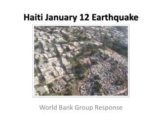
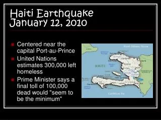
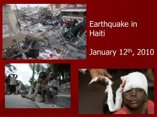
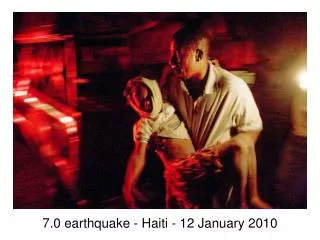
January 12, 2010 Haitian Earthquake Damage Assessment Using High Resolution Satellite Imagery. Mahtab A. Lodhi, Ph.D. Department of Geography University of New Orleans, Louisiana. Natural disasters…. …are extreme events within the earth’s system…

E N D
January 12, 2010 Haitian Earthquake Damage Assessment Using High Resolution Satellite Imagery Mahtab A. Lodhi, Ph.D. Department of Geography University of New Orleans, Louisiana
Natural disasters… • …are extreme events within the earth’s system… • …the economic losses due to natural disasters have shown a significant increase in recent years…
…hazard and disaster …hazard – a potentially damaging phenomenon…
….Remote sensing for disaster management… Preparedness Mitigation Disaster Event Reconstruction Relief Efforts Rehabilitation
Study Area ALI (July 30, 2010) Bands 4,5,6 merged with Pan band
Imagery Data Used • DigitalGlobe Constellation • Quickbird & Worldview–2 • Pre & Post Event • used in visual Analysis • NASA’S Earth Observing–1 (EO–1) • Advanced Land Imager (ALI) • Pre & Post Event • used in digital analysis • Hyperion • Pre & Post Event
Spatial resolution VS. spectral resolution Hyperion WorldView-2
EO-1 Advanced Land Imager (ALI) 10 meter 30 meter 30 meter
Pre & post-WorldView2 Post EO-1A Post EO-1A Mosaic Rectification Raw (DN) Visual Analysis HPF Merging NDVI Damaged Buildings AOI Extraction AOI Extraction ISODATA ISODATA Recoded Image Recoded Image Merged Image Damage Map
Before After
Before After
Before After
Before After
Before After
Before After
Before After
… on-screen delineation of damaged buildings using post event Worldview2 imagery…
Damaged buildings AOI extracted from post event Worldview2 imagery.
ISODATA Clustering of EO1 Data… …starts with all pixels as members of spectral class number 1, then creates fewer variable spectral classes from the initial variable spectral classes…
…some challenges of working RS data in urban environment…
Thank you. WorldView-2 & Quickbird Data Courtesy of DigitalGlobe Inc. EO-1 ALI and Hyperion Data Provided by USGS.