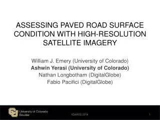
ASSESSING PAVED ROAD SURFACE CONDITION WITH HIGH-RESOLUTION SATELLITE IMAGERY
440 likes | 653 Vues
ASSESSING PAVED ROAD SURFACE CONDITION WITH HIGH-RESOLUTION SATELLITE IMAGERY. William J. Emery (University of Colorado) Ashwin Yerasi (University of Colorado) Nathan Longbotham ( DigitalGlobe ) Fabio Pacifici ( DigitalGlobe ). Outline. Background Road Quality Assessment

ASSESSING PAVED ROAD SURFACE CONDITION WITH HIGH-RESOLUTION SATELLITE IMAGERY
E N D
Presentation Transcript
ASSESSING PAVED ROAD SURFACE CONDITION WITH HIGH-RESOLUTION SATELLITE IMAGERY William J. Emery (University of Colorado) Ashwin Yerasi (University of Colorado) Nathan Longbotham (DigitalGlobe) Fabio Pacifici (DigitalGlobe) IGARSS 2014
Outline • Background • Road Quality Assessment • Road Asphalt Identification • Final Remarks IGARSS 2014
Background IGARSS 2014
Motivation • In situ surveillance of paved road surfaces • Primarily performed manually • Slow and tedious • Limited coverage • Remote sensing of paved road surfaces • Primarily performed automatically • Comparatively efficient • Large area coverage • Latter technique can be used as a precursor or compliment to the former IGARSS 2014
In Situ Data • Standard road surface parameters of interest • Roughness (IRI) • Rutting • Cracking (fatigue, etc.) • Interpretation of measurements varies by planning organization • In general, road condition is rated holistically • Good, fair, poor • High, moderate, low drivability • Etc. Road Quality Surveillance Van (Pathway Services Inc.) IGARSS 2014
Remotely Sensed Data • Provided by DigitalGlobe • Collected by WorldView-2 spacecraft • Panchromatic imagery • 1 band (450-800 nm) • Spatial resolution ~0.5 m • 11-bit digital numbers • Multispectral imagery • 8 bands (400-1040 nm) • Spatial resolution ~2 m • 11-bit digital numbers WorldView-2 (DigitalGlobe) IGARSS 2014
Road Quality Assessment IGARSS 2014
Asphalt Degradation • Lighter and less uniform appearance correlated with degradation • Road quality thus potentially assessable through texture analysis of imagery Asphalt Spectra (M. Herold) Good Road (Boulder County) Fair Road (Boulder County) Poor Road (Boulder County) IGARSS 2014
Road Quality Assessment Overview Panchromatic Imagery Asphalt Pixel Statistics Texture Filtered Imagery (3 Features) Road Quality Road Asphalt ROIs IGARSS 2014
Digital Number 21B 115A 24A Colorado Springs Highways IGARSS 2014
Digital Number IGARSS 2014
Data Range 21B 115A 24A Colorado Springs Highways IGARSS 2014
Data Range IGARSS 2014
Variance 21B 115A 24A Colorado Springs Highways IGARSS 2014
Variance IGARSS 2014
Entropy 21B 115A 24A Colorado Springs Highways IGARSS 2014
Entropy IGARSS 2014
WorldView-2 Sensor Noise Analysis WV-2 Sensor Noise (DigitalGlobe) Colorado Springs Highways IGARSS 2014
Road Asphalt Identification IGARSS 2014
Road Asphalt Identification Overview OpenStreetMapShapefiles Multispectral Imagery Pansharpened Imagery (8 Bands) Road Asphalt ROIs Panchromatic Imagery Texture Filtered Imagery (3 Features) IGARSS 2014
Road Identification Masked Scene Original Scene with OSM Shapefile Original Scene Must disregard non-road features in scenery Use OpenStreetMapshapefiles as mask IGARSS 2014
Asphalt Identification • Must distinguish asphalt from non-asphalt features in roads • Vehicles, paint, shadows, etc. • 11 total dimensions contained in image pixels • 8 spectral, 3 texture • Training set manually selected • Asphalt vs. non-asphalt • Random forest classification • Cohen’s kappa coefficient of ~0.91 obtained from experimental trials Asphalt Vehicle Paint Shadow IGARSS 2014
Final Remarks IGARSS 2014
Conclusions • Road asphalt can be identified from high-resolution satellite imagery • For the data analyzed, road asphalt becomes lighter in panchromatic grayscale shade as it degrades • Digital number increases • For the data analyzed, road asphalt becomes less uniform in texture as it degrades • Data range increases • Variance increases • Entropy increases • These apparent qualities can potentially be used to assess road pavement condition via satellite remote sensing IGARSS 2014
Questions IGARSS 2014
Backup Slides IGARSS 2014
Pansharpening Multispectral Panchromatic Pansharpened IGARSS 2014
Occurrence-Based Texture Filtering Filtered Image Original Image IGARSS 2014
Occurrence-Based Texture Filtering Digital Number (Original Data) Data Range Variance Entropy IGARSS 2014
Digital Number 25A 392A 287C Loveland Highways Loveland Highways IGARSS 2014
Digital Number IGARSS 2014
Data Range 25A 392A 287C Loveland Highways Loveland Highways IGARSS 2014
Data Range IGARSS 2014
Variance 25A 392A 287C Loveland Highways Loveland Highways IGARSS 2014
Variance IGARSS 2014
Entropy 25A 392A 287C Loveland Highways Loveland Highways IGARSS 2014
Entropy IGARSS 2014
WorldView-2 Sensor Noise Analysis WV-2 Sensor Noise (DigitalGlobe) Loveland Highways IGARSS 2014