Download
1 / 20
210 likes | 411 Vues
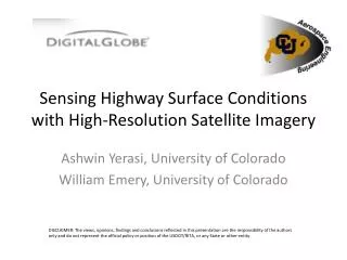
Sensing Highway Surface Conditions with High-Resolution Satellite Imagery. Ashwin Yerasi, University of Colorado William Emery, University of Colorado.

E N D
Sensing Highway Surface Conditions with High-Resolution Satellite Imagery Ashwin Yerasi, University of Colorado William Emery, University of Colorado DISCLAIMER: The views, opinions, findings and conclusions reflected in this presentation are the responsibility of the authors only and do not represent the official policy or position of the USDOT/RITA, or any State or other entity.
Motivation • In situ surveillance of highway surfaces • Slow and tedious • Analysis done by eye • Limited coverage • Remote sensing of highway surfaces • Comparatively quick and effortless • Analysis done by machine • Full area coverage • Latter technique can be used as a precursor to the former or as a compliment
In Situ Data • Provided by the Colorado Department of Transportation • Collected by Pathway Services Inc. • Road parameters of interest • Roughness (IRI) • Rutting • Cracking (fatigue, etc.) • Remaining service life • >10 years: Good • 5-10 years: Fair • <5 years: Poor >10 years: Good 5-10 years: Fair <5 years: Poor Pathway Services Inc. Surveillance Van
Remotely Sensed Data • Provided by DigitalGlobe • Collected by WorldView-2 spacecraft • Panchromatic images • 450-800 nm • Spatial resolution 46-52 cm • 11-bit digital numbers WorldView-2
Digital Number 21B 115A 24A
Occurrence-Based Texture Filtering Filtered Image Original Image
Data Range Example of a homogeneous surface typical of good pavement Homogeneous Window Filtered Pixel Example of a homogeneous surface typical of poor pavement Heterogeneous Window Filtered Pixel
Data Range 21B 115A 24A
Mean Example of a homogeneous surface typical of good pavement Homogeneous Window Filtered Pixel Example of a homogeneous surface typical of poor pavement Heterogeneous Window Filtered Pixel
Mean 21B 115A 24A
Variance Example of a homogeneous surface typical of good pavement Homogeneous Window Filtered Pixel Example of a homogeneous surface typical of poor pavement Heterogeneous Window Filtered Pixel
Variance 21B 115A 24A
Entropy Example of a homogeneous surface typical of good pavement Homogeneous Window Filtered Pixel Example of a homogeneous surface typical of poor pavement Heterogeneous Window Filtered Pixel
Entropy 21B 115A 24A
Conclusions • Highway pavement becomes lighter in panchromatic grayscale shade as it degrades • Digital number increases • Mean increases • Highway pavement becomes less uniform as it degrades • Data range increases • Variance increases • Entropy increases • These changes are detectable through satellite remote sensing techniques and can likely be used to classify road surface conditions such as good, fair, poor and to justify repaving needs