Download
1 / 48
480 likes | 635 Vues
Towards Mobile Phone Localization without War-Driving Ionut Constandache Co-authors: Romit Roy Choudhury and Injong Rhee. Context. Pervasive wireless connectivity + Localization technology =. Location-based applications (LBAs). Context. Pervasive wireless connectivity +

E N D
Towards Mobile Phone Localization without War-Driving Ionut Constandache Co-authors: Romit Roy Choudhury and Injong Rhee
Context Pervasive wireless connectivity + Localization technology = Location-based applications (LBAs)
Context Pervasive wireless connectivity + Localization technology = Location-based applications (LBAs) (iPhoneAppStore: 6000 LBAs, Android: 1000 LBAs)
Location-Based Applications (LBAs) • Examples: Location-based recommendations, geo-tagging GeoLife: shopping list when near a grocery store TrafficSense: real-time traffic conditions
Localization Technology • LBAs executed on mobile phones AccuracyTechnologyEnergy-Efficiency 10m GPS 4h-8h 20-40m WiFi / Skyhook 16h 200-400m GSM ~days
Localization Technology • LBAs executed on mobile phones AccuracyTechnologyEnergy-Efficiency 10m GPS 4h-8h 20-40m WiFi / Skyhook 16h 200-400m GSM ~days Best Scenario: Accurate and Energy-Efficient Localization
Localization Technology • LBAs executed on mobile phones AccuracyTechnologyEnergy-Efficiency 10m GPS 4h-8h 20-40m WiFi / Skyhook 16h 200-400m GSM ~days
WiFi / Skyhook Localization • Basic Idea: • Several trucks war-drive a place • Create Radio map = <Location: WiFiAPs> • Distribute map to phones • Phone user goes to war-driven region, overhears WiFiAPs • Reverse Look Up WIFI APs against radio map • Obtains location
Is Skyhook the solution? Middle Ground (Lower Accuracy than GPS, Longer Battery lifetime) (Better Accuracy than GSM, Shorter Battery lifetime)
Is Skyhook the solution? Middle Ground (Lower Accuracy than GPS, Longer Battery lifetime) (Better Accuracy than GSM, Shorter Battery lifetime) but …
Is Skyhook the solution? Middle Ground (Lower Accuracy than GPS, Longer Battery lifetime) (Better Accuracy than GSM, Shorter Battery lifetime) but … At the cost of: • Degraded location accuracy: walking paths ~ 60m • Reliance on infrastructure (APs) • War-driving ($$ + carbon footprint) “NYTimes: Skyhook fleet 500 trucks/drivers”
Visual Representation Of the State of the Art (Duke Campus)
No Eng. Eff. & Acc. Solution Skyhook Better than GPS Eng. Eff. SkyHook GPS unusable with phone battery GSM too inaccurate
Eng. Eff. & Acc. Solution CompAcc GPS unusable with phone battery GSM too inaccurate GPS unusable with phone battery
Contents • CompAcc • Evaluation • Limitations and Future Work • Conclusion
Contents • CompAcc • Evaluation • Limitations and Future Work • Conclusion
Goals • No War-Driving • Cannot drive walking paths (campus, parks, …) • Expensive / Environment unfriendly • No reliance on WiFi infrastructure • Scale to rural regions / developing countries • Good accuracy (~ GPS) • Improved energy-efficiency • Better than Skyhook, GPS
CompAcc: Basic Idea • Initial GPS puts user at known location on path GPS
CompAcc: Basic Idea • Direction(compass) + Displacement(accelerometer) = Directional Trail Directional Trail
CompAcc: Basic Idea • Direction(compass) + Displacement(accelerometer) = Directional Trail Directional Trail <Step, Direction>
CompAcc: Basic Idea • Direction(compass) + Displacement(accelerometer) = Directional Trail • Compass direction noisy => User’s Location Drifts Directional Trail
CompAcc: Basic Idea • Direction(compass) + Displacement(accelerometer) = Directional Trail • Compass direction noisy => User’s Location Drifts Directional Trail
CompAcc: Basic Idea • Direction(compass) + Displacement(accelerometer) = Directional Trail • Compass direction noisy => User’s Location Drifts • Assume user follows the paths in her vicinity Directional Trail
CompAcc: Basic Idea • Direction(compass) + Displacement(accelerometer) = Directional Trail • Compass direction noisy => User’s Location Drifts • Assume user follows the paths in her vicinity • Compute path signatures • Derived from a local electronic map (Google Maps) Path Signature Directional Trail …
CompAcc: Basic Idea • Direction(compass) + Displacement(accelerometer) = Directional Trail • Compare directional trail with path signatures • Best match corrects direction Path Signature Directional Trail …
CompAcc: Basic Idea • Direction(compass) + Displacement(accelerometer) = Directional Trail • Compare directional trail with path signatures • Best match corrects direction Path Signature Directional Trail …
Turns correct displacement … Path Signature Directional Trail
Turns correct displacement … Path Signature Directional Trail
Turns correct displacement … Path Signature … Path Signature Directional Trail Directional Trail
Turns correct displacement … Path Signature Corrected Location … Path Signature Directional Trail Directional Trail
Advantages • No war-driving / No WiFi infrastructure • Maps available ubiquitously • Improves battery lifetime
Directional Trail: displacement • Accelerometer based step count • displacement = step_count * step_size
Path Signature • Extract from Google Maps • Geodesic formulas
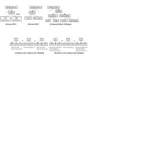
Matching Directional Trail with Path Signatures Path Signature Directional Trail Dissimilarity Metric: ci = compass readings pi = path computed direction N = directional trail size
Contents • CompAcc • Evaluation • Limitations and Future Work • Conclusion
Results • Compared 3 localization schemes • CompAcc • Skyhook • Wifi-War-Walk (We war-droved walking paths in campus) • Metrics Instantaneous Error = distance(estimated, real) Average Localization Error (ALE) = Average Instantaneous Error
Results Average ALE GPS: 10m CompAcc: 11m WiFi-War-Walk: 30m Skyhook: 70m Energy GPS: 10h CompAcc: 23h WiFi-War-Walk:16h Skyhook:16h
Skyhook CompAcc g – GPS s – Skyhook c - CompAcc Assume GPS is absolute truth Assume GPS is absolute truth
Contents • CompAcc • Evaluation • Limitations and Future Work • Conclusion
Limitations and Future Work • Map Generation • Manually mark footpaths • User Position Estimated along the Path • Apply particle filters to accommodate wide roads • Multiplexing between Localization Methods • Hand-off to Skyhook/GPS when driving • Extend to vehicular movement
Contents • CompAcc • Evaluation • Limitations and Future Work • Conclusion
CompAcc • Today’s localization technologies limited • Energy- Efficiency • Coverage/Accuracy • Rely on simple localization mechanism • Need: Compass, Accelerometer and Maps • Evaluation results: • ALE: 11m • Battery: 23h • CompAcc scales to any mapped region of the world
Questions? Thank You! Visit the SyNRG research group @ http://synrg.ee.duke.edu/