Download
1 / 17
170 likes | 260 Vues
Improving Flash Flood Prediction in Application of a Distributed Model in Areas of Complex Terrain. Michael Schaffner, NOAA/NWS Patrick Broxton, UA Peter Troch, UA David Goodrich, USDA-ARS Hoshin Gupta, UA Carl Unkrich, USDA-ARS Thorsten Wagener, Penn State. UCAR Award No.: S09-75794.

E N D
Improving Flash Flood Prediction in Application of a Distributed Model in Areas of Complex Terrain Michael Schaffner, NOAA/NWS Patrick Broxton, UA Peter Troch, UA David Goodrich, USDA-ARS Hoshin Gupta, UA Carl Unkrich, USDA-ARS Thorsten Wagener, Penn State UCAR Award No.: S09-75794
Flash Flood Prediction in Small Fast Responding Basins • Generally involves mapping radar rainfall to small basins using the Flash Flood Monitoring and Prediction Program (FFMP). • Running a “site specific” lumped model (utilizing hourly rainfall input and hourly time steps) for gaged basins. API model and SAC-SMA model. KINEROS model at Weather Forecast Office (WFO) Binghamton.
3 KINEROS Overview • Event based, distributed • High temporal and spatial resolution • Consists of a series of overland flow planes and channel elements • Kinematic wave equations to route channel flow • Dynamic Infiltration For heavy rains, KINEROS is used to predict flow hydrograph In model scheme, will run at high spatial and temporal resolution during events
4 KINEROS Current Usage • Used operationally at NWS Binghamton on 9 basins. • Being tested nationally under the NWS HOSIP process at a total of 4 WFOs in Eastern, Central, and Western Region: • Pittsburgh, PA • La Crosse, WI • Kansas City, MO • Portland, OR
Motivation: To Improve Upon Existing Flash Flood Forecasting Methodologies of the KINEROS Model • Initial Soil Moisture Conditions • What is the catchment’s ability to absorb incoming precipitation during a given storm event? • Model Improvement: Because the flash flood model (KINEROS) in this study is an event-based model, we use a continuous model (SM-hsB) to keep track of the hydrologic state with which to initialize KINEROS • Precipitation Uncertainty and Precipitation Type • What is the “true” precipitation input that results in a flood? • Model Improvement: In addition to gridded and point precipitation measurements, we add support for snow so that flood events involving snowmelt can be modeled • Catchment Response in Humid Regions • How does runoff get generated during storm events? • Model Improvement: Adding a subsurface flow component will improve KINEROS’s ability to reproduce observed hydrographs in humid catchments
6 SM-hsB Overview ET • Continuous, semi-distributed Model Infiltration • Modules to handle: Water and energy balance at land surface while incorporating snow Root Zone Transmission Zone Root zone water balance and lateral subsurface transport of soil water hsB Aquifer Deep Aquifer Keep track of the hydrologic state between KINEROS runs In model scheme, will run at lower spatial and temporal resolution between events
7 Study Sites – New York Watersheds • Five Watersheds in New York’s Catskill Mountains: • Humid catchments that are focus of current efforts 1) W Branch Delaware River at Walton, NY (332 sq mi) 2) W Branch Delaware River near Delhi, NY (134 sq mi) 3) East Brook near Walton, NY (25 sq mi) 4) Platte Kill near Dunraven, NY (35 sq mi) 5) Town Brook near Hobart, NY (14 sq mi)
Study Sites – Arizona Watersheds 8 • Three watersheds in Arizona: • Semi-Arid catchments to compliment humid catchments 1) Sabino Canyon at Tucson, AZ (332 sq mi) 2) Rincon Creek near Tucson, AZ (134 sq mi) 3) Walnut Gulch near Tombstone, AZ (25 sq mi)
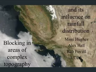
Study Sites – Comparison 9 • New York Watersheds: Average Temperatures: -20 – 20°C Average Annual Precipitation: ~1000-1300 mm Few orographic effects, less than 1/3 of precip falls as snow, floods can occur at any time of year Annually, ~70% of precipitation is translated into streamflow • Arizona Watersheds: Average Temperatures: -5 – 40 °C Average Annual Precipitation: ~300-800 mm Strong orographic effects, flash flood events are typically caused by summer rains Annually, ~15% of precipitation is translated into streamflow
Data Sources 10 • Calibration Data • Historical distributed hydrometerologic data • North American Land Data Assimilation System (NLDAS) Historical gridded reanalysis of hydrometeorologic variables Reanalysis of historical temperature, pressure, humidity, wind speed, downward shortwave radiation, downward longwave radiation, precipitation MPE • Multisensor Precipitation Estimator (MPE) Gridded Precipitation Estimates based on radar and gauges • Historical Gauge Data SNODAS Can be used to validate gridded products • Snow Data Assimilation System (SNODAS) Historical Snow Information used to calibrate snow model
Data Sources 11 • Real Time Data MPE • Distributed data that is disseminated in near-real time • National Digital Forecast Database (NDFD) NWS Gridded forecasts Current and future projections of temperature, humidity, wind, and cloud cover (to be used with hsB modeling) NDFD Future projections of rain and snow amounts • Multisensor Precipitation Estimator (MPE) Gridded Precipitation Estimates based on radar and gauges (used as input to hsB modeling) Q2 • DHR, Q2, HPE/HPN High resolution precipitation estimates and precipitation nowcasts (used as input to KINEROS modeling)
12 KINEROS Calibration • Designed for semiarid environments where overland flow dominates. • Calibration of global multipliers of saturated hydrologic conductivity and channel length. • Events are calibrated using a Z-R Relationship that matches ground truth • This project seeks to extend it to work well in humid catchments • Typical hydrographs for Platte Kill Watershed in the New York (absence of subsurface flow)
13 SM-hsB Calibration • Each Component must be calibrated separately January 23,2010 February 27,2010 March 1, 2010 200 mm • Energy Balance/snow component calibrated based on visual inspection using all available data 100 mm 0 • Subsurface flow component calibration procedure is fully automatic and based on matching the baseflow characteristics of the stream hydrograph
14 Coupling KINEROS and SM-hsB to run in Real Time • Ongoing work includes: • Implement continuous SM-hsB model in Real-Time to keep track of hydrologic state during interstorm periods • Keep track of catchment wetness so KINEROS can be initialized with the correct initial conditions • Keep track of snowmelt and initial snowmelt • Also provide simple flood risk assessment taking into account potential snow melt • This part of the system will run with a coarser temporal time step (~1 hour) and with fewer spatial discritizations than the high resolution portion
Coupling KINEROS and SM-hsB to run in Real Time 15 • Ongoing work includes: • Initialize KINEROS with correct initial conditions during flooding, combine subsurface flow dynamics so it better matches observed flow hydrographs hsB Hillslopes KINEROS Hillslopes • Initial states, projected snowmelt called from the continuous model component • Distributed and run at a very small temporal timestep (5 min) • Subsurface dynamics of SM-hsB model will have same temporal and spatial frequency as KINEROS using infiltrated water from KINEROS planes
Summary 16 • Use SM-hsB to keep track of hydrologic state between events, initialize KINEROS using those states • Coupling of models has three primary objectives: • Add support for snow; forecast flooding that involves rapid snowmelt and rain-on-snow • Improve KINEROS’s ability to reproduce hydrographs in humid catchments by adding a subsurface flow module • Models have been calibrated and tested in humid New York basins as well as semi-arid Arizona basins • Final model system will consist of two parts: • Lower resolution continuous model to keep track of hydrologic state and to do simple flood risk assessment • Higher resolution event-based model to simulate the flood hydrograph given current and forecast rainfall
Questions? 17 Contact info: Michael Schaffner Senior Service Hydrologist Mike.Schaffner@noaa.gov 607-770-9531, ex. 234 Reference: S. Yatheendradas, T. Wagener, H. Gupta, C. Unkrich, M. Schaffner, D. Goodrich, A distributed, real-time semiarid flash-flood model utilizing radar data, Regional Hydrologic Impacts of Climate Change, IAHS Publ. 296, 2005.