Profile and Differential Leveling
Profile and Differential Leveling. AGME 1613 Fundamentals of AST. Objectives. Define differential and profile leveling, and explain the purpose(s) and agricultural applications of each. Identify and correctly set-up and use leveling equipment.

Profile and Differential Leveling
E N D
Presentation Transcript
Profile and Differential Leveling AGME 1613Fundamentals of AST
Objectives • Define differential and profile leveling, and explain the purpose(s) and agricultural applications of each. • Identify and correctly set-up and use leveling equipment. • Properly record leveling field notes and perform error checks for differential and profile leveling surveys. • Complete differential and profile leveling surveys.
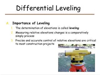
Leveling Definition and Types • A surveying procedure used to determine the elevation of points on the Earth’s surface. • Differential Leveling • Profile Leveling
B Difference? A Differential Leveling Purpose is to determine the difference in elevation between two (or more) points on the Earth’s surface.
Where is Differential Leveling Used? • Determining field slope (conservation plans, soil loss prediction, etc.). • Laying out and checking drainage ditches, waterways, tile drainage systems, etc. • “Cut-and-fill” requirements for building foundations. • Establish new “benchmarks” that have elevations tied in with existing benchmarks.
X X B X X X X X X X X A Profile Leveling Purpose is to describe the elevation at selected points on the Earth’s surface.
Where is Profile Leveling Used? • Developing field “contour maps.” • Designing and checking grade for drainage ditches and waterways. • Laying out farm ponds. • Road and highway construction.
Leveling Equipment:The Engineer’s Level • Telescope with “crosshairs.” • Base plate – attaches level to tripod. • Leveling screws – allows user to establish a “level line of sight.” • Level bubble – Instrument is level when bubble is inside target. • Focusing knob
Hundredths (.01) of a foot Tenths (.10) of a foot Feet Reading the Leveling Rod
.10 .09 .08 .07 .06 .05 .04 .03 .02 .01 6.00-ft.
Crosshair Reading the Leveling Rod Feet = 6 Tenths = .0 Hundredths = .09 Reading = 6.09 ft.
B A Direct Differential Leveling “What is the difference in elevation between two points, Where both points can be “shot” from the same location?” 6.45
Direct Differential Leveling 3.21 B A
- B A Direct Differential Leveling • Difference in Elevation • Rod reading at A = 6.45 • Rod reading at B = 3.21 Difference in elevation = 3.24-ft Which point is higher, A or B?
Leveling Terms • Station (STA) • Benchmark (BM) • Backsight (BS) • Height of Instrument (HI) • Foresight (FS) • Elevation (ELEV)
Leveling Terms • Station (STA) • Point where the rod is placed for a reading • Stations typically use a “distance-numbering” identification system: • STA 0 + 00 = 0 hundred feet + 0 feet • STA 2 +75 = two hundred feet + 75 feet • STA 5 + 05 =?????????
Leveling Terms • Backsight • A rod reading taken on a point of known elevation: • BM • TBM • Turning Point (TP)
Leveling Terms • Benchmark (BM) • A point of known elevation used as a reference point in a leveling survey. • A BM has a precisely known elevation above “mean sea level.” • Established by a variety of government agencies. • Temporary Benchmark (TBM) – Point of “assumed” elevation. Commonly used in “on-farm,” local surveys.
Leveling Terms • Height of Instrument (HI) • Height (elevation) of the level’s line of sight. • HI = BS + Known Elevation
Determining HI HI = 100.00 ft + 4.35 ft = 104.35 ft 4.35 HI = Elev + BS BM-1 Elev = 100.00 ft.
Leveling Terms • Foresight (FS) • Rod reading taken on a point of unknown elevation • HI – FS = Elev
Determining Elevation HI = 104.35 ft 6.35 Elev = HI - FS Elev = 104.35 ft. – 6.35 ft. = 98.00 ft.
Leveling Terms • Elevation (ELEV) • Vertical distance above “mean sea level” of a point on the earth’s surface. • Depending on purpose of survey, may be determined to nearest: .1 –ft .01 – ft. .001 –ft.
Differential Leveling 3.21 TBM-1 BM-1 Elev = 1225.50 ft.
Differential Leveling 3.01 TBM-1 BM-1 TP-1
Differential Leveling 6.04 TBM-1 BM-1 TP-1
Differential Leveling 0.28 TBM-1 BM-1
Differential Leveling 6.45 TBM-1 BM-1
Differential Leveling 10.98 TBM-1 BM-1 TP-2
Differential Leveling 3.95 TBM-1 BM-1 TP-2
Differential Leveling 5.36 TBM-1 BM-1 TP-2
Error of Closure • Difference in the “beginning” and “ending” elevation of a known point. • All surveys will have error. • The question is, “How much error can we tolerate in our survey?”
AE = 0.10 √ M Error Check • Mathematical Error Check • Error of closure =|SBS - SFS| • Allowable Error Check • Depends on purpose of the survey • Maximum feet of error based on distance
Simulated Profile Survey (Elev = 100.00) TBM-A