Enhancing Urban Flood Management with Effective Models
490 likes | 519 Vues
Join the workshop on Urban Flood Management conducted by Professor Kapil Gupta from IIT Bombay on July 13, 2018. Learn about best practices in limiting space, modeling applications in cities like Mumbai, Thane, Ahmedabad, and Ludhiana, rain and flood alert systems, model usage for drain sizing, and future directions. Explore solutions to downstream flooding challenges through flow control, attenuation, and BMPs for stormwater runoff. Discover applications like porous pavements, rainwater harvesting, detention, and retention ponds, and innovative storage schemes. Gain insights into flood early warning systems and disaster risk management plans using real-time data and hydrological simulations.

Enhancing Urban Flood Management with Effective Models
E N D
Presentation Transcript
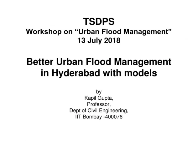
TSDPS Workshop on “Urban Flood Management”13 July 2018 Better Urban Flood Management in Hyderabad with modelsby Kapil Gupta,Professor, Dept of Civil Engineering,IIT Bombay -400076
Outline • Hyderabad drainage scenario • Best practices under limiting space • Applications of modeling in other cities Mumbai, Thane, Ahmedabad, Ludhiana • Rain alert system • Flood alert System • Use of models for sizing drains/storages • Future Direction
Current Scenario • Water supplied from distant sources to cities • Rapid developments in water supply sector
Development of the corresponding sewer systems very slow • Developments along natural drainage
The Problem The problem and it’s challenges • Downstream Flooding caused by excessive upstream flows • Conventional solution • Larger relief sewer - modify or upgrade • Space may not be available in urban areas • Costly, Severely disruptive, Not effective until fully implemented • Difficult to modify or upgrade The Solution
Hydrograph Schematic of Downstream Flooding or Spill 3 3 Upstream capacity of 3 units. Combined flows of 6 units is greater than downstream system capacity of 4 units. This leads to a Spill or Flood Volume with a peak of 2 units 2 6 EXCESS FLOOD VOLUME 4 Conveyance system (pipe) or Treatment Capacity of 4 units FLOW TO OUTFALL OR TO TREATMENT Flooding (Existing system downstream has a limited capacity leading to flooding)
Hydrograph Schematic showing effects of Flow Control and Attenuation (Storage) 3 3 ATTENUATION ATTENUATION Capacity of 3 units upstream Capacity of 3 units upstream 2 2 Downstream flows controlled to 2 units by flow control Combined flow does not exceed 4 units 4 0 FLOOD VOLUME OR CSO TO RIVER Flow within capacity of downstream system therefore NOflooding FLOW TO OUTFALL OR TO TREATMENT 4
BMPs - Structural Controls • Appropriate engineering devices implemented to control or delay storm water runoff and/or pollution
Applicationsand Scope • Porous pavements are presently being used for parking lots, driveways and sidewalks • With reasonable safeguards, they offer an elegant engineering alternative for streets and highway surfaces • Thus, porous pavements are an exciting example of sustainable building practice • http://cfpub.epa.gov/npdes/stormwater/menuofbmps/index.cfm?action=factsheet_results&view=specific&bmp=136&minmeasure=5 Permeable resin surfacing around a tree-pit
Source Control- Rooftop RWH (a) Roof itself (b) Ground level (c) Below the ground
Rooftop Rainwater Collecting System- storage on ground • 3 components • Collection • Conveyance • Storage Rooftop Rainwater Collecting System(Cacas, Brazil) Source: http://www.rain4food.net/wp-content/blogs.dir/10/files/sites/10/2013/11/ Rainwater-Harvesting-in-North-Eastern-Brazil-Blog-H.-Heijnen.pdf Near Nashik, Maharashtra
Flooding reduction due to rainwater tanks Percentage reduction on overflow volume for different size rainwater tanks (Butler, 2006)
Detention/Retention Ponds • Detention/Retention ponds constructed along urban drainage systems to provide temporary storage for U/S stormwater peak flows, controlled pond outlet • Detention pond- dry between flood events • Retention pond- some water always (lake!) • Wetlands are retention ponds with plants • Reed family help in pollutant retention as well
Detention Ponds in Japan Kirigaoka Regulating Pond http://www.worldwaterforum4.org.mx/sessions/FT5_19/4.%
Detention Ponds in Japan Kirigaoka Regulating Pond http://www.worldwaterforum4.org.mx/sessions/FT5_19/4.%
Instead of upgrading existing drains and construction of 7 kms long new box culverts in the most densely populated districts, which would take 10 years to complete, The Tai Hang Tung Storage Scheme, an integral part of the West Kowloon drainage improvement scheme, was designed to address the flooding threats in MongKok (Hong Kong) http://www.hkie.org.hk/ea/eng/details.asp?id=69 Inside view of Tai Hang Tung Storm water Storage Tank Capacity = 100,000m3
Smart Applications for Flood EWS • Use of weather and water level sensors for • Remote monitoring • Real time alerts, and • Mitigation measures • Mumbai Case Study • Real Time Flood Warning System • Flood Risk Assessment • Disaster Risk Management Master Plan (DRMMP)
Requirements for FEWS • Rainfall is highly variable in area and time • Network of rain gauges required which can measure and transmit rainfall in real time to managing authorities • Can issue alert for heavy rainfall • Flow gauge and channel/drain/slope data can enable computer Model (HEC-RAS from USACE) and predict water level in channel
Flood/water level forecast • Catchment data - Precipitation data • Discharge data Hydrological simulation - HEC HMS • River Geometry • Bridges • Culverts (Airport) (critical!) Hydraulic Simulation -HEC RAS Flow depth in river channel
Technology- Tipping Bucket Rain-Gauge http://lawr.ucdavis.edu/faculty/gpast/hyd151/tipbucket.html
Mumbai Rain Gauge Network • 35 state-of-the-art weather stations with tipping bucket rain gauges installed all over the city since June 2006 • 25 more installed in 2012; Total 60 • In each sub-catchment /grid, fire station chosen • Manned 24 hours, first point of rescue • Can give rainfall data every minute • Set to 15 minutes recording/ display data in real time • Calibrated to give alarm at predefined values of rainfall intensity (40 mm/h) • Average density 1 in 10 km2 • Administered by MCGM • Technical expertise by KG (IITB) • 1 ultrasonic flow (level) gage installed on Mithi River at Powai
Catchment runoff Recorded rainfall events, catchment characteristics HEC-HMS (Hydrological model) Rainfall runoff curves Model development Depth discharge curves River geometry HEC-RAS (Hydraulic model) Water level LS-SVM PGSL Rainfall forecast model 20-min ahead rainfall Real-time rainfall data Runoff Model application Flood alert Flood warning Water level Alert dissemination system: Communication to Municipalities, transport authorities, mass media and citizens using email, sms, mobile app MEDIUM HIGH LOW
Smart City should know the rainfall pattern over the city - Isohyetalmaps Rainfall on 3rd July, 2006 Rainfall on 4th July, 2006
Disaster Risk Management Master Plan (DRMMP) for Mumbai • The development of Mumbai’s DRMMP was started in April 2009 and completed in June 2011 • The project envisaged following main goals: 1. To establish a competent emergency management system for Mumbai that is based on the international standards of practice, 2. To institutionalize a DRM practice, operation and function for Mumbai by which hazards, vulnerability and risks are understood and competently managed, and 3. To develop a coherent set of objectives and recommendations to reduce disaster risk within Mumbai and consequently in the country
Disaster Risk Management Master Plan (DRMMP) for Mumbai • The DRMMP considered earthquake and flood hazards to Mumbai • Detailed risk assessment for the two hazards were carried out, which went beyond the traditional risk assessment found in scientific publications, and also considered the requirement for emergency management, response, rehabilitation, etc. • The risk assessments were also used to assess the likely impact on the governance and administrative structure of the city
Flood Risk Assessment for Mumbai • Objectives • To provide flood spread v/s ward area for Mumbai • To provide flood spread v/s people affected for Mumbai
Methodology for estimation of flood spread and population affected DEM from SRTM Generation of contours Delineation of catchment Rainfall data Catchment and drain characteristics Computation of runoff volume Inundation depth Flood spread Ward specific information Population affected
E Ward EF2 EF6 Flood spread for rainfall intensity = 50 mm/h Flood spread for rainfall intensity = 100 mm/h
Population affected for rainfall intensity 50 mm/h and 100 mm/h
Action Plan for Hyderabad • Phase I – 33% AWS coverage subject to minimum 2 AWS per catchment • Identify safe sites for AWS installation • Criteria • Manned 24 h. e.g. Fire Stations, GHMC pump houses, etc. • Connect AWS to GHMC control room through internet
Hyderabad: Requirement of AWS @ 1 per 4 sq km Areas from GHMC DPR prepared by Voyants Consultants AWS required- 1 per 4 sq km as per NDMA Urban Flooding Guidelines
Phase II • Satellite Images • Radar Images/data • Rainfall Data • Radar-rainfall correlation • Rainfall-water level correlation • Direct water level from radar data • Better Flood Early Warning System
Aims of a Master Drainage Plan • To facilitate proper draining of rainwater • prevent flooding/ waterlogging in developed/developing areas
Master Plan- Technical contents • Hydrologic Analyses • Clearly state design storm recurrence intervals for which drainage facilities are planned • Sufficient detail to provide reasonable estimates of required system conveyance capacities • Estimates of expected future flows in developing drainage basins • Zoning master plans • Estimates of ultimate land use
Take Home Message • Models like HECRAS, SWMM, MIKE, etc are computational tools to help us to determine • the size of the drains and • Sizes of best management practices like detention storage tanks, etc for the expected rainfall • Accurate rainfall intensity and data required! • There is no substitute for physically widening the drains in the hotspots • Otherwise flooding will only continue to increase as IPCC have indicated increased rainfall intensity
Thank you for your attention Contact Information: Prof. Kapil Gupta Department of Civil Engineering IIT Bombay 400 076 Phone 9820-409-433 Email: kgupta@iitb.ac.in profkgupta@gmail.com Kapil Gupta, IIT Bombay


