Download

1 / 22
220 likes | 331 Vues
The Central African Regional Program for the Environment (CARPE) aims to reduce forest degradation and biodiversity loss in the Congo Basin, the world's second-largest humid tropical forest. Funded by USAID, CARPE enhances local and regional resource management and governance, utilizing remote sensing (RS) to monitor forest changes. By building regional capacity and incorporating RS data into policy-making, CARPE addresses critical threats from population growth and unsustainable resource use. This document outlines CARPE’s strategic objectives, phases, and partnerships, highlighting the need for continuous data availability for effective forest monitoring.

E N D
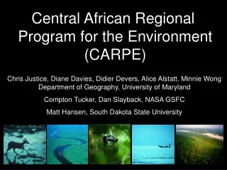
Central African Regional Program for the Environment (CARPE) Chris Justice, Diane Davies, Didier Devers, Alice Alstatt, Minnie Wong Department of Geography, University of Maryland Compton Tucker, Dan Slayback, NASA GSFC Matt Hansen, South Dakota State University
Overview • Brief introduction to CARPE • Using RS to monitor the Congo Basin Forests • Using RS products used to support policy and decision making • Building regional capacity to monitor LCLUC and the State of the Forest
Why the Congo Basin? • 2nd largest dense humid tropical forest • Species richness and endemism • Under increasing pressure from population growth, unsustainable resource use, poor management and other problems related to poverty and political instablity
What is CARPE? A 20 Year regional initiative funded by USAID Strategic Objective:To reduce the rate of forest degradation and loss of biodiversity in the Central African region through increased local, national and regional natural resource management capacity
CARPE Intermediate Results • Manage natural resources sustainably • Strengthen natural resources governance (institutions, policies, laws) • Institutionalize natural resources monitoring
How CARPE fits with international initiatives CARPE Phase I CARPE Phase II 1995 2010 2003 Presidents initiative on illegal logging 2002 World Summit on Sustainable Development Launch of the Congo Basin Forest Partnership 1999 Yaoundé Declaration Associated action plan (Plan de Convergence) Framework for transboundary forest conservation
Brief introduction to CARPE • Using RS to monitor the Congo Basin Forests • Using RS products used to support policy and decision making • Building regional capacity to monitor LCLUC and the State of the Forest
Dense humid forest Open / degraded forest Wooded savannah Grassland Water with sediment Deep water Basin Wide Monitoring Using an automated approach MODIS 500m surface reflectance composite (1999-2002) map of the Congo Basin
Preliminary Assessment of Intact Forest – used to train Landsat classifications Source: M. Hansen SDSU
Automated procedure applied to two Landsat epochsenabling a direct and spatially explicit comparison of forest cover from circa 1990 to circa 2000 This information will provide a baseline of forest change Source: M. Hansen SDSU
5 km Critical Issue of High Resolution data coverage • Landsat: SLC-off problem - April 2003 • On-Going Forest monitoring dependent on continued data availability 179062 2005 SLC off data 179062 2005 gap filled data 179062 2002 data A typical example of clouds in the gap fill data making the gap filled data more difficult to interpret and map.
Brief introduction to CARPE • Using RS to monitor the Congo Basin Forests • Using RS products used to support policy and decision making • Building regional capacity to monitor LCLUC and the State of the Forest
Landscape mosaics: created to provided a natural resource overview map for CBFP partners.
Brief introduction to CARPE • Using RS to monitor the Congo Basin Forests • Using RS products used to support policy and decision making • Building regional capacity to monitor LCLUC and the State of the Forest
Building Regional GIS and RS Capacity through OSFAC (Observation par satellite des forêts d’Afrique Centrale) GOFC-GOLD Central Africa Network
OSFAC Overview • Office established in Kinshasa • Links to the GIS/RS lab at the University of Kinshasa • Capacity building • Satellite data holding • OSFAC website • State of the Forest Report
Congo Basin State of the Forest Report • Report released Jan 2005 • Towards a periodic assessment of the Forest • US/EU/NGO participation Next steps • CBFP framework: combined efforts of all partners to synthesize data for national and international decision makers • Build national capacity to provide assessments
Next Steps • Build on current activities- basin wide monitoring- detailed mapping at the landscape level- data dissemination (CARPE Mapper, OSFAC)- capacity building - State of the Forest reporting • Secure high resolution multi-source imagery beyond 2003
For more information CARPE: http://carpe.umd.edu CARPE Mapper: http://maps.geog.umd.edu/carpemapper CBFP: http://www.cbfp.org Photos courtesy of Allard Blom, WWF and Steve Blake, WCS