Download
1 / 15
150 likes | 275 Vues
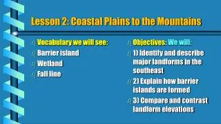
Lesson 2: Coastal Plains to the Mountains. Vocabulary we will see: Barrier island Wetland Fall line. Objectives : We will: 1) Identify and describe major landforms in the southeast 2) Explain how barrier islands are formed 3) Compare and contrast landform elevations.

E N D
Lesson 2: Coastal Plains to the Mountains • Vocabulary we will see: • Barrier island • Wetland • Fall line • Objectives: We will: • 1) Identify and describe major landforms in the southeast • 2) Explain how barrier islands are formed • 3) Compare and contrast landform elevations
Coastal Plains • Beaches are favorite places for swimming. • The wetlands are wet areas such as swamps or marshes. • The Florida Everglades are home to many rare plants and animals, such as egrets and ibis.
The Coastal plain runs all along the coast. It is area of LOW ELEVATION and has sandy soil. If you’ve been to the beach, you’ve been to the coastal plain.
LET’S HIT THE BEACH! It’s where we go for FUN!!! • Most of the states in the Southeast lie along the Atlantic Coast, the coast of the Gulf of Mexico, or BOTH! Beaches, such as this one, in HOLDEN BEACH, North Carolina, is a barrier island.
What is a barrier island? • A barrier island is a land mass that was formed over thousand s of years as more and more sediment was deposited by the ocean waves, currents and main land rivers.
Outer Coastal Plain /Inner Coastal Plain • Inland from the shore (where you are actually enjoying the crashing waves!) are ininnerand outer coastal plains. They are on the main land, and not part of the barrier island.
Wetlands in the Southeast: • Wetlands are areas of land covered by water • There are many wetlands in the coastal plain. Swamps, marshes and bogs are examples. • The Great Dismal Swamp is a huge swamp between Virginia and North Carolina A vast covers the southern tip of Florida. It is known as the Everglades. • A swamp is a low area of land that is covered by water at least part of the year. The Great Dismal Swamp Click to start the ride (4:32) The Florida Everglades Click the swamp to see a video of the beautiful Everglades (9:54
More than 300 kinds of birds live in the Everglades. • Alligators, crocodiles, turtles, snakes, and otters live in the park as well. • Manatees also live in the Everglades
Landform Map: This map identifies the coastal plain, the fall line, the piedmont and the Appalachian Mountains.
The Fall Line: End of the line! The hard bedrock of higher elevations will not wear away like the sandy soil of the coastal plain. When you move from the coastal plain inland, toward the mountains, you will notice that the land “juts up”. If there is a river or stream, there will be a water fall. This is the fall line. The fall line separates the coastal plain from the piedmont.
The Piedmont: Heading up! Past the fall line, starts and area of rolling hills and beautiful valleys. This area is know as the Piedmont. The word piedmont means “foot of the mountain”. The soil of the piedmont is different from the sandy soil of the coastal plain. The soil is dark brown or reddish. Sometimes it even looks like clay! We live in the piedmont. If you have ever dug into the ground when it is wet you have probably found some of this clay.
The soil: You can grow anything here! The soil is very rich and very good for farming. The many rivers flow through the piedmont toward the Atlantic Ocean which provides fresh water.
Appalachian Mountains • The Appalachian Mountains run from Maine to Alabama. • They are rugged and steep, with narrow valleys. • The longest marked hiking trail is in the Appalachians. • The trees provide wood for furniture.
The Blue Ridge Mountains and Mount Mitchell The Blue Ridge Mountains are part of the Appalachian Mountain range, like the Adirondacks, Green, White and Pocono Mountains. Mount Mitchell is the highest point east of the Mississippi River at 6684 ft.
Appalachian Mountains • The Appalachian Mountains are rich in natural resources, including coal and dense forests. • One area in and around the Appalachian Mountains is known as Appalachia.