Mind
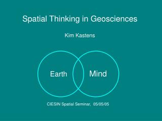
Spatial Thinking in Geosciences Kim Kastens. Mind. Earth. CIESIN Spatial Seminar, 05/05/05. Thanks to:. Toru Ishikawa, L-DEO Lynn Liben, Penn State psychology dept

Mind
E N D
Presentation Transcript
Spatial Thinking in Geosciences Kim Kastens Mind Earth CIESIN Spatial Seminar, 05/05/05
Thanks to: • Toru Ishikawa, L-DEO • Lynn Liben, Penn State psychology dept • Participants in GSA Pardee Symposium, October 2002: “Toward a Better Understanding of the Complicated Earth: Insights from Geologic Research, Education, and Cognitive Science.” • Participants in Wingspread Symposium, July 2002: “Bringing Research on Learning to the Geosciences” • Members of NRC Committee on “Enhancing Spatial Thinking in K-12 Education”
Lithosphere Atmosphere Hydrosphere
Lithosphere Atmosphere Hydrosphere Fertile research areas at interfaces
Mind Earth
Mind Earth Fertile research area at interface
Mind Earth Fertile research area at interface How does the human mind comprehend and reason about something as big, old, and complicated as the Earth System?
How does the human mind comprehend and reason about something as big, old, and complicated as the Earth System? • having evolved to think about spatial scales ranging from a handsbreadth to the distance one could walk in a day…
How does the human mind comprehend and reason about something as big, old, and complicated as the Earth System? • having evolved to think about spatial scales ranging from a handsbreadth to the distance one could walk in a day… • and temporal scales from a moment to a day to a season to a year to a lifetime…
How does the human mind comprehend and reason about something as big, old, and complicated as the Earth System? • having evolved to think about spatial scales ranging from a handsbreadth to the distance one could walk in a day… • and temporal scales from a moment to a day to a season to a year to a lifetime… • and complexity scales from ??? to ???
“Oil is found in the minds of men” [and women] Wallace Pratt, Humble Oil … and so is every other discovery and insight in geoscience! (Photo from www.nps.gov/gumo/ adhi/adhi3.htm)
Know the strengths and weaknesses and limitations of your instruments. www-mpl.ucsd.edu/research_programs/ deeptow.html
A Case Study:Spatial Thinking in the Geosciences What are the spatial thinking tasks that expert geoscientists excel at ….and that geoscience students must master?
Describing the shapes of natural objects, rigorously and unambiguously. • Categorizing objects by their shape. • Ascribing meaning to the shape of a natural object. • Recognizing a shape or pattern amid a cluttered noisy background. • Visualizing a 3-D object or structure or process by examining observations collected in one or two dimensions. • Describing the position and orientation of objects in the real world relative to a coordinate system anchored to the Earth. • Recalling locations of previously observed geological phenomena. • Mentally manipulating a volume by folding, faulting, and eroding. • Envisioning the motion of objects or materials through space in three dimensions. • Making and interpreting spatial representations (including maps). • Using spatial thinking to think about time. • Using spatial thinking to think about non-spatial properties.
Describing the shapes of natural objects, rigorously and unambiguously. Crystallographer’s description of crystal: “a symmetry plane at right angles to each of the 2-fold rotation axes, and four 3-fold axes of rotary inversion.” Figures 60 from: Hurlbut, Cornelius S. (1971) Dana’s Manual of Mineralogy, 18th ed. New York: John Wiley & Sons, Inc. Figure A11 from: Hobbs, Bruce E., Winthrop D. Means, and Paul F. Williams (1976) An Outline of Structural Geology. New York: John Wiley & Sons, Inc.
Describing the shapes of natural objects, rigorously and unambiguously. • Elements used in geoscientists’ descriptions of shapes: • Symmetry • Size • Angular relationship • Projections of 3-D objects onto a plane
Describing the shapes of natural objects, rigorously and unambiguously. Downs and Liben (1991) studied college students’ ability to anticipate the form of a shadow cast by a shape rotated to various angles. Figure 5B in: Downs, Roger M. and Lynn S. Liben (1991) The Development of Expertise in Geography: A Cognitive-Developmental Approach to Geographic Education. Annals of the Association of American Geographers, 81(2), pp.304-327.
Describing the shapes of natural objects, rigorously and unambiguously. They found that college students performance on projective tasks is poor when the shapes are three dimensional. Figure 2 in: Merriwether, Ann M. and Lynn S. Liben (1997) Adults’ Failures on Euclidean and Projective Spatial Tasks: Implications for Characterizing Spatial Cognition. Journal of Adult Development, Vol. 4, No. 2.
Describing the shapes of natural objects, rigorously and unambiguously. Question: • What is known about how people perceive symmetry? • What is known about how people estimate size and distance? • What is known about how people estimate angles?
Classifying or categorizing an object by its shape. Marshak, Stephen, (200) Earth Portrait of a Planet, new York, W.W. Norton & Co. Inc., Appendix B-2 Flow Charts for Identifying Minerals .
Classifying or categorizing an object by its shape. Collins and Quillian’s (1969) seminal paper on how knowledge is represented in the brain, postulated that concepts are represented as hierarchies of inter-connected concept-nodes. A schematic diagram of the sort of hierarchical, semantic networks proposed by Collins and Quillian (1969). M. W. Eysenck & M. T. Keane (1995). Cognitive psychology: A student's handbook. Hove, UK: Psychology Press.
Classifying or categorizing an object by its shape. They tested this hypothesis by measuring the time to answer questions that require a search from one node to another, e.g.. “Is a canary a bird?” vs. “Is a canary an animal?” M. W. Eysenck & M. T. Keane (1995). Cognitive psychology: A student's handbook. Hove, UK: Psychology Press.
Classifying or categorizing an object by its shape. Questions: • Did humans evolve a brain that organizes knowledge in hierarchies in order to make sense of a world which is inherently organized that way? • Do we impose hierarchical organizational schema on nature because that is how our brains are good at organizing knowledge? or
Ascribing meaning to the shape of a natural object. Distribution of modern species of planktonic foraminifera. Figure 16-1 in: Kennett, James (1982) Marine Geology. Englewood Cliffs, NJ: Prentice-Hall, Inc. Mylonite. Note fine grain size and strong foliation probably caused by intense shearing. Source: http://www.glg.ed.ac.uk/cgi-bin-2/config2-spvft Source: http://www.geolab.unc.edu/Petunia/IgMetAtlas/meta-micro/mylonite.X.html
Ascribing meaning to the shape of a natural object. Misconception Research: Kusnick’s (2002) analysis of student narratives about rock formation found that many students believe that pebbles “grow” or accrete.
Ascribing meaning to the shape of a natural object. Question: • How do people go from observations about shape, geometry, and pattern to inferences about process and causality? • Form follows function • Form reflects formative processes • Meaning is inferred from co-occurrence under known conditions. • Meaning is inferred in situation with only one dominant causal factor.
Visualizing a 3-D object or structure or processby examining observations collected inone or two dimensions. Marie Tharp in her Lamont Hall office, c. 1961. World Ocean Floor by Bruce C. Heezen and Marie Tharp.
Visualizing a 3-D object or structure or processby examining observations collected inone or two dimensions.
Visualizing a 3-D object or structure or processby examining observations collected inone or two dimensions. David Marr’s (1982) studies of visual perception emphasize that we have vast experience translating from 2-D data to 3-D mental models.
Visualizing a 3-D object or structure or processby examining observations collected inone or two dimensions. Question • Can we build on this notion of primal sketch and 2 1/2 dimensional sketch as a way to help learners go from 1-D or 2-D viewer-centered (or sensor-centered) data to a 3-D mental model not tied to viewpoint?
Describing the position and orientation of objects in the real world relative to a coordinate system anchored to the Earth.
Describing the position and orientation of objects in the real world relative to a coordinate system anchored to the Earth.
Describing the position and orientation of objects in the real world relative to a coordinate system anchored to the Earth. Levinson (1996) describes 3 frames of reference… S. C. Levinson (1996). Frames of reference and Molyneux's question: Crosslinguistic evidence. In P. Bloom, M. A. Peterson, L. Nadel, & M. F. Garrett (Eds.), Language and space (pp. 109-169). Cambridge, MA: MIT Press.
Describing the position and orientation of objects in the real world relative to a coordinate system anchored to the Earth. … and has designed tasks to reveal whether subjects have employed intrinsic, relative, or absolute frames of reference during the task. S. C. Levinson (1996). Frames of reference and Molyneux's question: Crosslinguistic evidence. In P. Bloom, M. A. Peterson, L. Nadel, & M. F. Garrett (Eds.), Language and space (pp. 109-169). Cambridge, MA: MIT Press.
Describing the position and orientation of objects in the real world relative to a coordinate system anchored to the Earth. Subjects in western cultures overwhelmingly used a relative frame of reference... S. C. Levinson (1996). Frames of reference and Molyneux's question: Crosslinguistic evidence. In P. Bloom, M. A. Peterson, L. Nadel, & M. F. Garrett (Eds.), Language and space (pp. 109-169). Cambridge, MA: MIT Press. … but that tendency is not the same across cultures.
Describing the position and orientation of objects in the real world relative to a coordinate system anchored to the Earth. Question: • How can we foster learners’ ability to think in absolute frames of reference within a language which seems to favor relative frames of reference? • How do people convert information from a relative frame of reference to an absolute frame of reference?
Recalling locations of previously observed geological phenomena. I know I’ve seen something like this before.… Now where was that?
Recalling locations of previously observed geological phenomena. McBurney et al. (1997) and Eals and Silverman (1994) test subjects’ recall of location of objects. Figure 3 from: Eals, Marion and Irwin Silverman (1994) The Hunter-Gatherer Theory of Spatial Sex Differences: Proximate Factors Mediating the Female Advantage in Recall of Object Arrays. Ethnology and Sociobiology, 15: 95-105.
Recalling locations of previously observed geological phenomena. In contrast to many spatial skills, they find females out-perform males. McBurney, D. H., S. J. C. Galin, et al. (1997). "Superior spatial memory of women: stronger evidence for the gathering hypothesis.” Evolution and Human Behavior 18: 165-174.
Recalling locations of previously observed geological phenomena. They attribute this to women’s evolutionary role as gatherers who needed to remember the location of medicinal and edible plants. "Rice Gatherers" by Seth Eastman, 1867, from the Capitol, Washington, D.C.
Recalling locations of previously observed geological phenomena. Questions • Can the evolutionary dimorphism hypothesis be tested? • Can we extrapolate from a table top to a geologist’s entire world of remembered outcrops? • Can we extrapolate from a half hour experiment to a geologist’s lifetime of field experiences? • What other aspects of location memory should be studied (in addition to gender contrast) to support geoscience experts and geoscience learners?
Mentally manipulating a volume by folding, faulting and eroding. Figure 24.13 in: Ramsay, John G. and Martin I. Huber (1987) The Techniques of Modern Structural Geology, Volume 2: Folds and Fractures. New York: Academic Press; Harcourt Brace Jovanovich, Publishers.
Mentally manipulating a volume by folding, faulting and eroding. Paper folding tasks are classic measures of spatial visualization ability. J. Eliot & I. M. Smith (1983). An international directory of spatial tests. Windsor, UK: NFER-NELSON.
Mentally manipulating a volume by folding, faulting and eroding. Question: • What has been learned from >50 years of studying paper folding, that can be applied to thinking about the folding of geological strata?
Using spatial thinking to think about non-spatial properties.
Using spatial thinking to think about non-spatial properties. Questions • Why is spatialization of non-spatial information so powerful? • How can we help learners learn to harness the power of spatialization?
Lamont Research • Describing the shapes of natural objects • Categorizing objects by their shape. • Ascribing meaning to the shape of a natural object. • Recognizing a shape or pattern amid a cluttered noisy background. • Visualizing a 3-D object or structure or process. • Describing the position and orientation of objects in the real world relative to a coordinate system anchored to the Earth. • Recalling locations of previously observed geological phenomena. • Mentally manipulating a volume by folding, faulting, and eroding. • Envisioning the motion of objects or materials through space in three dimensions. • Making and interpreting spatial representations (including maps). • Using spatial thinking to think about time. • Using spatial thinking to think about non-spatial properties.
How do geology students learn to visualize 3-D geologic structures from the limited information available in outcrops?