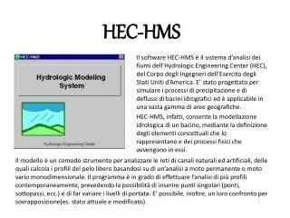
HEC-HMS HEC-HMS 를 이용한 강우 - 유출해석
HEC-HMS HEC-HMS 를 이용한 강우 - 유출해석. 2012.11.14. 담당교수명 : 서 영 민 연 락 처 : elofy@naver.com 010-2507-7107. HEC-HMS 다운로드 및 설치. http:// www.hec.usace.army.mil/. HEC-HMS 설치. HEC-HMS_35_Setup.exe 실행. HEC-HMS 설치. HEC-HMS 설치. HEC-HMS 설치. HEC-HMS 설치. 실습유역.

HEC-HMS HEC-HMS 를 이용한 강우 - 유출해석
E N D
Presentation Transcript
HEC-HMS HEC-HMS를 이용한 강우-유출해석 2012.11.14 담당교수명: 서 영 민 연 락 처 : elofy@naver.com 010-2507-7107
HEC-HMS 다운로드 및 설치
HEC-HMS 설치 HEC-HMS_35_Setup.exe 실행
HEC-HMS 실행 & 새 프로젝트의 시작
HEC-HMS의 실행 시작 모든 프로그램 HEC HEC-HMS 3.3 (또는 C:\Program Files (x86)\HEC\HEC-HMS\3.3에서 HEC-HMS.exe 실행)
새 프로젝트의 시작 File New Name : 프로젝트 이름 Description : 프로젝트에 대한 설명 Location : 프로젝트가 저장될 위치지정 Default Unit System : 단위설정(Metric)
Basin Model 가져오기 File → Import → Basin Model
Basin Model 가져오기 배경 Map 가져오기 Desktop의 빈공간을 오른쪽 마우스 버튼 클릭 Background Layers Add 버튼 클릭 map 파일 선택 Select 버튼 클릭
Basin Model 가져오기 Map의 최대범위 설정 View → Maximum Extents Method : Union Of All Maps and Elements
Basin Model 가져오기 Element의 이름 변경 (optional) 각 element를 선택 → F2 키를 누른 후 이름 변경 (또는 오른쪽 마우스 클릭후 rename 클릭)
Basin Model 가져오기 Basin Model에 대한 단위설정 - Basin Model 클릭 → Unit System 설정 (Metric)
Basin Model 설정: Subbasin • - Area : 유역면적 (km2) • - Loss Method : 손실산정기법 선택 • (예, SCS Curve Number) • Transform Method : 강우-유출모델 선택 • (예, Clark/Snyder/SCS) • - Baseflow Method : 기저유출산정기법 선택 • (예, Recession)
Basin Model 설정: Loss - Initial Abstraction : 강우초기손실 빈칸으로 남겨둘 경우 다음 식을 이용하여 산정됨. - Curve Number : 소유역에 대한 CN값 (홍수유출분석시 AMC-III 조건 적용) - Impervious : 불투수율 (도시화 영향이 CN값에 반영될 경우 불투수율은 빈칸으로 남겨둠)
Basin Model 설정: Transform a) Clark Unit Hydrograph - Time of Concentration : 도달시간, Tc (hr) - Storage Coefficient : 저류상수, K (hr)
Basin Model 설정: Transform b) Snyder Unit Hydrograph - Standard Lag : 지체시간, Tp(hr) - Peaking Coefficient : 첨두계수, Cp(0.4~0.8) c) SCS Unit Hydrograph - Graph Type : Standard - Lag Time : 지체시간, Tp(min)
Routing Model 설정 Reach 선택 → Reach 탭에서 Routing Method 설정 (Muskingum)
Routing Model 설정 Muskingum Routing - Muskingum K (hr) : travel time through reach - Muskingum X : 0.0~0.5 0.0 : maximum attenuation 0.5 : no attenuation - Subreaches :- affects attenuation :- One subreach gives more attenuation and increasing the number of sub-reaches decreases the attenuation. :- Good approximation :
Basin Model 설정 각 소유역에 대한 Basin Model 설정을 한번에 지정하는 방법 - Watershed Explorer에서 소유역을 모두 선택(Ctrl+Click 또는 Shift+Click)
Basin Model 설정 - Parameters → Subbasin Methods → Transform - Change Method창에서 원하는 transform method를 선택
Basin Model 설정 - Parameters → Subbasin Methods → Loss - Change Method창에서 원하는 loss method를 선택
Basin Model 설정 - Parameters → Subbasin Methods → Baseflow - Change Method창에서 원하는 baseflow method를 선택
Basin Model 설정 각 소유역에 대한 매개변수값을 한번에 입력하는 방법 - Parameters → Subbasin Area - Show Elements를 All Elements로 선택 매개변수값 입력 Apply Close
Basin Model 설정 - Parameters → Transform → Clark Unit Hydrograph - Show Elements를 All Elements로 선택 매개변수값 입력 Apply Close
Basin Model 설정 - Parameters → Loss → SCS Curve Number - Show Elements를 All Elements로 선택 매개변수값 입력 Apply Close
Basin Model 설정 - Parameters → Baseflow → Recession - Show Elements를All Elements로 선택 매개변수값 입력 Apply Close
Basin Model 설정 - Watershed Explorer에서 Reach를 모두 선택(Ctrl+Click 또는 Shift+Click)
Basin Model 설정 - Parameters → Reach Methods → Routing - Change Method창에서 원하는 Routing method를 선택
Basin Model 설정 - Parameters → Routing → Muskingum - Show Elements를All Elements로 선택 매개변수값 입력 Apply Close
새로운 Control Specification 생성 Control Specification : 모의 시작과 종료시간, 시간간격을 설정 - Components → Control Specifications Manager - New 버튼 클릭 → Name 및 Description 입력 → Create 버튼 클릭
새로운 Control Specification 생성 - 생성된 Control Specifications 클릭 → 아래의 그림과 같이 모의 시작과 종료 및 시간간격설정 ※ Time Interval :- 1분~24시간 사이 선택 가능 :- 모의결과에 대한 시간간격과 동일 :- 모의 종료로 지정된 시간은 시간간격의 배수가 되어야 함. 예) 시간간격이 10분일 경우 종료시간은 10:00, 10:10, 10:20 등이 되어야 함.
Gage 생성 시계열 자료 입력
시계열 자료: Precipitation Gage (1) 새로운 Gage 생성 - Components → Time-Series Data Manager - Data Type : Precipitation Gages
시계열 자료: Precipitation Gage - Name 및 Description 입력 - 이와 같은 방법을 각 관측소에 대해 반복
시계열 자료: Precipitation Gage - 각 관측소에 대한 추가정보 입력 · Data Source : Manual Entry · Units : Incremental Millimeters · Time Interval : 1hr (강우자료의 시간간격) · Latitude Degrees~Longitude Seconds : 관측소 좌표 (관측소 좌표는 역거리법에서만 필요하므로 역거리법을 사용하지 않을 경우는 생략해도 무방함)
시계열 자료: Precipitation Gage (2) Time Window 생성 - Components → Time-Series Data Manager - 관측소 선택 → Add Window
시계열 자료: Precipitation Gage - Create From Control Specifications : Enter Manually → 시작 및 종료 시간 입력 → Add 버튼 클릭 또는 Gage의 Time Window를 선택한 후 아래의 Time Window 탭에서 시작 및 종료 시간 입력
시계열 자료: Precipitation Gage - 다른 관측소 지점에 대해 위와 같은 작업을 반복