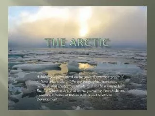
The Arctic Paradox
Arctic Sea Ice: A Tragic Tale of Loss and Revenge. Jennifer Francis, Rutgers University. The Arctic Paradox. or. Glen Gerberg Weather and Climate Summit Breckenridge, CO -- 8-13 January 2012. Photo by Janes. In the good old days… . The new normal.

The Arctic Paradox
E N D
Presentation Transcript
Arctic Sea Ice: A Tragic Tale of Loss and Revenge Jennifer Francis, Rutgers University The Arctic Paradox or... Glen Gerberg Weather and Climate Summit Breckenridge, CO -- 8-13 January 2012 Photo by Janes
In the good old days… The new normal. The difference in ice area is ~1,300,000 miles2.
That’s an area covering about 42% of the lower 48. generated by J. Masters
So, the question is not whether sea-ice loss is affecting large-scale atmospheric circulation… …it’s how can it not ? …but, let’s back up a bit. How did we get into this mess?
The story goes like this… The fossil fuel era began with the industrial revolution… CO2 Concentration
Good ol’ days Increasing GHGs and related feedbacks caused ice to gradually thin. 1990s GHGs Ice thickness (m) Rothrock and Kwok, 2009
Ice extent in the good ol’ days was controlled mainly by wind variations... …but the recent thinner ice was defenseless against the attack of the AO+ during the ‘90s Normal conditions Arctic Oscillation Index Positive AO Index Ice-age Movie From NOAA’s ClimateWatch
Ice Age is a Big Deal because… it’s a proxy for ice thickness. And THAT’s a big deal because a thinner ice cover is more easily melted, more easily moved by the wind, and more likely to follow a trajectory of loss as GHGs continue to increase. Thick ice by Maslanik and Fowler, NSIDC, Arctic Report Card 2011
Ice age at the end of March 8 6 4 2 0 5+ years 4 3 2 Ice extent (millions of km2) Ice age at the end of summer First year ice 8 6 4 2 0 1985 1990 1995 2000 2005 2010 5+ years Ice extent (millions of km2) 4 3 2 First year ice 1985 1990 1995 2000 2005 2010 From Stroeve et al. (2011) Climatic Change
The thinner ice cover is more mobile and more vulnerable to anomalous wind patterns, like those generated by a high-amplitude jet stream: The Arctic Dipole (Overland and Wang, 2010) 2007 2008 2009 2010 2011 Thick ice of the good ol’ days was much less affected by these wind patterns (Wang et al, 2009)
All that new open water absorbs additional solar radiation during spring and summer… …that heats the sea surface and adds yet more fuel to the Arctic fire… Sea surface temps ∆SST AK
Summary so far… • GHGs => gradual thinning • Natural variability: period of AO+ flushes thick ice out of Arctic in ‘90s • Thinner ice cover more easily pushed by winds and melted by anomalous heat fluxes: it can’t recover • Additional open water absorbs more sunlight, heats ocean surface, melts more ice • What’s up with all that heat?? Ice extent anomaly 1960 1970 1980 1990 2000
During autumn and winter, energy - lots more than normal – is being transferred to the atmosphere as sensible heat, water vapor, and infrared radiation.
Which brings us back to the question: It’s not whether sea-ice loss is affecting large-scale atmospheric circulation… …it’s how can it not? And what are the mechanisms ? Budikova, Global Planet. Change, 2009 Honda et al, GRL, 2009 Bhatt et al, Geophys. Mono., 2008 Overland and Wang, Tellus, 2010 Deser et al, J. Climate, 2007, 2010 Petoukhov and Semenov, JGR, 2010 Francis et al, GRL, 2009 Seierstad and Bader, Clim. Dyn., 2009 Higgins and Cassano, JGR, 2009 Sokolova et al, GRL, 2007
This study focuses on the connections between Arctic Amplification and extreme weather in northern hemisphere mid-latitudes Extreme weather = high-amplitude, slow-moving upper-level patterns that cause persistent weather conditions Wettest days in Chicago Coldest days in Tampa Hottest days in Atlanta 500 hPa 500 hPa 500 hPa
1000-500 hPa thickness anomaly during fall 2000 to 2010 Near-surface temperature anomaly during fall 2000 to 2010 Temperature anomaly at 850mb during fall 2000 to 2010 OND Temperature anomaly at 700mb during fall 2000 to 2010 North Atlantic North Pacific High ice High ice … and winter Poleward 1000-500 hPa thickness gradient Low ice Low ice from Francis et al, GRL, 2009 9 10 11 12 1 2 3 month 9 10 11 12 1 2 3 month Data obtained from NCEP/NCAR Reanalysis, Kalnay et al. (1996), NOAA/ESRL Physical Sciences Division, Boulder CO from their web site at http://www.esrl.noaa.gov/psd
N. America and N. Atlantic Connecting the dots (focus on fall and winter): Thickness increases are larger in high latitudes than in mid-latitudes =>expect 2 main effects: First effect:Weaker poleward temperature gradient => weaker zonal wind speeds. Do we see that? JFM OND 1000-500 hPa thickness difference between 80-60oN and 50-30oN Yep. JFM OND ~ 20% less 14 12 10 8 JAS AMJ Zonal mean wind at 500 hPa, 40-60oN
Weaker zonal wind speeds favor slower moving Rossby waves, which leads to more persistent “stuck” weather patterns. Sound familiar?
Second effect: Larger warming at high latitudes causes peaks of ridges to elongate • Wave amplitude increases • Higher-amplitude waves progress more slowly • More persistent weather patterns 500 hPa isopleth
Is this really happening? Let’s dig deeper: • Focus on 500 hPa heights – integrates effects of heating in lower troposphere. • Select narrow height range that captures trajectory • Analyze temporal and spatial behavior All data for this work are from the NCEP/NCAR Reanalysis, Kalnay et al. (1996), obtained from the NOAA/ESRL Physical Sciences Division, Boulder CO at http://www.esrl.noaa.gov/psd
Is wave amplitude really increasing? Trends (OND) • Wave amplitude measured as seasonal-mean difference in latitude between ridges and troughs at each longitude • Amplitude is increasing almost everywhere
How has the spatial and temporal distribution of 500 hPa heights changed during autumn? Autumn (OND) Fractional anomalies in number of gridpoints with selected 500 hPa height • Increased ridging north of 50oN • Decreased troughs • Has wave amplitude increased or has whole pattern shifted northward?
Autumn (OND) Sept ice area r = -0.8 • Maximum latitude of ridges increasing • Bottoms of troughs steady since ~1980 • Amplitude increasing steadily since ~1980 • High correl’n with ice r = -0.1 r = -0.8
Where are northward elongations occurring? Autumn (OND) Trends (OND) 340 260 300 • Ridge peaks located mainly over western N. America and eastern N. Atlantic • Number of ridge points north of 50oN increasing west of Greenland
Could this be contributing to increasing max and min fall temperatures in U.S. since mid-1990s?? 1920 1940 1960 1980 2000 T-max T-min 1920 1940 1960 1980 2000 from NCDC/NOAA Climate Extremes Index
Now let’s take a look at winter: Winter (JFM) Fractional anomalies in number of gridpoints with selected 500 hPa height • Increased ridging north of 40oN • Decreased troughs • Increased wave amplitude ?
Winter (JFM) AO Index r = 0.3 • Maximum latitude of ridges increasing • Bottoms of troughs shifting northward • Amplitude increasing steadily since late 1980s • Weak correl’n with AO r = 0.7 r = 0.1
from NOAA/CPC Sunspots
Trends (JFM) Winter (JFM) 340 260 300 • Ridge peaks located mainly over western N. America and eastern N. Atlantic • Number of ridge points north of 40oN increasing, especially over N. America
Winter (JFM) troughs Trends (JFM) 340 260 300 • Troughs consolidating along US east coast • Fewer (weaker) troughs over west/central US and eastern N. Atlantic
What about summer? • Snow is melting earlier over high-latitude land • Soil is exposed to sunlight earlier, so it dries and warms earlier • Further Arctic amplification Summer surface T anoms from Rutgers Snow Lab
Summer (JAS) May snow area r = -0.9 • Ridge peaks and troughs shifting northward • Amplitude increasing • High correlations with May snow area r = -0.9 r = -0.7
Summer (JAS) Trends (JAS) 340 260 300 • Preferential ridging over western N. America • Ridging increasing generally, especially in recent years and in western N. Atlantic (=> Greenland?)
Could this be contributing to increasing max and min summer temperatures in U.S.? 1920 1940 1960 1980 2000 T-max T-min 1920 1940 1960 1980 2000 from NCDC/NOAA Climate Extremes Index
J.A. Francis – Rutgers Univ. Weather and Climate Summit, 2012 Summary Arctic Amplification High latitudes warming more than mid-latitudes, especially in fall and winter, but also in summer over land => Poleward thickness gradient weakening Weaker upper-level, zonal-mean flow, reduced phase speed Peaks of upper-level ridges elongate northward, wave amplitude increases • Rossby waves progress more slowly • Weather conditions more persistent • Increased probability of extremes: cold spells, heat waves, flooding, prolonged snowfall, and drought