Census Data Update
Census Data Update. Craig Best Supervisory Geographer Kansas City Regional Office. Today’s Discussion Topics. Geographic Products Demographic Products Geographic Support System Initiative (GSS). Census Bureau Geography.

Census Data Update
E N D
Presentation Transcript
Census Data Update Craig Best Supervisory Geographer Kansas City Regional Office
Today’s Discussion Topics • Geographic Products • Demographic Products • Geographic Support System Initiative (GSS)
Census Bureau Geography • The integrating factor for all U.S. Census Bureau products. The framework on which the data rest. • The key to mapping the data is the Geographic Identifier (GEOID) • Each piece of census geography has a unique GEOID
Guide to State and Local Census Geography http://www.census.gov/geo/www/guidestloc/guide_main.html
Good Ole Census Maps • 2010 Census Reference • Census Block Maps • Census Tract Reference Maps • School District Reference Maps • P.L.94-171 County Block Maps • P.L.94-171 VTD/SLD Reference Maps • 2010 Census Reapportionment Map • 2010 Census Local Census Offices with Type of Enumeration Areas • Census Geography (2000 and 1990) • American Indian Tribal Census Tract Outline Maps:Description2000 • American Indian/Alaska Native/Hawaiian Home Land Block Maps:Description2000 • Census Block Maps: (Also available on DVD)Description2000 | 1990 • Census Tract Outline Maps: (Also available on DVD)Description2000 | 1990 • 2007 Economic Census Maps • State, County and Combined Statistical/Metropolitan/Micropolitan Area (CBSA) Maps • General Reference • State/County Wall Map of the United States:2010 | 2003 • State-based County Outline maps (page-size):Description2000 | 1990 • State/County Subdivision Outline Maps (page-size):2000 • Census Regions and Divisions of the United States:[PDF] or [Text] • Partnership Program Maps • Boundary and Annexation Survey Maps • Congressional District Maps Congressional District Map Products • 112th Congressional District Maps111th Congressional District Maps110th Congressional District Maps109th Congressional District Maps108th Congressional District Maps • Metropolitan Areas Maps • Metropolitan and Micropolitan Statistical Areas Wall Maps:2009 | 2008 | 2007 | 2006 | 2005 | 2004 | 2003 • State-based Metropolitan and Micropolitan Statistical Areas maps (page-size):2004 | 2003 • New England City and Town Area Wall Maps: 2006 | 2003 • State based Metropolitan Areas maps (page-size):1999 • U.S. based Metropolitan Areas maps (page-size):1999 • Metropolitan Areas of the United States and Puerto Rico (wall map):1999 • New England Metropolitan Areas (wall map):1999 • Census 2000 Public Use Microdata Area (PUMA) Maps • Super-Public Use Microdata Area (Super-PUMA) Maps (1-percent sample):Description2000 • Public Use Microdata Area (PUMA) Maps (5-percent sample):Description2000 • Urban Areas • Urbanized Area (UA) Outline Maps (wall-size):Description2000 • Urban Cluster (UC) Outline Maps (wall-size):Description2000 • Census 2000 Redistricting Data Program Maps • (Available on DVD and CD-ROM) P.L. 94-171 County Block Maps:Description2000 • P.L. 94-171 Voting District/State Legislative District Outline Maps:Description2000 • THEMATIC MAPS(description) • Population Density: 2010 [PDF] • Total Population & Population Change: 2010 • Population Profiles: 2010 | 2000 • Centers of Population: 2010 | 2000 | Historical • Population Distribution of the United States:2010 | 2000 | 1990 • SPECIAL PURPOSE MAPS • May 2011 Mississippi River Flood Area Resource Maps • The American Indians and Alaska Natives in the United States Wall Map 2010 | 2000 • Mapping Census 2000: The Geography of U.S. Diversity Description2000 • Census Regions and Divisions of the United States[PDF] or [Text]
TIGER/Line Files • Have been around since the 1990 Census • First release was in 1988 • Currently available for download as shapefiles • State and County based • FTP and web interface • WFS option is in the works
TIGER/Line Files • Provides the most detail • State and County based files • Files for Geographic Areas • State, county, tract, block groups, block, school districts, legislative districts, etc • Files for Features • Roads, rails, hydro, landmarks, military installations
TIGER/Line Files • Good for mapping at the state, county, or sub-county level • Best product for spatial analysis
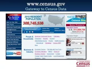
www.census.gov http://www.census.gov
Cartographic Boundary Files • State level files for selected geographies • These are generalized files… • Line segments removed to simplify boundaries • Significantly reduces the size of the files • CAUTION!! Don’t mix county based TIGER/Line files with Cartographic Boundary files
COB Advantages • Simplified shapes improve the appearance of geographic areas when displayed at small scales. • These boundary files take up less disk space than their ungeneralized equivalents. • Cartographic boundary files take less time to render on screen.
COB Limitations • These files should not be used for: • geographic analysis including area or perimeter calculation. • geocoding addresses. • determining precise geographic area relationships. • Some geographic areas are excluded from these files. • Geographic areas may not align with the same areas from another year.
COB Scale • Files are available at target map scales of: • State Level • 1:500,000 • National Level • 1:5,000,000 • 1:20,000,000
Refer to document entitled “Cartographic Boundary File Summary Level Codes” to determine the layer type.
KMLs • Prototypes coming very soon • “Testing the Market” • Initial release to include County and Census Tract
What is Summary File 1? • Contains data compiled from the questions asked of all people at every housing unit • Population items include sex, age, race, Hispanic or Latino Origin, household relationship, household type, household size, family type, family size and group quarters
SF1 Continued • Housing items include occupancy status, vacancy status, and tenure. • Data available at all census geographic levels • From just 10 questions, SF1 provides 331 tables of data.