Download
1 / 11
120 likes | 350 Vues
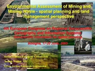
4th European Congress on Regional Geoscientific Cartography and Information Systems Geoscientific information for spatial planning Bologna, 17-20 June, 2003. Environmental Assessment of Mining and Mining Waste - spatial planning and land management perspective. Stefan Sommer European Commission

E N D
4th European Congress on Regional Geoscientific Cartography and Information SystemsGeoscientific information for spatial planningBologna, 17-20 June, 2003 Environmental Assessment of Mining and Mining Waste - spatial planning and land management perspective Stefan Sommer European Commission Tsehaie Woldai ITC Gyozo Jordan European Commission
PLANNING: DPSIR framework for mining impacts DRIVING FORCES impact/risks reduction regulations good management practice remediation demand for mineral resources IMPACTS RESPONSE mineral resource exploitation waste production emissions STATE PRESSURES source pollution natural resource degradation life quality degradation landuse conflicts pathway natural background historical pollution baseline other landuses receptor Conceptual framework developed by EEA for environmental assessment and reporting Introduction: impact assessment and spatial planning problems specific to mining
Life cycle of mineral commodity (on-site) prospecting treatment extraction storage Life cycle of mine project exploration production remediation development closing PLANNING: Life Cycle Analysis
FOREGS Underground: high information uncertainity Natural background PROBLEMS SPECIFIC TO MINING 1. Exploration: the geological environment Spatial problem: 3D Non-renewable natural resources
environmental impacts collected data useful for environmental protection 2. Exploration:preparing for mining Long-term exploration Investigations during mine exploration project
other industries: use infrastructure Mining: brings infrastructure and industry secondary / indirect impacts CLOSING !! 3. Development and environmental planning Mineral deposit no alternatives for location Concession right actual mining: long-term delay
pollution • Natural background • Baseline HISTORIC MINING change of technology • Market change of mineral mined • Market by-products • Long-term suspension 4. Operation All mining projects are unique (deposit type:confined vs. disperse, etc; open vs. underground; etc) • Operation for several decades • Processing in place • Collected data useful for environmental protection
Long-term monitoring 5. Closing and Remediation Reopening as market prices change Huge amount of waste Underground can never be fully restored • Perfect remediation impossible: • Huge amount of waste • Underground • Natural background
Spatial aspects for regional planning RESPONSESociety • Regional planning: SEIA • Regional/EU legislation PRESSURE Emissions Hazard: local/point source IMPACTS • smelters (air) • historic mine regions (soil, water, society) REGIONAL ASPECTS • STATEEnvironment • Geology of mineral deposit (natural background) • Groundwater system • 3D problem • geology, hydrogeology, mineral chemistry • spatial uncertainty
Session organisation Number of papers: Oral Poster PLANNING 4 1 GIS Remote Sensing Environmental modeling 4 3 IMPACT ASSESSMENT MAPPING 1 3 2
Session organisation 09:00-09:10 09:10-09:30 09:30-09:50 09:50-10:10 10:10-10:30 10:30-10:50 10:50-11:10 11:10-11:30 11:30-11:50 11:50-12:10 12:10-12.30 12:30-12:50 G. Jordan, S. Sommer, T. Woldai Introduction: impact assessment and spatial planning problems specific to mining T. Hamor, J. Halmai Competing land-uses and the mineral extraction industries: a legislation review S. V. Solar Long-term spatial planning and mineral resource management – case study: aggregates in Slovenia S. Veliciu, P. Stratulat Inventory of metal mining wastes in Romania: a methodological approach S. Sommer, G. Bidoglio, M. D’Alessandro, G. Jordan, E. Puura, A. VijdeaPECOMINES - linking watershed and regional scale models to the impact assessment of mining activities Coffee break R. B. Wanty, B. R. Berger, B. A. Kimball, P. L. Verplanck, M. L. TuttleDelineation of environmental tracts in mineralised areas using geological criteria T. Woldai, G. RukezoEnvironmental impact study of the area around Rio Tinto and the surrounding mines, SW Spain M. J. Batista, A. J. Sousa, M. M. Abreu, M. Serrano Pinto Defintion of anthropogenic and natural anomalies: an exercise in Neves Corvo mining region, Portugal D. LimpitlawMapping mining waste and environmental impacts in Zambia with LANDSAT S. ChevrelRemote sensing assessment and monitoring of environmental impact of mining activities in various European vegetated environments… K. Grösel, R. BelockyMining site environmental assessement and re-vegetation planning utilizing advanced remote sensing techniques Convenor Tsehaie Woldai Convenor Stefan Sommer