OCEAN ECOSYSTEMS
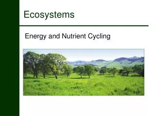
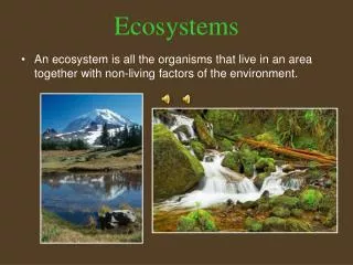
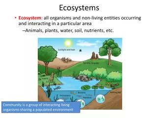
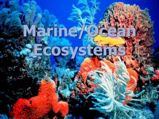
OCEAN ECOSYSTEMS. Powered by solar energy, with sunlight driving photosynthesis by phytoplankton. INTERTIDAL ECOSYSTEMS. Where ocean meets land Uppermost reach of high tide to lowest limit of low tide. Caused by the gravitational pull of the moon (every 6 hours)

OCEAN ECOSYSTEMS
E N D
Presentation Transcript
OCEAN ECOSYSTEMS Powered by solar energy, with sunlight driving photosynthesis by phytoplankton.
INTERTIDAL ECOSYSTEMS • Where ocean meets land • Uppermost reach of high tide to lowest limit of low tide. • Caused by the gravitational pull of the moon (every 6 hours) • Organisms adapted to extremes in temperature, moisture, sun exposure, and salinity • Predators (land and sea)
INTERTIDAL ENVIRONMENT • Huge diversity of life • High nutrient content • Many primary producers • Filter feeders • sea stars prey on filter feeders • Crabs are scavengers • Some animals burrow in the sand
INTERTIDAL ZONE • Copy figure 12 below (p. 189)
NERITIC ECOSYSTEMS • From the low tide mark to the continental shelf • Entirely sunlit-great productivity • Contain 2 of the world’s most productive ecosystems: • kelp forests and coral reefs
KELP FORESTS • Kelp-a type of large brown algae that grows from the floor of the continental shelf • Can grow 200 feet tall - can grow 18 inches in one day!!! • Provide shelter and food for invertebrates and fish • Those organisms provide food for predators
KEYSTONE SPECIES • Species that has a strong or wide-ranging impact on a community • Sea otters are the keystone species in the neritic ecosystems • They eat sea urchins • If otters disappear, urchins overgraze and destroy kelp forests • Kelp forests absorb wave energy/ protect shorelines from erosion
MAPPING KELP FORESTS • WE WILL COMPLETE THIS ACTIVITY. • Take A HANDOUT • Colored pencils • Slide 37 of AP biology ch. 58, shows upwelling areas of the world.
Kelp Forest Mapping Lab p.3 • Kelp forest locations • North American west coast • South American west coast • Eastern Canadian coast • Southwest tip of African coast • Northwest tip of African coast • Southern tip of Greenland • Entire coast of Iceland • Northwest coast of Europe • Eastern coast of Japan and East Asia • Southeastern tip of Australia
QUESTIONS FOR KELP LAB • 2. Anywhere in the Indian Ocean or other sea where the sea surface temperature is too warm. • 3. Kelp Forests are found at latitudes 28o N-55o N and 28o S-55o S, approximately. No Kelp Forests are located between 28o N and 20o S.
QUESTIONS FOR KELP LAB • 4. List and identify an area affected by a cold-water current that runs parallel to the land. • 5. The warmer temperatures of the shallows will mean less available nutrients for kelp and other producers, which in turn will mean declines in their numbers. This deprives grazers, such as sea urchins, of a food source. This result could cause members of each trophic level to starve or migrate.
CORAL REEFS • Found in shallow subtropical and tropical waters • Skeletons of coral are made of calcium carbonate • Coral are tiny invertebrate animals like anemones and jellyfish( except all are sessile; attached to rock, coral, sea floor) • Some capture food with tentacles, others have symbiotic relationship with algae
MORE ABOUT CORAL • Most are colonial, colorful, plentiful • When they die they leave behind their skeleton • This increases the reef’s size • They shelter shorelines • Host a tremendous biodiversity • Worldwide decline due to warming of surface waters and pollutants
# 17 p. 107-Attach a piece of loose leaf to complete the table
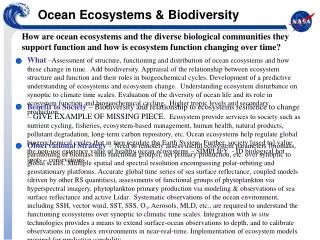
OPEN-OCEAN ECOSYTSEMS • Begins on the edge of the continental shelf • Contains the majority of the Earth’s water; 90% • Least productive ecosystem (most is dark) • Even at the surface lack of nutrients reduces productivity • Except in upwelling regions
MICROSCOPIC PHYTOPLANKTON • Base of the food chains • Phytoplankton-> zooplankton->fish, whales, jellyfish and other free-swimmers--->larger fish, sea turtles, sharks, fish-eating birds
APHOTIC ZONE • Bizarre-looking creatures that scavenge carcasses or eat detritus that falls from above • Symbiotic mutualistic bacteria • Predators with bioluminescence (bacteria that produce light chemically) • Example the anglerfish p. 191
BENTHIC ZONE • Hydrothermal vents (very hot) • Tubeworms, shrimp, white crabs • Survive on bacteria that live in these thermal conditions • Can withstand tremendous pressure. • Difficult to study because die if brought to the surface • Humans can only explore this area in special submarines
ECOLOGICAL FOOTPRINTS ACTIVITY • We will read and complete p. 110 in the wkbk. You may use a calculator • Then on loose leaf we will read and complete the activity on p. 197 in textbook. • You may use a calculator • Examine the graph on p. 197.Answer the 3 questions. • DO #14, 15, 21& 32 p. 196-197 • HAND IN FOR A QUIZ GRADE