Download
1 / 45
450 likes | 548 Vues
This project documents the pioneering use of GPS technology in MICS4 surveys across ESA region countries. It showcases the collaborative mapping efforts on OpenStreetMap, particularly in areas like Kibera, Haiti, and Swaziland. The initiative involves piloting GPS units during data collection, converting GPS data into shapefiles, and utilizing GPS data for spatial analysis and correlation studies. By sharing lessons learned and insights gained, this project aims to inspire further advancements in leveraging GPS technology for survey research and mapping projects.

E N D
Piloting and Documentation of Innovative Employment of GPS units in MICS4 Surveys in ESA Region CountriesMikel Maron GroundTruth Initiative OpenStreetMap
Let's figure out the cool stuff we can do with GPS in the survey
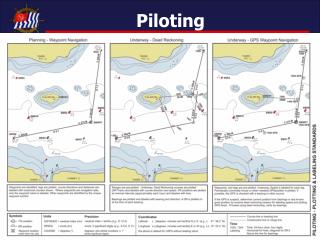
Current use of GPS in MICS Collect single point in center of cluster
OpenStreetMap Global Collaborative Mapping “kinda like Wikipedia for Maps”
Haiti http://news.bbc.co.uk/2/hi/uk_news/magazine/8517057.stm
Before After In OSM
Uses Immediate recovery Ongoing reconstruction
Map Kibera photo: http://gallery.me.com/dbullington#100816&view=null&bgcolor=black&sel=12
Kibera 1 million people(?), 2.5 km2 was a blank spot on the map
* The Mappers The Mappers
Voice of Kibera: http://voiceofkibera.org/ Shortcode to report: 3002, “Kibera”
MICS4 Swaziland
Preperation Conversion Garmin GPS Maps Shapefiles
DURING Base Map Cluster Location
DURING Track Collection
DURING Point Collection
What cool stuff did we do with GPS in the survey
Tracks 8 GPS 1 trkpt per second 2+ months > 10 million trkpt
Track Animation Week 1
Points of Interest No substantial collection Demanding Survey Supervisors Busy Optional Activity
Points of Interest Lessons Find right people (Measurers?) Require & Cost (Time, People, Geography) Motivation
Household GPS Map Huge benefit to teams Opportunity emerged in training
Household GPS Map Listing preparation and survey are two people Head of households sometimes misidentified
Usability More context needed in base map Basic GPS operations and procedures need more training Power cables and mounts not reliable
GPS Capacity at CSO gpx2shp Convert GPS data into ESRI Shapefile in one automated step
GPS Capacity at CSO gpsbabel + mkgmap Create GPS base maps from spreadsheet data
What cool stuff do we do next with GPS in the survey
Final Collection Tracks, Waypoints, Forms following conclusion of survey
Editing Tracks Into Base Map 15-20 million Trackpoints Every road in The country
MICS Spatial Analysis Correlation of Proximity of services to indicators Nearby schools : enrollment Nearby hospitals : health
Track Analysis & Applications Distances per vehicle, date, time of day Speed variability Distribution of movement
Data Sharing? CSO / Ministries Service Level Data Sets
Data Collection? Focused POI collection in reusable way Neighborhood Care Centres
Thanks! Mikel Maron mikel@mapkibera.org