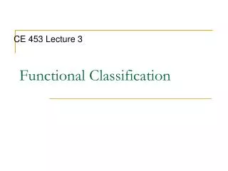
Functional Classification
Functional Classification. CE 453 Lecture 3. Objectives. Summarize general highway design process Identify different roadway classification systems Identify and describe functional classes and their characteristics Summarize functional system characteristics (rural – urban)

Functional Classification
E N D
Presentation Transcript
Functional Classification CE 453 Lecture 3
Objectives • Summarize general highway design process • Identify different roadway classification systems • Identify and describe functional classes and their characteristics • Summarize functional system characteristics (rural – urban) • Gain basic knowledge and feel for extent of Iowa system by class
Design Process (General) • Much is decided in early stages (concept and alternative planning/design) • Environmental concerns and public involvement are very important • Involves generating full range of alternatives and technically evaluating • One of the most important parts of the design process is determining what purpose (or who) a roadway serves?
Flexibility in Highway Design - Chapter 3 - FHWA.htm, Roadway Design Manual, Virginia DOT, 1995
Iowa DOT Design Process (Zoom in for detail) 7 years (typ.) First design work
Classification schemes: • Design Type – Design and Traffic Engineers – examples? • Route – Traffic Engineers, cartographers? • Administrative – Financial and Program Managers • Function – Planners and planning engineers
Functional Classification • Determined by system network planning (how it fits in system) • Goals: • Match trip portion with roadway • Aggregate trips safely and efficiently • Satisfy trip demands • Fit to the context/environment • Basis of Current Design Approach (form follows function) • Defines Design Standards • Sizing based on function and demand
Roadway Functional Classes • Determined by characteristics: • function • access density • traffic demands • trip length • expected speed
Three Major Roadway Classes and their functions: • Arterial (high mobility, low access, long trips, fast speeds) • Collector (moderate, moderate, moderate, moderate) • Local (low, high, short, slow)
http://web.ics.purdue.edu/~tarko/CE562/lectures/Lect13.ppt Your friend’s house Termination (driveway) Access (local) Distribution (collector) Main movement (arterial) Collection (collector) Access (local) Your house Origination (driveway) Hierarchy of Movements and Roads
Access vs. Mobility by Design Type (not functional classification)
Developed by Transportation Planners or Transportation Planning Engineers
Rural Functional SystemPrincipal Arterials • Function: Statewide/Interstate Travel and Connect urbanized areas • Characteristics: Long trips, no stubs, highspeed, widely spaced, full/partial access control • Subclasses: Freeways, Other non-Freeways with access control http://www.tfhrc.gov/safety/pubs/01158/images/cover.jpg
Rural Minor Arterials • Function: intrastate/inter-county trips, connect small urban areas with major trip generators • Characteristics: Moderate everything (routes, speed, spacing, mostly mobility)
Rural Collectors • Major Collectors: Connect county seats to large towns not served by arterials, link entities with nearby arterials, urban areas • Minor Collectors: Serve remaining small towns, link local traffic generators with rural areas • Characteristics: Shorter, Moderate Speeds (in rural areas), Intermediate spacing
Rural Local Roads • Function: Provide access to land on collector network, serve short distance travel http://www.glo.gis.iastate.edu/la562/images/Gravel%20road.jpg • Characteristics: Short routes that terminate at higher classes, relatively low speeds, intermediate spacing
Urban Functional SystemPrincipal Arterials • Functions: carry most trips entering/leaving urban area, serve intra-urban trips, carry intra-urban and intercity bus routes, provide continuity to rural arterials • Characteristics: longest distance routes and highest volume, high speed, spacing is less than 1 km in CBD and greater than 8 km in urban fringe, full/partial access control • Subclasses: interstates, other freeways and expressways, other principal arterials with partial access control
Urban Minor Arterials • Functions: interconnect with and augment principal arterials, accommodate moderate length trips, distribute traffic, carry local buses, provide intra-community continuity, connect to urban collectors • Characteristics: moderate trip length high volumes, moderate speeds, spacing 0.2 to1.0 km in CBD and 3 to 5 km in suburbs
Urban Collectors • Functions: Provide traffic circulation within residential neighborhoods and industrial/commercial areas, collect traffic from locals and channel to arterials, carry local buses, provide some direct land access • Characteristics: Shorter than minor arterials, moderate speeds, spacing intermediate to arterials, penetrates residential neighborhoods • Subclasses: major and minor
Urban Locals • Functions: Provide direct access to land, connect properties to higher class streets (i.e., collectors) • Characteristics: Short in length, dead end – terminate at collectors, low speeds, no bus routes
Iowa Extent of System (approximate) • By ownership: • Interstate: 800 mi. • US Highways: 4000 mi. • Other State Routes: 5000 mi. • Total Iowa DOT: 10,000 mi. • Municipal: 13,000 mi. • County: 90,000 mi. • Total: 115,000 mi. • By purpose: • Farm to Market: 30,000 • Local: 70,000
Iowa Extent of System (approximate) • By pavement type: • Paved: 40,000 mi. • Unpaved: 75,000 mi. • By Function: • Principal arterials: 5000 mi. • Minor arterials: 5500 mi. • Major collectors: 16,000 mi. • Minor collectors: 16,000 mi. • Local: 75,000 mi.