Download
1 / 13
130 likes | 336 Vues
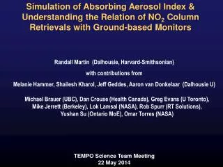
Simulation of Absorbing Aerosol Index & Understanding the Relation of NO 2 Column Retrievals with Ground-based Monitors. Randall Martin (Dalhousie, Harvard-Smithsonian) with contributions from Melanie Hammer, Shailesh Kharol , Jeff Geddes, Aaron van Donkelaar (Dalhousie U).

E N D
Simulation of Absorbing Aerosol Index & Understanding the Relation of NO2 Column Retrievals with Ground-based Monitors Randall Martin (Dalhousie, Harvard-Smithsonian) with contributions from Melanie Hammer, ShaileshKharol, Jeff Geddes, Aaron van Donkelaar(Dalhousie U) Michael Brauer (UBC), Dan Crouse (Health Canada), Greg Evans (U Toronto), Mike Jerrett (Berkeley), LokLamsal (NASA), Rob Spurr (RT Solutions), Yushan Su (Ontario MoE), Omar Torres (NASA) TEMPO Science Team Meeting 22 May 2014
Growing Use of Remote Sensing for Exposure Assessment Looking backward: Use of (A)remote sensing data to supplement (B) available routine air quality monitoring Looking forward: Use of (B)available routine air quality monitoring to supplement (A)remote sensing data Wu J, et al (2006). Exposure assessment of PM air pollution before, during, and after the 2003 Southern California wildfires. Significant Association of Satellite-derived Long-term PM2.5 Exposure with Cardiovascular Mortality at Low PM2.5& Associations with Diabetes and Hypertension Crouse et al., EHP, 2012; Brook et al., Diabetes Care, 2013; Chen et al., EHP, 2013; Chen et al., Circulation, 2013 Henderson SB, et al (2008). Use of MODIS products to simplify and evaluate a forest fire plume dispersion model for PM10 exposure assessment. Some Groups Using Remote Sensing for Exposure Assessment: WHO, World Bank, OECD, Environmental Performance Index, Global Burden of Disease
Develop Assimilation System of Suite of TEMPO Observations to Estimate PM2.5 Composition, Ground-level Ozone, and Ground-level NO2 • Absorbing Aerosol Index (aerosol composition) • NO2(ozone and aerosol composition) • Aerosol optical depth • Ozone profile • SO2 (aerosol composition) • HCHO (ozone and aerosol composition) • Vegetation (VOC emissions) Assimilation System Could Also be Useful for AMF Calculation
Simulation of Absorbing Aerosol Index (AAI) A measure of the aerosol-induced spectral dependence of back-scattered UV GEOS-Chem Simulation of Aerosol Composition Coincident with OMI Simulated Absorbing Aerosol Index LIDORT Radiative Transfer Model TOMS UV Surface Reflectance (from Omar Torres) OMI Viewing Geometry Example observed AAI showing a smoke plume over the United States
Initial GEOS-Chem& LIDORT Simulation of OMI Absorbing Aerosol Index (July 2008)Will be Useful to Interpret AAI from TEMPO OMI GEOS-Chem & LIDORT OMI Cloud Fraction < 5% -2.5 -1.5 -0.5 0 0.5 1.5 2.5 Melanie Hammer
General Approach to Estimate Surface Concentration Daily OMI NO2 Column Coincident Model (GEOS-Chem) Profile Altitude Concentration • S→ Surface Concentration • Ω → Tropospheric column Also uses OMI to inform subpixel variation following Lamsal et al. (2008, 2013)
Bias in Satellite-Derived NO2 Trend (2005-2011) In Situ OMI-Derived r = 0.73 n = 102 y = 0.40x + 0.02 Slope with BEHR ~0.5 Kharol et al., in prep
Why is Satellite-Derived Surface NO2 Biased vs In Situ? In situ (2005-2011) OMI NASA V2.1 (2005-2011) NO2 Mixing Ratio (ppbv) y = 0.40x + 0.09 r = 0.80 n = 215 Slope with BEHR over US ~0.5 In situ sampled at OMI overpass time Molybdenum converter measurements corrected for NOz following Lamsal et al. (2008, 2010) Urban areas included Kharol et al., in prep
Use Land Use Regression (LUR) Datasets to Examine Effects of Monitor Placement Toronto Hamilton LUR from Jerrett et al. 2009 Kharol et al., in prep
Monitor Placement Contributes to Bias Versus Area Average LUR NO2 at Measurement Site Area Average LUR NO2 Kharol et al., in prep
Consistent Relative Trends in Ground-level NO2 Indicate Both Observe Changes in Large-Scale Processes In situ OMI Kharol et al., in prep
Remote Sensing Offers Observational Estimate of Area-Average Concentrations & Changes in Surface NO2 Trend Concentration 2005to 2011 ΔNO2 (ppbv yr-1) NO2 (ppbv) ShaileshKharol Lamsalet al. (2013)
Conclusions • Initial simulation of Absorbing Aerosol Index • Spatial bias in surface NO2 from satellite and in situ monitors partially arises from monitor placement • Ambiguity remains about long-term area-average NO2 in urban areas • Consider for TEMPO validation a dense collection (>10) of long-term monitors of ground-level NO2 and column NO2 within a TEMPO footprint for multiple urban areas Acknowledgements: NSERC, Environment Canada, Health Canada