Download
1 / 23
240 likes | 454 Vues
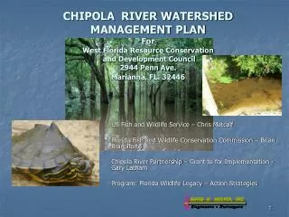
CHIPOLA RIVER WATERSHED MANAGEMENT PLAN For West Florida Resource Conservation and Development Council 2944 Penn Ave. Marianna, FL. 32446. US Fish and Wildlife Service – Chris Metcalf Florida Fish and Wildlife Conservation Commission – Brian Branciforte

E N D
CHIPOLA RIVER WATERSHED MANAGEMENT PLANForWest Florida Resource Conservation and Development Council2944 Penn Ave.Marianna, FL. 32446 US Fish and Wildlife Service – Chris Metcalf Florida Fish and Wildlife Conservation Commission – Brian Branciforte Chipola River Partnership – Grant to for Implementation - Gary Latham Program: Florida Wildlife Legacy – Action Strategies
Unique Wildlife Hydric Flatwoods Springs Ecosystem DiversitySpecies Richness Caves 1270 SQUARE MILESof WATERSHED Swamps
The Watershed Boundary Marianna Lowlands – Dougherty Plain New Hope Ridge (Sand Hills) Lower Gulf Coastal Plain (Flatwoods) Map by USFWS and Chris Metcalf
GEOLOGY Of The FLORIDA Chipola River Watershed Photo by Gary Latham Terrestrial Cave – Jackson County
The Watershed Boundary and Blue Springs Basin Overlap Map by USFWS and Chris Metcalf
GOALS And PURPOSES of the CHIPOLAWatershed Management Plan • IDENTIFY ACTION STRATEGY PARTNERSHIPS – Agencies, Conservation Organizations, Private Industry, Local government, Landholders, and various Stakeholders….. • IDENTIFY ACTION STRATEGIES – Additional Data and Inventory Needs, Research, Actions to implement now……. • MAINTAIN AND RESTORE Sustainable Native Wildlife, Plant Communities, and Fisheries…….. • GENERAL PLANNING MODEL And EDUCATION – Watershed Based Boundaries – Assist Local Planning Decisions……. • Current First Plan Draft is a TOOL for Subsequent Study and Action Implementation – Updating needed periodically…..
Natural Resource Agencies and NGO’s That can or do play a rolewithin the Chipola River Watershed. Helpful Studies, Plans, and Resources
Protection of Wetlands, Clean-Water Act, Fisheries, and Conservation of Threatened and Endangered Species • These protections, although not implemented and enforced perfectly, do in-a sense, by default serve to protect portions of our watershed…… and they are a source of renewal funding by statute or accepted public policy. This is necessary funding for a wide variety of conservation management efforts and acquisition for conservancy lands. • Another concern to myself, and other ecologists, is the fragility and rarity of upland natural ecosystem surfaces. Existing land use comprehensive plans throughout the CRW offer little, none, and in some cases ‘negative’ protection. The entire surface landscape pattern and fabric of our watershed needs attention…
Landscape ‘Pattern Language’ Typical in the Chipola Watershed • Labins TM Aerial
Functions and Values of WetlandsWithin the Chipola River Watershed • Water Quality – Filtration and Cleansing • Flood and Erosion Control (Sedimentation-Flood Damage) • Groundwater Recharge and Discharge • Biological Habitat • Education, Recreation, Aesthetic Values • Economic Values
Types of Wetlands of Chipola River Watershed • Riparian Stream Corridors – Blackwater streams, Spring runs, Alluvial streams, and seepage streams • Sandhill lakes and ponds (Karst ponds) • Forested Swamps – Cypress – Gum • Hydric Pine Flatwoods • Chipola River System • Choctawhatchee – Holmes Creek • Seepage slopes • Springs – Sinkhole springs • Dug ditches, roadside swales • Other lakes – ponds • Depressional wetlands (Bays, swamps) • Wet meadows pastures – Ephemeral ponds • Impounded farm ponds and Dug farm ponds
Important Values of WetlandsFiltration and Cleansing • Wetlands serve as a filter and cleansing mechanism for pollutants discharged into the watershed (drainage basin) directly and indirectly. These discharges may be direct, such as storm water run-off from vehicular roadways, industrial sites, or lawns, going into ditches and drainage ways. Indirect discharges are such as pollutants seeping directly into the soil and groundwater, or leaching over non-wetland (upland) areas, before reaching the surface wetland systems. • These pollutants include excess nutrients from lawns and agricultural runoff, complex hydro-carbons and heavy metals from roadways and urban-industrial sites, herbicides and pesticides from agricultural runoff, and sedimentation (fine soils and sands) discharging into downstream wetlands and drainage ways that smother the plants and animals living in the wetlands, contribute to muddy (turbid) water. • The natural wetlands, through physical entrapment and bio-chemical and biological processes, serve as a processor and sponge, thus protecting downstream areas from pollutant build-up. Bio-chemical and biological processes actually ‘clean’ the water as it is used by living plant and animal organisms. Some materials, such as some heavy metals, carbon, nitrogen, and phosporous to a degree, are actually used and become part of the biomass and or physical substrate of the wetland, and are thus prevented from passing downstream.
Flood, Erosion Control, and Sediment Storage Value • Wetlands provide a storage for excess water from heavy rainfall storm water events. This storage occurs in two closely related ways and benefits are obvious in a reduction of downstream flooding and erosion impacts. The energy potential in flowing water is tremendous, and the wetlands serve as large energy dissipators to moderate the damaging erosive affects downstream, since they act to slow the water down. • Depressional wetlands serve as giant sponges that slowly absorb and then release water from the local watershed areas as they reach a saturated or flooded condition. The flood plains along streams, rivers, and small drainage branches serve as temporary storage areas along the linear corridors receiving the water, and moderate the tremendous power of the flowing water. These floodplains also receive regular dosages of sediment from the upstream areas. As the water stream widens in a flood event, the water slows down in these areas and the sediments are discharged. This natural discharge of silt-sediment water is part of the natural floodplain ecosystem, especially the transport of annual organic loads such as leaves and plant debris. • Any artificial channeling of streams and drainage ways, and the ditching and draining of natural wetland depressions greatly reduces the flood and sediment storage, and increases flooding and erosion impacts downstream.
Groundwater Recharge and Discharge Value • Wetlands provide varying degrees of Recharge into groundwater, often known as Aquifer recharge. The degree of recharge value is primarily a function of topography and the perviousness (porosity) of subsurface geologic or subsoil strata. Groundwater recharge from ‘natural’ wetlands are especially important in our area. Jackson and Washington County have numerous depressional areas, sinkholes, karst (lime outcrop) areas providing direct surface exposure of the subsurface aquifer. Pollutants can directly enter our groundwater and damage springs and wells. • Discharge occurs in a slow and moderate manner to distant and downstream rivers creeks, lakes, contributing to a perched (closer to surface) groundwater level or a deeper aquifer that feeds springs and wells. Natural wetlands provide for a more even flow of water for streams and rivers, and water levels in ponds and lakes by consistent groundwater discharges. This provides extra water in times of drought due to ample groundwater supplies.
Education, Recreation, Aesthetic Values • Education - Wetlands usually provide concentrated examples of a high diversity of plants and wildlife in relatively small study areas for education. Plant identification, birds and birdsong song identification, microscopy projects, and many other projects inventorying ecosystem elements and water quality parameters are able to be studied. The dynamics of the water cycle and how water availability, duration, and flow affects and creates micro-habitats for plants and wildlife. • Recreation – Wetlands provide passive and active opportunities for many types of physical activities. Hiking, hunting, fishing, and canoeing are obvious examples, but combination educational-recreational activities such as bird watching and ecosystem monitoring are important common endeavors are also done in wetlands. • Aesthetic Values – The visual experience and mysterious interface of water with land is magnified in the wetlands. An inner call to a higher purpose and creative inspiration is found by many persons along these edges of the upland with the dynamics of life giving water. Whether an open visual expanse of a wetland meadow and swathes of wildflower species, or a sequestered darkened canopy deep within a primeval swamp forest, the availability of these habitats provides an opportunity to elevate the human experience.
Biological Habitat Value • Naturally diverse plant communities provide the basis for all wildlife communities. The transitional ecotonal areas between uplands and wetlands are especially rich in diversity. Many rare, threatened, and endangered species of plants and animals find a safe refuge in wetlands and associated buffer areas. Without their protections, more species would be on the decline. • Bird rookeries and nesting habitat, fish species, reptiles and amphibians, and other small benthic organisms such as crayfish, mussels, and insects, have their greatest diversity and/or concentration of habitat usage in these wetland edge areas. • Several species of turtles utilize the wetland transitional areas as hibernating areas during the cool season, such as the box turtle, the chicken turtle, and the eastern mud turtle. • The interior wetlands, due to difficulty of timber harvest and current protective laws, often have the older and larger trees, including dead snags, stumps, and hollow trees. These serve as apartment complexes for a myriad of wildlife species, and are critically the only habitat that many species can utilize. [Tree snags, hollow trees, old trees, and all stumps and logs are critical wildlife habitat, both in wetlands and uplands. As a rule they should never be removed accept for direct safety purposes such as a dead snag or tree over a structure or parking area.] • Some of the Rare, Threatened, and Endangered species……………lists are in the CRWM Plan Numerous mussels species, fishes, reptiles and amphibians, birds, numerous plant species, insects, The Mussels, amphibians and reptiles, small fishes and aquatic insect taxa are important indicator species (canary in a coal mine cliché’) as a measure of the relative health and viability of various ecosystems.
PROTECTION Of Our WETLANDSAction Strategiesand Avoidances we Should Not Do • Tell others about the many values of wetlands, and if possible and you so inclined, join and contribute to conservation organizations that protect wetlands and other natural areas. • Minimize the use of detergents, fertilizers, and other chemicals to minimum and just amount needed for the job. This especially applies to lawn fertilizers and agricultural applications of all kinds. These practices have seriously affected the groundwater of our springs, aquifers, and wetlands, in our area and around the world. • Do not change oil and spill it on the ground, pour it on fence posts, or any other landscape surface. Recycle it. • Do not disturb wetland edges for general open ‘beautification’ purposes. This usually will ensure infestation with invasive nuisance species such as Chinese Privet, Fire ants, and other pests. This also occurs in uplands occurs when any natural landscape surface profile is disturbed. • The transitional buffer area just above the wetland boundary is critical to the health of the wetland also. Respect the area as you would a wetland; it is part of the wetland system and is why the County law protects it with a minimum fifty foot buffer.
PROTECTION Of Our WETLANDS DO’S Build Filtration Pond for Livestock Operation Maintain Buffers Strips along Riparian areas Construct temporary sediment basins to hold construction project run-off
N’T Dig a Steep Sided Pondor a PondO PROTECTION Of Our WETLANDS DO NOT Dig Steep Sided Ponds OR Dig a Pond in an Existing Wetland! Note the Poor Water quality and Lack Of Vegetated Shallow Slopes . Vegetated Shallow Slopes are needed to Cleanse Water and Provide Habitat
PROTECTION Of Our WETLANDSAction Strategies we Should Do and Avoidances we Should Not Do • When possible, provide periodic prescribed burning of the landscape surface to the edges and wetland itself, depending on the moisture levels. This prescribed burning increases the diversity of plants and wildlife, and increases the ’use ability’ of the landscape surface. • Do not allow runoff from any open, raw soil area of a construction site, field, roadway or driveway cut, or similar area. Contain the area of potential erosion with silt fencing and hay bales. • If you have a traditional deep sided, farm pond, with little vegetation around the edges, DO create habitat niches for wildlife with snags, logs, and wetland plants and of the water, except in needed select areas, because this contributes to poor water quality. • Obtain necessary local County, State, and Federal permits for any activities in wetlands or the buffer area, including driveways and drainage culverts and extensions. Encourage others to do the same.
Some Action StrategiesFor Threatened and Endangered Species • Habitat Conservation species – Inventory, mapping, GIS system • Priority acquisition conservation easements and habitat partnerships with landowners. • Eliminate and minimize sand clay roadbed sedimentation into low wetland crossings, branches, and depressions • Restore and expand remnant seed bank areas of wiregrass and associated native herbaceous cover • Assure provision of woody snags and woody material • For stream ecosystems, habitat niches, diversity of sand-gravel bars, riffles, …… • Begin eradication of invasive nuisance plants…. • Minimize, control, and eliminate pollutants contributing to degradation of springs, aquifer • Implement and enforce known Best Management Practices (BMP’s) for agriculture, forestry, and county road maintenance operations, while Developing new applicable BMP’s.
Lets not let this happen! Kudzu Infestation