Download

1 / 23
230 likes | 399 Vues
Benefits of satellite altimetry for transboundary basins. S. Biancamaria 1,2 , F. Hossain 3 , D. P. Lettenmaier 4 , N. Pourthié 2 and C. Lion 1,2 1 LEGOS, Toulouse, France 2 CNES, Toulouse, France 3 CEE, Tennessee Tech University, Cookeville, TN, USA

E N D
Benefits of satellite altimetry for transboundary basins S. Biancamaria 1,2, F. Hossain 3, D. P. Lettenmaier 4, N. Pourthié 2 and C. Lion 1,2 1 LEGOS, Toulouse, France 2 CNES, Toulouse, France 3 CEE, Tennessee Tech University, Cookeville, TN, USA 4 CEE, University of Washington, Seattle, WA, USA IGARSS 2011 - session WE2.T10
Transboundary basins • 256 river basins are shared among 2 or more countries (Wolf et al., 1999) = 45% land surfaces Brahmaputra basin Indus basin Ganges basin IGARSS 2011 - session WE2.T10
Outline • Forecasting Brahmaputra/Ganges water elevations using satellite altimetry • Monitoring Indus reservoirs with SWOT IGARSS 2011 - session WE2.T10
Brahmaputra and Ganges basins • Brahmaputra: drainage area=574,000km2; population=30 Millions; unmanaged. • Ganges: drainage area=1,065,000km2; population=500 Millions; 34 dams/diversions. China Nepal Bhutan Brahmaputra Ganges India Bangladesh IGARSS 2011 - session WE2.T10
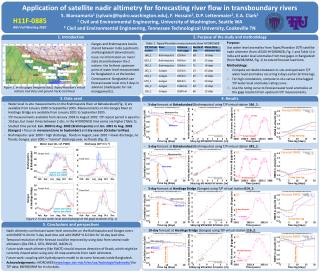
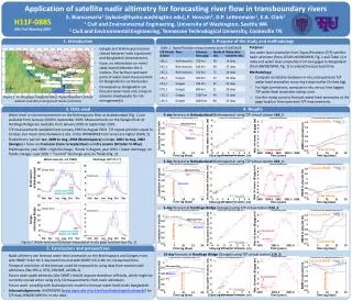
Issue • 90% of water flowing in Bangladesh comes from India. • No India/Bangladesh real time data sharing. • Using in-situ measurements at its border -> forecast in Bangladesh only with 2 or 3 days lead time. • Study purpose: Use satellite-based water elevation upstream in India to forecast water elevation at the gauge locations (India/Bangladesh border). IGARSS 2011 - session WE2.T10
Data used: in-situ measurements IGARSS 2011 - session WE2.T10
Data used: satellite altimetry • Topex/Poseidon (T/P) satellite altimeter. • Overlap with in-situ: January 2000/August 2002. • Data downloaded from HYDROWEB: http://www.legos.obs-mip.fr/en/soa/hydrologie/hydroweb/ 116_2 166_1 242_1 014_1 IGARSS 2011 - session WE2.T10
Methodology 1/2 • Compute the cross-correlation between upstream T/P and in-situ measurements: with k=lead time Correlation Upstream: halti(t) Water level Downstream; hinsitu(t) 0.8 0.6 0 0 k Time Lead time k IGARSS 2011 - session WE2.T10
Methodology 2/2 • Compute scatter plot in-situ measurements & T/P measurements k days earlier. • Use linear fit to forecast water level at gauge location from T/P measurements. hin-situ(t) Water level hinsitu (downstream) k day lead time forecast Linear fit of hinsitu(t)=f[halti(t-k)] 0 0 halti(t-k) Time IGARSS 2011 - session WE2.T10
Results on the Brahmaputra • 5-day lead time Forecasts: T/P virtual station 250 km upstream: T/P virtual station 550 km upstream: Brahmaputra water elevation Brahmaputra water elevation Legend: 5 4 3 2 1 0 -1 -2 -3 5 4 3 2 1 0 -1 -2 -3 In-situ T/P forecast Water elevation (m) Water elevation (m) 2000 2001 2002 2000 2001 2002 5-day forecast RMSE ~ 0.5 m 5-day forecast RMSE ~ 0.5 m IGARSS 2011 - session WE2.T10
Results on the Ganges • 5-day lead time forecast: • 10-day lead time forecast: T/P virtual station 530 km upstream: T/P virtual station 1560 km upstream: Ganges water elevation Ganges water elevation 6 4 2 0 -2 -4 6 4 2 0 -2 -4 Legend: In-situ T/P forecast Water elevation (m) Water elevation (m) 2001 2001.4 2001.8 2001 2001.4 2001.8 5-day forecast RMSE ~ 0.6 m 10-day forecast RMSE ~ 0.9 m IGARSS 2011 - session WE2.T10
SWOT and the Brahmaputra/Ganges • SWOT = Water mask + water elevation (and river slope) with 2 or more observations per 22 days IGARSS 2011 - session WE2.T10
Expectedbenefitsfrom SWOT • Higher precision on measurements -> better forecasts. • More observations on the basin -> better time sampling. • Water extent will improve inundation forecast: Brahmaputra water elevation Brahmaputra water elevation 7 6 5 4 3 2 1 0 5 4 3 2 1 0 -1 -2 -3 Water elevation (m) Discharge (104 m3.S-1) 2000 2001 2002 2000 2001 2002 IGARSS 2011 - session WE2.T10
Conclusion for Brahmaputra/Ganges • Forecasting water elevation from nadir altimeters with lead time between 5 day and 10 day. • Expected improvement from SWOT due to water elev. + extent, better accuracy, global observation. • Fore more details: Biancamaria et al., GRL, 38, L11401, “Forecasting transboundary river water elevations from space” (June 2011). IGARSS 2011 - session WE2.T10
Outline • Forecasting Brahmaputra/Ganges water elevations using satellite altimetry • Monitoring Indus reservoirs with SWOT IGARSS 2011 - session WE2.T10
SWOT and world lakes/reservoirs 3 2.5 2 1.5 1 0.5 0 Surface area seen (106 km2) 2 4 6 8 10 SWOT visits per repeat cycle IGARSS 2011 - session WE2.T10
Indus reservoirs • Indus basin=1.14x10⁶km2, 53% to Pakistan, 34% to India. • 2008 filling of Baglihar reservoir by India. • 2009 construction of Kishenganga dam. -> Lack of information = difficulties in downstream water management IGARSS 2011 - session WE2.T10
SWOT and Indus reservoirs • Reservoirs are seen between 2 to 3 times per 22 days IGARSS 2011 - session WE2.T10
Baglihar dam • Baglihar dam: 450 MW Run-of-river type • Pondage volume = 37.5 x 10⁶ m3 • Full pondage level – dead storage level = 5 m -> Pondage area > 1 km2 5 m 37.5x10⁶ m3 • SWOT requirements on lakes and reservoirs = 10 cm error on 1 km2 area. -> SWOT should be able to observe Baglihar dam IGARSS 2011 - session WE2.T10
Baglihar dam • Reservoir in mountainous region = SWOT might be affected by layover. • Layover=geometric distortion when radar beam reaches top of a tall feature before it reaches the base. • Layover modeled by SARVisor for ALOS/PalSAR, 7° incidence angle (yellow=layover): Ascending track: Descending track: Baglihar Baglihar IGARSS 2011 - session WE2.T10
Kishengangaproject • 330 MW hydro-power plant. • Layover modeled by SARVisor for ALOS/PalSAR, 7° incidence angle (yellow=layover): Ascending track: Descending track: Kishenganga Kishenganga IGARSS 2011 - session WE2.T10
Conclusion for Indus reservoirs • Hydro-electric reservoirs are needed to respond to the growing demand on electricity. • Water management for downstream country is more difficult. • Huge potential of SWOT to provide reservoir water volume changes • Ongoing study to characterize layover on SWOT data and better quantifying SWOT accuracy and time sampling. IGARSS 2011 - session WE2.T10
Thank you for your attention IGARSS 2011 - session WE2.T10