Download
1 / 9
90 likes | 246 Vues
OPERATIONAL HEAT POTENTIAL ESTIMATES FOR HURRICANE INTENSITY. Michelle Mainelli, Lynn K. Shay, S. D. Jacob, P.G. Black.

E N D
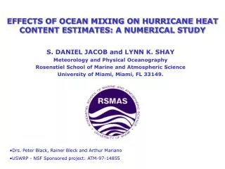
OPERATIONAL HEAT POTENTIAL ESTIMATES FOR HURRICANE INTENSITY Michelle Mainelli, Lynn K. Shay, S. D. Jacob, P.G. Black Goal: To combine radar altimeter data with climatological and in situ data to estimate heat potential in the western Atlantic Ocean Basin to relate to hurricane intensity change. Research support by NSF/NOAA.
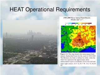
INTRODUCTION: • SSTs only reflect skin temperatures of the ocean. • As SSTs mix with ocean mixed layer during storm passage-depth of 26oC water and integrated heat potential are important parameters for the ocean’s influence on storms. • More stable indicator for possible storm intensity. • Satellite altimetry (from TOPEX and ERS-2) locate warm ocean features relative to storm tracks to aid intensity prediction .
APPROACH: • Surface Height Anomaly field from blended altimeter (T/ERS-2) fields. • Objectively analyzed to a 0.5 o grid in western Atlantic Ocean Basin. • Combine data with hurricane climatology for depth of 20 and 26oC isotherms and SSTs. • Two-layer model to estimate these depths and the heat potential using a gradient method. • Delineate warm and cold ocean features, and assess differences between observed and satellite-inferred heat potential.
OBJECTIVE ANALYSIS: Blended SHA fields from altimeters TOPEX/ERS-2. Mariano and Brown (1992) algorithms to analyze 2-D and 3-D snapshots of ocean fields. Use scales applied to hurricane Gilbert data (Shay et al., 1992). Comparison of fields to Barnes analysis to ocean OA-found much better resolution of ocean features. Comparison of TOPEX versus Blended Fields reduced mapping error.
IMPROVEMENTS: Research • TOPEX/ERS-2/ to monitor Hurricane HP Globally (Build a data base). • Explore data assimilation schemes to ingest SHA/SST data into oceanic models- HYCOM. • Evaluate estimates of Heat Potential from profiling Floats, etc to improve algorithms. • Deploy AXCTDs/AXCPs/AXBTs along satellite tracks (Recon flights). • Relate atmospheric data (GPS) to HP Variability and its change.
MICOM/HYCOM : • Quiescent, Climatological, Realistic Cases with Eddy Field-Based on OA SAIC CTD data. • OML Parameterizations: KT, PRT, Gaspar, and Deardorff. • Analytical/Real Wind Cases • Comparison to both OML temperatures and Velocities from AXCP/AXBTs. • High Levels of Correlation, Mean Current Differences 10 cm/s. • Deardorff overmixed OML.
TOPEX /ERS-2 ANALYSES: Analyses From Several Storms Over Past Two Years Have Revealed: • Wind Speed Changes Lagged Heat Potential Change By 12-18 Hours. • Annual Climo and Hurricane Climo- High Correlation to heat Content, 20 and 26C isotherm depths from 1999 • Cross-Correlation Indices >0.7 for all cases Wind / Heat Potential Changes. • Related to Air-Sea Fluxes, Theta_e, Over Heat Potential Gradients.
SUMMARY: • Explore/Improve Data Assimilation Techniques for SHA/SST and T,S,U,V (z) in Oceanic Models. • Evaluate uncoupled and coupled model performation with data (i.e. ocean mixing schemes under high winds). • Oceanic feature analysis provides an early warning to the forecaster that rapid or steady intensificaton may occur under neutral to favorable atmospheric conditions. • Improve forecasting for the public.
TRANSITIONS: Approach using radar altimetry from satellites is now being transitioned. to improve the product: • Acquire high resolution ocean data-not a technology issue-rather a fiscal one; • Combine these 3-D snapshots through Objective Analysis Schemes; • Develop assimilation schemes for models; and. • Require forecasters and researchers to open a dialogue-push the frontier.