Download
1 / 16
160 likes | 271 Vues
Flight Planning Smoke Outlook SEAC4RS 2013. 08/04/2013 1800 hours PDT, 01:00Z (Updated 0530 PDT, 12:30Z) Forecast period: Monday (8/5) - Tuesday (8/6) David Peterson Marine Meteorology Division Naval Research Lab - Monterey, CA. Bottom Line Upfront. Fire Observations:

E N D
Flight Planning Smoke OutlookSEAC4RS 2013 08/04/2013 1800 hours PDT, 01:00Z (Updated 0530 PDT, 12:30Z) Forecast period: Monday (8/5) - Tuesday (8/6) David Peterson Marine Meteorology Division Naval Research Lab - Monterey, CA
Bottom Line Upfront Fire Observations: • 7-8 fires in SW Oregon and Northern California, 3-4 in Idaho/Montana • Several newer fires in northern CA! • Aspen fire is still burning in the Sierra (Fresno County) Key Forecasting Points (Tuesday 8/6): • Oregon/California fire activity is expected to persist, but some fires may be contained • Potential for off-shore smoke transport is increasing! • Low clouds likely present over land in SW Oregon in the morning hours • Stratus deck now looks more likely to persist through early afternoon! • Best time to sample Oregon fires is 10AM-5PM PDT (17Z-00Z), when fire activity is building, but broken cloud cover is still present. Earlier is better for smoke over clouds, later is better for a well defined plume. Smoke Predictions (Saturday 8/3 - Tuesday 8/6): • SW Oregon/N California: low concentrations before ~18Z, increasing throughout the afternoon hours each day. • Sierra Nevada: Aspen fire smoke output will slowly decrease through the period • Idaho/Montana: possible backup option, but smoke output will slowly decrease
Fire Trends (Past 48 hrs) Aqua MODIS: ~1430 PDT Sunday Similar fire/smoke setup as Saturday, but more stratus! Aqua MODIS: ~1430 PDT Saturday Fires reinvigorated, and smoke is present over stratus! Terra MODIS: ~1130 PDT Fri. As expected, Oregon clouds broke earlier on Friday and marine layer mixed out Smoke & stratus Smoke and stratus Smoke Smoke Smoke was near the coast!
Fire Trends (Past 24 hrs, OR) • Fires grew again Friday - Sunday! At least 4 are still active and producing smoke! • At least 3 of the fires were started by lightning in remote regions • Two of the fires are now partially contained
Fire Trends (Past 24 hrs, CA) • Aspen Fire continues to burn, but is partially contained • Expect steady or decreasing smoke output • Dance fire in northern CA is now contained • The newer Butler and Salmon River fires are producing lots of smoke!
Fire Trends (Past 24 hrs, ID/MT) Idaho is a potential backup option… • 2-3 large fires are burning, but they are at least partially contained. • A few smaller fires exist, but they are nearly extinguished. • OR/CA fires seem like a better option?
Synoptic Pattern 8/5/13, 0600Z • A Rex Blocking Pattern (high over low) is currently in place, and becoming sheared! • The trough will continue to become stretched (or sheared) during the forecast period. • NAM, GFS, and NAVGEM now show the expected closed low off the coast of OR/CA. Primary forecast issues: • Lifting from upper level low can yield a higher but uniform deck. • Possibility of occasional higher clouds traversing the region • If the low stays well offshore, conditions will be better for status • Possible erratic upper-level winds near the end of the forecast period • Isolated convection Tuesday afternoon? H L
Surface Conditions 8/4/13, 21:00Z Oregon and Northern California Fires: • Cloud cover is typical over in the morning hours. • Since Thursday, clouds (over land) burned off each afternoon. Fire weather conditions were more favorable on Friday (lower RH/dew points), and even better on Saturday-Sunday. • The potential for dry lightning has diminished across the region, at least for now. Monday (8/5) –Tuesday (8/6)… • Cloudy in the morning, then clearing, warming, and drying in the afternoon • Upper-level SW flow is likely to develop by Monday afternoon due to the upper-level low located offshore • Some monsoonal moisture many be advected into the area • Potential for elevated convection and dry lightning increases again on Tuesday!
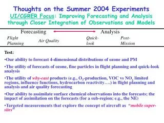
Fire Weather Conditions • Overall, moderate to high fire danger in SW Oregon and Northern CA on Saturday and Sunday afternoon • Fire danger consistently moderate to high in the Sierra Monday (8/5) –Tuesday (8/6)… • Expect the fire danger to generally increase during the afternoon hours in SW Oregon and North CA! • Persistence is probably a good forecast. • The big issue is the potential impacts from a cutoff low (located offshore) later in the period! • More favorable dry lightning conditions? • Increased instability/CAPE? Haines Index 1-2: low fire danger 3-4: moderate fire danger 5-6: high fire danger High-Elevation Haines Mid-Elevation Haines
Weather Forecast: Surface Monday 0000 – Tuesday 2300 PDT, near Grants Pass, OR Fire weather conditions are generally favorable for fire growth in the afternoon hours each day. Inland highs persist in the 80s and 90s. • Low RH in the afternoon, wind speed will vary with terrain • Persistent northerly wind direction!
NAVGEM 500 mb heights/vorticity, Tuesday 18Z Weather Forecast: Upper Air Tuesday (8/6): • Most models show an upper-level low (cutoff) near the cost of CA/OR • The formation of the cutoff is delaying a bit in some runs. • The low now reaches below 700 mb • Some monsoonal moisture appears to reach Oregon via southerly flow • Enhanced rising motion is present by evening • There is a slight chance for elevated convection and dry lightning! It will be isolated. NAVGEM 700 mb heights/RH, Weds. 00Z
COAMPS 850 mb, Tues. 12Z Weather Forecast: 850 mb Tuesday (8/6): • COAMPS, GFS, NAM, and NAVGEM develop cyclonic flow off the OR/CA coast by 12Z Tuesday • Convergence near the coast at 18Z • Weak offshore flow seems possible • There is an increasing chance of off-shore smoke transport near the CA/OR border! • The exact position of the low will be critically important! COAMPS 850 mb, Tues. 18Z
Winds and Stratus (Near-Surface) COAMPS 10m winds, Tues. 18Z Tuesday (8/6): • Coastal winds are expected around 5-15 kts. • Weaker winds than the previous runs • Marine stratus may persist into the late morning hours • NAVGEM and GFS also have relatively weak winds on Tuesday
NAAPS Smoke/Aerosol Forecast View slideshow for loop!!! • Smoke increases from late morning to evening in SW Oregon/North CA each day! • Smoke concentrations generally persist near the Aspen Fire (CA). • Idaho smoke output seems too high! • While this seems to indicate smoke will be present through Tuesday, other factors may impact the forecast… • Containment of older fires • Potential for new ignitions • Major changes in weather conditions, which seems unlikely at this time
Summary • Fires and smoke will generally persist through Tuesday. • Steady fire growth is likely during the afternoon hours, but explosive growth is not expected. • Low cloud cover will be present in SW Oregon during the morning hours each day, marine layer should persist offshore • 850 mb winds may shift to the NNE on Tuesday due to an off-shore (cut-off) cyclone. • Large scale smoke transport over open ocean seems more likely! • Chance for convection increases through the forecast period