SEAC4RS Hurricane Study
SEAC4RS = Studies of Emissions and Atmospheric Composition, Clouds, and Climate Coupling b y Regional Surveys. SEAC4RS Hurricane Study. Brief Description of SEAC4RS Science Objectives of SEAC4RS Hurricane Component How both experiments can benefit Sample flight plans.

SEAC4RS Hurricane Study
E N D
Presentation Transcript
SEAC4RS = Studies of Emissions and Atmospheric Composition, Clouds, and Climate Coupling by Regional Surveys SEAC4RS Hurricane Study Brief Description of SEAC4RS Science Objectives of SEAC4RS Hurricane Component How both experiments can benefit Sample flight plans
Four Focused Studies using a DC-8 and ER-2 aircraft • Air chemistry over the Southeastern U.S. (Discover-AQ, SENEX) • Forest Fires –(BBOP) • North American Monsoon • Hurricanes- HS3
1, 2, and 3 hour transits (raw flight time, not including TO/L diddling) for DC-8
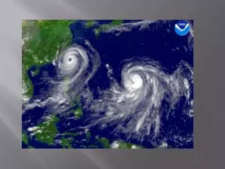
150 mb flow, Ivan, 2004 925 mb flow, Ivan, 2004 Inflow from Caribbean, outflow to the northeast, curving anticyclonicallyequatorward
Irene, 925 mb Irene, 150mb Large scale inflow and outflow patterns. Anticyclonic (of course) outflow pattern often sends air southward. Inflow in this case is partly from continent.
Background • TCs have significant impact on tropical UT water vapor budget (comparable to other convective regions – figures from E Ray
Background • Previous (unpublished) study (Rosenlof and Tuck, 1999) suggests TCs could contribute ~20% of the uplift at 70mb between 20-30 degrees latitude. • Previous aircraft studies of composition changes associated with TCs are very limited – typically ER-2 or B-57 flights showing water enhancements (Pfister et al, Kelly et al, 1993) in the stratosphere. • No systematic study measuring both inflow and outflow of TCs has been done with aircraft. This is unplowed ground – we could provide significant zeroth order information on this question.
Science Questions • How do TCs modify the chemical and aerosol environment of the UTLS? How does this relate to the composition of the inflow? By comparing our data with models (and successfully tuning transport models with it), we can start to get quantitative on this issue. This is the primary science issue we want to address regarding TCs • What are the cloud properties of cirrus and how do they vary within the storm (eyewall, rainbands) • What are the physical properties and structure of cirrus clouds in the outflow regions of hurricanes that demonstrate gravity wave features
Payload (DC-8) (http://espo.nasa.gov/missions/seac4rs/content/instruments • Chemistry and Tracers (long list) • Radiative flux measurements • In situ Aerosols (composition, size distribution, hydroscopicity, nephelometer etc) • Remote Aerosols (Aerosol AOD, DIAL) • Airborne Precip radar • In situ ice crystals and CCN (2 instrument packages)
Payload (ER-2) (http://espo.nasa.gov/missions/seac4rs/content/instruments • Polarimeters (2) RSP and AirMSPI • Radiometers • In situ chemistry • CPL • eMAS
Interaction • Environmental payload • Dropsondes can give us half hour delay outflow structure information • In situ and DC-8 radar information subbing for some of the over-storm instruments? • Over-Storm payload • CPL on ER-2 – one of the instruments on the environmental payload • Comparison of radars on DC-8 and GH • In situ micro information helps interpret GH radar data • For us, the most important benefit is probably the expertise of the HS3 forecast team in figuring out where to fly as the hurricane evolves
Interest expressed in Sahara dust. This would require a suitcase flight, preferably In August. HOWEVER, there are a lot of objectives (SE Chemistry, North American Monsoon) that are focussed on August (plus you are not there in August??). Suitcase flight to PR would exclude the ER-2. If we have had no Hurricane flights by Sep 10, would probably consider a suitcase flight to get one.
Aircraft specs • DC-8 – commercial aircraft, 10 hour typical flight time, 220 m/s (GH is 175 m/s), cruise ceiling 39kft (41kft last 2-3 hours). • ER-2 – 8 hour typical flight time, can go 10 hours for a few flights, 200 m/s, typical cruise is 65kft (higher than GH by ~5kft), ceiling 70 kft.
Why do we need the ER-2? Max outflow is at 14 km, DC-8 ceiling is about 13 km, so having ER-2 make soundings outside storm in outflow is preferable (from Peter Black’s presentation)
Atlantic Hurricane (Irene, 2011). Black, DC8, Red, ER2 • DC8 inflow run south of storm, spiral up at SE corner, outflow run north, rainband • run, cross-storm run (with ER-2), head home. ER-2 heads east of storm to do a vertical • Penetration of the outflow (down to 45 kft or lower if possible, in line dive), crosses • Storm with DC-8 and GH, heads home
Gulf Hurricane (we should be so lucky). DC8 heads SE at cruise, spiral to low altitude for BL run to Daytona Beach (?), spiral up to sample outflow and cruise northwestward. Do figure 4 across storm, along With a GW run to the west, and a microphysics run through the rain band. ER2 can probably do two in line dips to the east and (maybe) north-northeast of the Storm prior to coordinating with other aircraft on at least one over-eye run in the Figure 4.