SAI Decision Dashboards: Enhancing Sustainable Agriculture Intensification in Tanzania, Ethiopia, and Zambia
620 likes | 632 Vues
Explore decision dashboards designed to support evidence-based decision making and stakeholder engagement for sustainable agricultural intensification in Tanzania, Ethiopia, and Zambia. This guide provides step-by-step instructions for facilitators and champions to effectively use the dashboards.

SAI Decision Dashboards: Enhancing Sustainable Agriculture Intensification in Tanzania, Ethiopia, and Zambia
E N D
Presentation Transcript
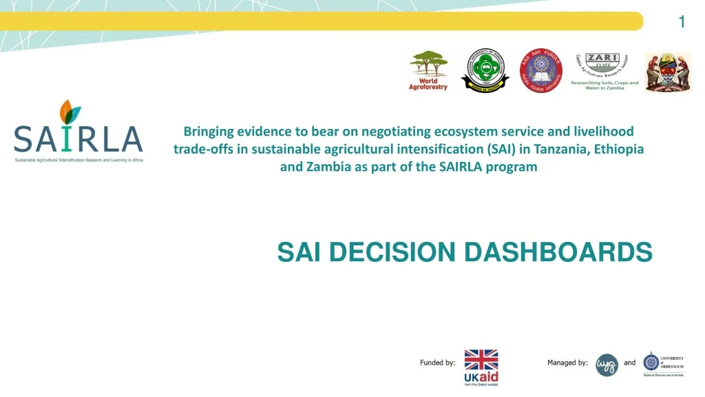
SAI DECISION DASHBOARDS Bringing evidence to bear on negotiating ecosystem service and livelihood trade-offs in sustainable agricultural intensification (SAI) in Tanzania, Ethiopia and Zambia as part of the SAIRLA program
Prepared by By Leigh Ann Winowiecki, Mieke Bourne, Sabrina Chesterman, Christine Magaju, Constance Neely, Tor Vågen, Faith Musili, Patricia Masikati, and HadiaSeid (ICRAF), Boniface Massawe (SUA) Further information Project website http://www.worldagroforestry.org/project/bringing-evidence-bear-negotiating-ecosystem-service-and-livelihood-trade-offs-sustainable Decision dashboards flyer http://www.worldagroforestry.org/output/decision-dashboards Links to SAI Country dashboards • http://landscapeportal.org/SairlaEthiopia/ • http://landscapeportal.org/SairlaZambia/ • http://landscapeportal.org/SairlaEthiopia/ SHARED stakeholder engagement process http://www.worldagroforestry.org/shared
Section 1 Purpose: Introduce what is a Decision Dashboard and the Engagement Process around the Design of the Dashboards.Audience: Facilitators and Champions to provide a background.Section 2 Purpose: Demonstrate each module in the Dashboard.Audience: Individual users of the dashboard and group sessions.Section 3Purpose: Apply the Dashboards for Decision Making and ensure its sustainability.Audience: Facilitators working with stakeholders.
SECTION 1 Background for Facilitators on Decision Dashboards and the Engagement Process
SECTION 1 – Background for Facilitators on Decision Dashboards and the Engagement Process • Purpose of the guidelines • What is a decision dashboard and why is it useful • Dashboard co-design process
Purpose of this Guide • To prepare facilitators to introduce new users and interested stakeholders to the SAI dashboards • Guidance on interaction with the SAI Dashboard • To elicit feedback on the sustainability and utility of the SAI dashboard • To identify mechanisms to raise awareness around the SAI dashboards • To establish a system for using the dashboards to facilitate discussions and encourage engagement around the use of evidence in decision making
Sustainable Agriculture Intensification (SAI) Dashboards • Tailored dashboards have been developed within the SAIRLA project • Ethiopia, Tanzania and Zambia each has its own dashboard co-designed by target users
How have the SAI dashboards been built? • SHARED Stakeholder engagement process which uses a specialized co-design framework to build the dashboards
Engagement Process for the SAI Dashboard • District-level Workshops • User interaction and feedback process • Building of prototype dashboards • National-level workshops to present prototypes • Engagement process with NLAs for continues feedback, capacity needs and embedding dashboards into planning and intervention processes on SAI
SHARED Engagement Process for the SAI Dashboard –Tanzania I • Initial district level (Mbarali) SHARED workshop in 2016 http://www.worldagroforestry.org/sites/default/files/outputs/SAIRLA_MbaraliWorkshopReport_Feb2017_sm.pdf • National level SHARED workshop in 2017 http://www.worldagroforestry.org/sites/default/files/outputs/SAIRLA SHARED Workshop Report May 2017 Tanzania_final_0.pdf • Continuous engagements with NLA &partners • District level meetings August 2018 • NLA meetings (quarterly) • Beta version of the dashboard in 2018
SHARED Engagement Process for the SAI Dashboard – Ethiopia • Initial district level (Ziway) SHARED workshop in 2016 http://www.worldagroforestry.org/sites/default/files/outputs/SAIRLA_ZiwayWorkshopReport_Feb2017_sm.pdf • National level SHARED workshop in 2017 http://www.worldagroforestry.org/sites/default/files/outputs/ICRAF%20Report_Ethiopia%20SAIRLA%20National%20SHARED%20workshop_March%202017_final.pdf • Establishment of Core Dashboard Team • Beta version of dashboard 2018 • Continuous engagements with NLA &partners • Nov 2018 – NLA meeting
SHARED Engagement Process for the SAI Dashboard – Zambia • Initial workshops at district level (Solwezi) and then national level as well as local engagements to understand stakeholder networks, decision making processes • 2016 http://www.worldagroforestry.org/sites/default/files/outputs/SAIRLA_SolweziWorkshopReport_Feb2017_sm.pdf • 2017 http://www.worldagroforestry.org/sites/default/files/outputs/SAIRLA%20Report_Zambia%20SHARED%20National%20Workshop_May2017_final.pdf • Establishment of core group for dashboard development and initial scoping of available data 2018 • Placement of the initial information (SAI priorities, root cause mapping and stakeholder networks) on the dashboard - 2018 • The dashboard can be accessed at: http://landscapeportal.org/SairlaZambia/
SECTION 2 Facilitation Guide for using the Dashboards: Exploring each Module
Objectives of the SAI Dashboards • To store, access, and share available SAI data online • To visualize data in a way that is easy and quick to understand • To view data on multiple topics at the same time to support decision making • To enhance capacity to interpret, discuss and use dashboard data, including to support tradeoff considerations when planning SAI interventions and policies
Three country-based SAI Dashboards ZAMBIA http://landscapeportal.org/SairlaZambia/ TANZANIA http://landscapeportal.org/SairlaTanzania/ ETHIOPIA http://landscapeportal.org/SairlaEthiopia/
Dashboard Interaction Session Workstations • Depending on the number of participants have workstations set up with a computer and the dashboard already loaded. Participants can also use their phones if needed. 4-6 participants per computer • Have the user guide printed next to the workstations to allow participants to refer to this • Feedback form to capture aspects on missing data and user functionality
Interactive Session Flow – Exploring each Module • General • Landing page – example from the Ethiopia dashboard • Root cause analysis – examples from the Ethiopia and Zambia dashboards • Social network model – examples from all three dashboards • SAI prioritization – example from Ethiopia dashboard • Land health module – example from the Ethiopia and Tanzania dashboards • Climate module – example from the Zambia dashboard • Socio-economic module – example from all dashboards • SAI Interventions- examples from Tanzania and Ethiopia dashboard
There are currently eight modules in each SAI Dashboard Socio-economic Root cause analysis Stakeholder mapping Prioritisation of SAI practices SAI Trials Trade-offs Land Health Climate
Landing Page – Ethiopia SAI Dashboard http://landscapeportal.org/SairlaEthiopia/
Root Cause Analysis Module - Ethiopia Select the root cause you would like to explore here This graphic assesses the root cause of lack of coordination within institutions
Select the root cause you would like to explore here Root Cause Analysis Module - Zambia This graphic assesses the root cause of lack of stakeholder participation in Zambia
Stakeholder Network Module – Zambia National Network The stakeholder maps show the organisations working on SAI. Use the key on the right to select to view the whole network, the network of one particular organisation, a type of organisation or to view the network according to how frequency. These maps are interactive so you can drag the dots (organisations) around and hover or click on a dot to see the name. When looking at the maps, the arrows originate from the organisation named and point to the organisation that was named as an SAI information source
Stakeholder Network Module – Tanzania Mbarali District SAI information network The stakeholder maps show the organisations working on SAI. We used the key on the right to select to view the network at the district level. The colors indicate the type of organization (red is farmer organization, yellow is government). These maps are interactive so you can drag the dots (organisations) around and hover or click on a dot to see the name. When looking at the maps, the arrows originate from the organisation named and point to the organisation that was named as an SAI information source
Stakeholder Network Module - Tanzania Mbarali District SAI information network Here we zoomed in to better see the names of the organizationNote the diversity of stakeholders active at the district level.
Stakeholder Network Module - Ethiopia Entire Network in Ethiopia Just Government Organizations Ethiopia
SAI Prioritization Module - Ethiopia Women Moist Lowland View the prioritized SAI practices as bubbles or in table format. Download the report here
SAI Prioritization Module - Ethiopia Men Moist Lowland View the prioritized SAI practices as bubbles or in table format. Download the report here
Land Health Module There are two options for exploring the land health data: By exploring by individual soil fertility elements
Land Health Module There are two options for exploring the land health data: By exploring by individual soil fertility elements By clicking on the Land Health maps tab to explore the spatial predictions of soil health indicators
Land Health Module – Soil Organic Carbon - Tanzania • Soil Organic Carbon (SOC) is a key indicator of soil health. SOC influences the water holding capacity of the soil, cation exchange capacity, soil fertility, among other key soil properties. • SOC is influenced by land management practices and aboveground vegetation. • A value of 20 g carbon per kg of soil, is often used as a general threshold needed for agricultural productivity. • Thus, soil with values less than this threshold could be considered constrained due to low SOC content. This map shows the value of the topsoil organic carbon for each of the 160 sampled LDSF plots. The density plot shows the distribution of SOC levels in the topsoil across the samples
Land Health Module – Total Nitrogen- Tanzania This map shows the value of the topsoil total nitrogen for each of the 160 sampled LDSF plots. The box plots on the left is a visualization of the total nitrogen. The boxplots show the range of the nitrogen quantity in the topsoil for a given cluster (n=16 clusters per site). The dots on the plot show the outliers. The heavy vertical line in the middle of the box shows the median point.
Land Health Module – Soil pH- Tanzania This map shows the value of the topsoil pH values for each of the 160 sampled LDSF plots. •Soil pH is an indicator of soil acidity. At low soil pH values (< 5.5) there is a risk of aluminum and magnesium toxicity. At high soil pH (> 8.3), there can be induced phosphorous and micronutrient deficiency which may also indicate high sodium levels.
Land Health Module- Exchangeable Bases- Tanzania • The sum of Exchangeable Bases is the sum of Ca+2, Mg2+,Na+,K+. This is an overall indicator of soil fertility. • The general thresholds are: values <4 cmolc kg-1 is extremely low, while 8 cmolc/ kg is low but can be managed. This map shows the value of the topsoil Exchangeable Bases for each of the 160 sampled LDSF plots.
Land Health Module – Clay Content - Tanzania • Soil contains different sized particles: sand (2.0 - 0.05 mm), silt (0.05-0.002 mm) and clay (<0.002 mm). • These data have implications for the water holding capacity of the soil, the infiltration rates as well as soil organic carbon storage potential. This map shows the clay content (%) of the topsoil for each of the 160 sampled LDSF plots.
Land Health Module – Maps Land Health Maps were generated using the Ecosystem Health Surveillance Database at World Agroforestry (ICRAF) Using the field data collected with the LDSF and Landsat imagery (2017) at 30 meter resolution Soil Organic Carbon (SOC) Soil Erosion Soil pH Wetness Index Fractional Vegetation cover using SATVI index -2017 Fractional Vegetation cover using SATVI index -1990
Land Health Module – Maps To activate the detailed indicator maps, you must click on the map to the left.
Land Health Module – Maps – Exploring Multiple Indicators By simultaneously exploring multiple land and soil health indicators one can start to look at the how the indicators potentially influence each other. For example, this location has LOW soil organic carbon (SOC), HIGH soil erosion prevalence, and has seen a decrease in fractional vegetation cover between 1990 and 2017. Soil Organic Carbon (SOC) Soil Erosion Soil pH Wetness Index Fractional Vegetation cover using SATVI index -1990 Fractional Vegetation cover using SATVI index -2017
Climate Module – Zambia There are two options for exploring the climate data: By exploring point click visualizations These rainfall data are the Tropical Rainfall Monitoring Mission (TRMM)
Climate Module – Zambia There are two options for exploring the climate data: By exploring point click visualizations or District Based Visualisations
Climate Module – Zambia – Point Click Visualisation Tab Rainfall trends from 1998-2017 Use the slider to select the years Boxplots of the same trends by looking at the variation in rainfall for each month – between the years 1998-2017
Climate Module – Zambia – District based visualisations 1) Use the slider to select the years 2) Select two different districts on the map 3) Compare the trends for the two districts by month 4) Compare the boxplots of the same trends by looking at the variation in rainfall for each month – between the years 1998-2017
Socioeconomic Module – Ethiopia HH and farm size Source of income Farm ownership
Socioeconomic Module – Zambia HH and farm size Source of income Source of labour
SAI Trials Module – Ethiopia • 70 farmers registered and engaged in the SAI intervention across three counties in June 2017 • Farmer selection was based on the following criteria: availability of plot of land and water, accessibility, farmer’s interest and accountability to mange fruit tree seedlings were considered. • In 2017 crop season for homegarden fruit and multipurpose tree integration