Download
1 / 11
110 likes | 380 Vues
Use of ArcGIS 8.1 for Land Development Planning on Small Acreage Sites. Tim Osting CE 394K.3 GISWR Fall 2001. Small Sites – Background . I would like to explore the possibility of applying GIS technology to a typical Land Development project

E N D
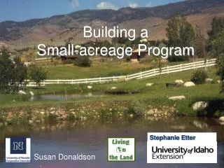
Use of ArcGIS 8.1 for Land Development Planning on Small Acreage Sites Tim Osting CE 394K.3 GISWR Fall 2001
Small Sites – Background • I would like to explore the possibility of applying GIS technology to a typical Land Development project • I would like to determine if existing GIS resources have adequate resolution for a typical small-acreage project (<100 acres)
Small Sites – Overview OBJECTIVE: Produce a PROJECT FEASIBILITY STUDY using readily-available GIS data without leaving my desk! • Review General Development Planning Requirements • Description of traditional methodology • Description of GIS methodology • Comparison of methods
Small Sites – A Typical Project • Location Map • Property Boundary Map • Drainage Area Map • Existing and Proposed Runoff Calculations • Floodplain Map • Area Geology • Area Wells
Traditional Methods Location Map from TxDOT CAD files Property Boundaries from plat (corners generated from ground and record information) Digitized Geologic Map from draft UT-BEG 7.5 quads Soils Map from UT-BEG Wells GIS-based Methods Location Map from TxDOT CAD files Property Boundaries from same GIS Geologic Map from USGS GIS Soils Map from SSURGO/TNRIS GIS Wells from TWDB Small Sites – Data Sources
Traditional Methods Drainage Area digitized from 7.5 degree topo map Rainfall/Runoff: HEC-1 or HEC-HMS Tc (or Tlag) Drainage Area CN Channel: HEC-RAS Floodplain Map GIS-based Methods NED-generated Drainage Area Or…Rainfall/Runoff: HEC-GeoHMS Tc (or Tlag) Drainage Area CN Channel: HEC-RAS Floodplain Map not available Small Sites – Drainage Calculations
Small Sites – Sample Project • 2.6-acre residential resubdivision • Located in ETJ near Hutto, TX, portions in both Williamson and Travis Counties • Large up-gradient drainage area • Existing drainage channel at front of lot
Small Sites – Digitized Drainage Map Site Drainage Area
Small Sites – Drainage Map by GIS Site Drainage Area GIS Stream Network
Small Sites – Tentative Conclusions • GIS speeds up data gathering process (Goal: Feasibility Study in 8 hours or less, <$600) HOWEVER, USE CAUTION! • Most development occurs in areas that are changing, so GIS data is often out of date • GIS data does not yet possess adequate resolution for a small-acreage site
Small Sites – Tentative Conclusions • GIS is well-suited for producing a Preliminary Project Feasibility Study for a small-acreage site (Drainage Areas <250 acres) • Current GIS is not well-suited to provide final design data • Supplemental information is required for final project design