Who Needs New Datums? NGS Says…
350 likes | 526 Vues
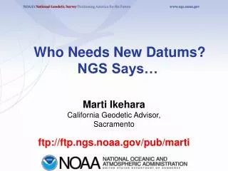
Who Needs New Datums? NGS Says…. Marti Ikehara California Geodetic Advisor, Sacramento. ftp:// ftp.ngs.noaa.gov/pub/marti. Outline. New datums down the road GRAV-D Program New datum, epoch for CORS soon Visualizing Geodetic control VDATUM. What IS a datum?.

Who Needs New Datums? NGS Says…
E N D
Presentation Transcript
Who Needs New Datums?NGS Says… Marti Ikehara California Geodetic Advisor, Sacramento ftp://ftp.ngs.noaa.gov/pub/marti
Outline • New datums down the road • GRAV-D Program • New datum, epoch for CORS soon • Visualizing Geodetic control • VDATUM
What IS a datum? • It is NOT the same (concept) as a “projection”, which controls how maps are represented or “look” on paper or on a screen. • It is a reference, a basis, for coordinates, so a datum has an origin and/or ‘zero’. • “Underlying” a horizontal datum system is an ELLIPSOID, that represents the global shape of the earth; a DATUM is the ‘continental’ shape as realized with physical marks (passive or active)
NGVD29 The National Geodetic Vertical Datum of 1929 was referenced to 26 tide gauges in the US and Canada
NAVD88 The North American Vertical Datum of 1988 is referenced to a single tide gauge in Canada
GEOID09 compared to GEOID03 09: teal, good; yellow: State advisor-rejected; red: analysis-rejected 03 (underlying dots): dk blue, kept; orange: rejected
From Helmer’s article in Winter 09/10 issue of California Surveyor
2009 National Research Council Report “…uniform national standards for FEMA flood maps cannot be met until an improved orthometric height datum and geoid model exist…”
Rationale for new Datums • Terminology • Horizontal becomes GEOMETRIC • Vertical becomes GEOPOTENTIAL • When? 2018, if GRAV-D program is complete • Why? But why?! • Primarily need a better vertical datum for “vertical” data(geoid, ortho ht) not obtained by traditional leveling • Geodetic Data collection relies upon navigation (GNSS) satellites orbiting around the mass center of the Earth • NAD83 reference frame/datum is not geocentric
Z Earth-Centered Earth-Fixed (ECEF) Coordinate System XA, YA,ZA (not NAD83) -Y -X Greenwich Meridian Earth Mass Center X, Y, Z = 0 Y X GRS 80 Ellipsoid -Z
Simplified Concept of NAD 83 vs. ITRF00 (or WGS84) h83 h00 Earth’s Surface ITRF 00 Origin 2.2 meters Identically shaped ellipsoids (GRS80) a = 6,378,137.000 meters (semi-major axis) 1/f = 298.25722210088 (flattening) NAD 83 Origin
Rationale for new Datums • Terminology • Horizontal becomes GEOMETRIC • Vertical becomes GEOPOTENTIAL • When? 2018, if GRAV-D program is complete • Why? But why?! • Primarily need a better vertical datum for “vertical” data(geoid, ortho ht) not obtained by traditional leveling • Geodetic Data collection relies upon navigation (GNSS) satellites orbiting around the mass center of the Earth • NAD83 reference frame/datum is not geocentric • Earth is not stable in all directions; reference frame must account for this to be as geodetically accurate as possible • NAD83 is not defined to include vertical velocities
Horizontal Velocities, relative to ‘stable’ NA tectonic plate, are reflected in HTDP model
CORS Data allows for Monitoring Vertical Crustal Motion Vertical velocities associated with Glacial Isostatic Adjustment (rebound)
Evolution of Geodetic Datums: from NAD27/NGVD29 to NAD83/NAVD88 to ?/ ? GPS H + V 2 + 1 27, 29 H + V 2 + 1 83(86), 88 H + VE+ VO 2 + 1 + 1 83(92), 88 +VELOCITIES (time) H + Ht+ VE +VO 2 + 2 + 1+ 1 83(07)+HTDP, 88 H + Ht+VE+ VEt 2 + 2 + 1+ 1 GEOMETRIC (VE+G)[+VEt] + Gt 1 + 1 GEOPOTENTIAL H + Ht+VE+ VEt 2 + 2 + 1+ 1 ITRF00 (2002.00) + GRAVITY (geoid model)
The Future of Height Mod: GRAV-D Gravity for the Redefinition of the American Vertical Datum • GRAV-D • Airborne gravity surveys (taking 10 years) • Coastal areas surveyed first • All USA states and territories • www.ngs.noaa.gov/GRAV-D • GOAL: • Orthometric heights-”elevations” – to be good to 2 cm anywhere, anytime with an excellent ellipsoid height from GNSS technology. Currently this takes 3-4 hours at 15-second recording and dual-frequency GPS • Height changes much more easily monitored than by leveling, using new technology – GNSS heights and gravity values • Spot-checking/monitoring gravity changes with portable field units
“CONUS” Alaska Guam / Northern Marianas Hawaii Puerto Rico / Virgin Islands American Samoa Planned GRAV-D Coverage
Status of GRAV-D in early 2010 As of Jan 2010: 6.7% of planned areas have been flown NGA funded NRL plane USACE funded
New datum, epoch for CORS • Current: ITRF2000, 2002.00 • Near end of year: ITRF2008, 2008.00 • NAD83 (“CORS96A”), 2010.00 • No change to passive monumentation, eg, NAD83 (NSRS2007), 2007.00 • About 1000 CORS nationwide • Those with >2 years of data • Changes on the order of mm, but some outliers are showing closer to decimeters • List will be prepared, showing amount of change
http://www.dot.ca.gov/hq/row/landsurveys/geodetic/geodetic_control.htmlhttp://www.dot.ca.gov/hq/row/landsurveys/geodetic/geodetic_control.html
http://www.dot.ca.gov/hq/row/landsurveys/geodetic/geodetic_control.htmlhttp://www.dot.ca.gov/hq/row/landsurveys/geodetic/geodetic_control.html
Anything Else?! • Marti.ikehara@noaa.gov • 916-227-7325 • ftp://ftp.ngs. noaa.gov/pub/marti