Landscape Analysis Layers
Landscape Analysis Layers. Pete Aniello Sean Breyer. Living Atlas: Earth & Life on ArcGIS Online. Landscape Layers are part of the Living Atlas. Living Atlas. ArcGIS. Demographics. Basemaps. Imagery and Observations. Lifestyles. Transportation. Urban Systems. Landscape. Story Maps.

Landscape Analysis Layers
E N D
Presentation Transcript
Landscape Analysis Layers Pete Aniello Sean Breyer
Living Atlas: Earth & Life on ArcGIS Online Landscape Layers are part of the Living Atlas Living Atlas ArcGIS Demographics Basemaps Imagery and Observations Lifestyles Transportation Urban Systems Landscape Story Maps Landscape Analysis Layers
Landscape: Earth, Life, People in Living Atlas Helps Us Understand and Analyze our World Landscape Analysis Layers
What are Landscape Analysis Layers? • A streaming authoritative-source data library to support biogeographic analysis, natural resource management, land use planning and conservation • Currently approx. 120 services for U.S • International coverage starting with Africa • Focused on national and regional scales … … Landscape Analysis Layers
What’s New? Esri is modernizing its content offerings by providing a large body of application ready DATA (not just maps, which are pictures of data) as services: • Image Services • Map Services w/ feature access • Story Maps that show examples of use • Provide content that supports ANALYSIS as well as visualization Landscape Analysis Layers
Landscape Analysis Layers Product Vision ArcGIS Desktop Publication of useful data for landscape analysis and decision-making that works across the ArcGIS System ArcGIS OnLine Web Map/Services GeoPlanner Location Analytics/Viewers Raster Data Vector Data Summarized Geographies Other Viewers & Apps Landscape Data Landscape Analysis Layers
Value of Landscape S Saves time and money User does not have to acquire, process, store, maintain essential data themselves Esri provides ready to use content • Input to models Landscape for Contributors for provider-direct content • Valuable content for users • Exposure to wider audience for providers Landscape Analysis Layers
Landscape Content Supports decision makers across many industries Modeling the land around us Land Management Layers Federal Land Native Lands • Planners • Policy makers • Scientists • Analysts • Educators Physical Geography Layers Watersheds Elevation Slope Aspect NHD+ Soils Landforms Faults Wetlands Evapotranspiration Cultural Geography Layers Roads Rail Flood risk Historic Sites Transmission Lines Pipelines Oil Shale Basins Coal Bed Methane Basins Earthquake Risks Bio-Geography Layers Critical Habitat Ecological Systems Land cover Landscape Analysis Layers
Ready to Use Online Analytics Online and Desktop GP Tools Location Analytics and Data Enrichment Landscape Analysis Layers
Data Criteria • Data that has a proven use case • Support for Key Performance Measurements (KPM) in Government • Support for Strategic Planning and Policy Development • Scale ranges that can support regional and national analysis • Larger-scale, limited-area data served/maintained by provider • Cost and benefits considered for each layer • Data that is considered authoritative • Measured, summarized, or modeled • Well documented • Currency is important Landscape Analysis Layers
Organization of Landscape Data Layers Climate Environmental Impact Soils/Geology Elevation Ecology Ecological Disturbance Man-made Hazards Oceans Species Biology Natural Hazards Land Cover Weather Water Subsurface Landscape Analysis Layers
Esri Evaluates and Documents the Quality and Integrity of Data • Review data via hardcopy plots, digital overlays • Identify layers that are likely to be correlated/integrated • Find the inconsistencies, problems with integrity, problems buried in process lineages • We employ a subcontractor to provide and independent evaluation of data • Provide quality assessments and recommendations to original authors Identify gaps in available data and find opportunities for adding value Landscape Analysis Layers
What Changes Do We Make to the Original data? • Minimal corrections to geometry or attributes (quick error fixes) • Project to Web Mercator (maps) or Equal Area (raster and vector data) • Convert Vector to Raster • Clip to a Shoreline • We may parse out a subset of data such as creating a raster for one soil parameter We are careful to preserve the integrity of the original content Landscape Analysis Layers
Data Processing and Access Concept: No “Throw-Away” Data ArcGIS Services Web Maps Desktop / GP Analysis Location Analytics Summarized Polygons Vectors Rasters Landscape Analysis Layers
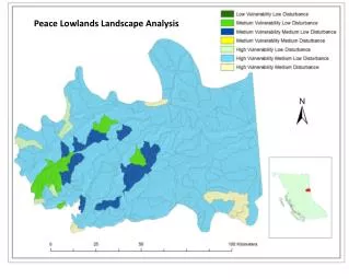
Rasterization Example SSURGO- Available Water Storage - 0-150 cm weighted average Landscape Analysis Layers
Landscape Data in ArcGIS Online Demo Landscape Analysis Layers
Landscape Data in ArcGIS Desktop Demo Landscape Analysis Layers
Landscape Data in Esri Insights Demo Landscape Analysis Layers
Landscape Data in Landscape Analyst Demo Landscape Analysis Layers
Landscape Data in GeoPlanner Demo Landscape Analysis Layers
Available Layers (U.S.) Raster Map Layers: USA Critical Habitat USA Critical Habitat Atlantic Salmon USA Critical Habitat Bull Trout USA Critical Habitat California Condor USA Critical Habitat Chinook Salmon USA Critical Habitat Chum Salmon USA Critical Habitat Coho Salmon USA Critical Habitat Delta Smelt USA Critical Habitat Desert Tortoise USA Critical Habitat Marbled Murrelet USA Critical Habitat Mexican Spotted Owl USA Critical Habitat Northern Spotted Owl USA Critical Habitat Peninsular Bighorn Sheep USA Critical Habitat Sockeye Salmon USA Critical Habitat West Indian Manatee USA American Crocodile GAP Distribution USA Atlantic Puffin GAP Distribution USA Black Footed Ferret GAP Distribution USA Desert Tortoise GAP Distribution USA Gunnison Sage-Grouse GAP Distribution USA All Federal Lands USA BLM Lands USA Historic Sites USA Native American Lands USA NPS Lands USA Protected Areas USA Unprotected Areas USA USFS Lands USA USFWS Lands USA Wilderness Areas USA ArcticTern GAP Range USA Bighorn Sheep GAP Range USA California Condor GAP Species Range USA Canada Lynx GAP Range USA Common Loon GAP Range USA Mexican Spotted Owl GAP Range Ground Surface Elevation - 30m USA Soils Albedo USA Soils Bedrock Depth USA Soils Corrosion Concrete USA Soils Corrosion Steel USA Soils Crop Production USA Soils Drainage Class USA Soils Erosion Class USA Soils Erosion Hazard Forest Roads USA Soils Farmland Class USA Soils Flooding Frequency USA Soils Frost Free Days USA Soils Hydric Classification USA Soils Initial Subsidence USA Soils Range Production USA Soils Runoff USA Soils Tfactor USA Soils Total Subsidence USA Soils Water Table Depth USA Active Quaternary Faults USA Aquifers USA Coal Bed Methane Basins USA Coal Fields USA Cropland USA Development Risk USA Evapotranspiration USA Flood Risk USA Forest Type USA Hazardous Waste Sites USA Insect and Disease Risk USA Land Surface Forms USA Landcover GAP USA Mean Rainfall USA Mean Temperature USA National Conservation Easement Boundaries USA NLCD USA Oil Shale Basins USA Railroads USA Roads USA Surface Water USA Transmission Lines USA Wetlands USA Wildland Fire Potential USA Wildland Urban Interface USA Woody Biomass USA NLCD 2011 USA Landcover Change 2006-2011 USA Impervious Surfaces 2011 USA Impervious Change 2006-2011 USA Tree Canopy 2011 Vector Map Layers: Provider-contributed Layers: National Insect and Disease Risk Basemap Idaho Elevation and Derivatives Fraction of photosynthetically active radiation (fPAR) for Idaho Idaho NDVI 2002 - present USA Active Quaternary Faults USA All Federal Lands USA Aquifers USA BLM Lands USA Coal Fields USA Coalbed Methane Basins USA Critical Habitat USA Earthquake Risk USA Flood Risk USA Geology Units USA Hazardous Waste Sites USA Historic Sites USA National Conservation Easement Lands USA Native American Lands USA NHDPlusV2 USA NPS Lands USA Oil Shale Basins USA Railroads USA Roads USA Soils USA USFS Lands USA USFWS Lands USA Wetlands USA Wilderness Areas Landscape Analysis Layers
International Layers • Harmonized World Soils • Topographic Moisture Potential • Global Land Cover • Surficial Lithology • Hydro flow direction • Isobioclimates • Climate Change Severity 2020, 2050 • Mean Temperature 1950-2000 • Mean Precipitation 1950-2000 • Evapotranspiration • Population Density • Infant Mortality • Global Crop Harvest Data • Terrestrial Ecosystems • Global Biodiversity Index • Carbon Biomass Rolling out on a continent-by-continent basis, beginning with Africa Landscape Analysis Layers
Additional Planned Landscape Content • International • New Analysis Layers • Crop Diversity, IUCN Red List derivative • 30m Hydro-conditioned DEM (Africa) • Flow Direction, Flow Accumulation, Synthetic Streams • From LandSAT8 • Land Cover, Land Use, Change Detection (Africa) • Beta Landscape Databuilder (“landscape kit”) for distributors/partners/national mapping agencies • Workflows, Tools • USA Content • 303d Impaired waters layer • Point source pollution layer • Natural Capital Project - InVest Sediment Retention analysis • Natural Capital Project - InVest Nutrient Removal analysis • Threats to Watershed (Report) Landscape Analysis Layers
Access • Requires an ArcGIS Online subscription • Discoverable through • ArcGIS Online • Featured groups • Map viewer (Add Esri map layers) • Living Atlas • Reserved tag: esri_landscape • Sample apps on Marketplace.arcgis.com Landscape Analysis Layers
What’s included in Landscape Landscape layers • Raster (as image services) • Vector (as web maps with feature access) Geoprocessing Services • Elevation-based (watershed, viewshed, others) Web maps Story maps Sample Apps for Landscape (on Marketplace) • Landscape Analyst • Landscape Modeler • Esri Insights Landscape Analysis Layers
Contacts • Sean Breyer (sbreyer@esri.com) • Pete Aniello (paniello@esri.com ) • Questions? Landscape Analysis Layers
Thank you… Please fill out the session survey: First Offering ID: 2000 Online – www.esri.com/ucsessionsurveys Paper – pick up and put in drop box Landscape Analysis Layers