Remote Sensing Hyperspectral Imaging
Remote Sensing Hyperspectral Imaging. AUTO3160 – Optics Staffan Järn. Introduction. Measurement of object properties on the earth’s surface using data acuired from aircraft and satellites Passive remote sensing Natural radiation that is emitted or reflected by the object or surrounding areas


Remote Sensing Hyperspectral Imaging
E N D
Presentation Transcript
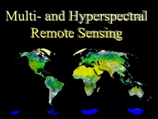
Remote SensingHyperspectral Imaging AUTO3160 – Optics Staffan Järn
Introduction • Measurement of object properties on the earth’s surface using data acuired from aircraft and satellites • Passive remote sensing • Natural radiation that is emitted or reflected by the object or surrounding areas • Reflected sunlight is the most common radiation measured • Active remote sensing • Emits energy • Detects and measures the radiation that is reflected or backscattered from the target. • RADAR and LiDAR systems measures time delay to establish the location, height, speed and direction of an object.
History • 1858 - Photographs of Paris from balloon • 1972 - Landsat Multispectral Scanner System (MSS) satellite. • High resolution earth images with 4 spectral bands. Each about 100 nm wide. • 80 m pixel size. 185 x 185 km • Today • Hundreds of images of the same area in 10nm spectral bands • Spectrum from 400 to 2400 nm • Advanced Visible/InfraredRed Imaging Spectrometer (AVIRIS), airborne • HyMap, airborne • Hyperion, satellite
Applications • Environmental monitoring (urban growth, hazardous waste) • Global change (global warming, deforestation) • Agriculture (crop condition, yield prediction) • Nonrenewable natural resources (wetlands, soils, forests, oceans) • Meteorology (atmosphere dynamics, weather prediction) • Mapping (topography, land use, civil engineering) • Military surveillance (strategic policy, tactical assessment) • News media (illustrations, analysis)
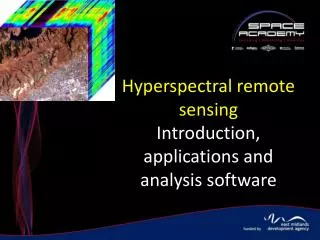
Multispectral & Hyperspectral Imaging • Both are related • Difference in number of bands • Depending on what is appropriate to the purpose • Multispectral • Discrete and narrow bands • Spectrum from visible to longwave infrared • Hyperspectral • Imaging narrow spectral bands over a continuous spectral range, and produce the spectra of all pixels in the scene
Hyperspectral Imaging • Collect image data in multiple narrow spectral bands • Possible to derive a continuous spectrum for each image cell
Hyperspectral Imaging • In reflected-light spectroscopy the property wanted to obtain is called Spectral Reflectance. • The ratio of reflected energy as a function of wavelength • Reflectance varies with wavelength for most materials because energy at certain wavelengths is scattered or absorbed to different degrees. • Absorption bands
Result • Image cube for spatial-spectra data
Sources • Remote Sensing, Models and Methods for Image Processing – R.A. Schowengerdt • Introduction to Hyperspectral Imaging, pdf document from AUTO3090 Chemometrics course • Wikipedia – Remote Sensing - http://en.wikipedia.org/wiki/Remote_sensing • Wikipedia - Hyperspectral Imaging - http://en.wikipedia.org/wiki/Hyperspectral_imaging