Download
1 / 15
150 likes | 267 Vues
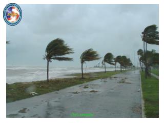
Satellite support for the NOAA/AOML Hurricane Research Division (HRD) annual field program. Background / History: AOML/HRD: Miami, FL NOAA's research aircraft (two WP-3D turboprops and a Gulfstream IV-SP jet) flown by NOAA's Aircraft Operations Center (MacDill AFB Tampa, FL) RAMSDIS

E N D
Satellite support for the NOAA/AOML Hurricane Research Division (HRD)annual field program • Background / History: • AOML/HRD: Miami, FL • NOAA's research aircraft (two WP-3D turboprops and a Gulfstream IV-SP jet) flown by NOAA's Aircraft Operations Center (MacDill AFB Tampa, FL) • RAMSDIS • “Tropical RAMSDIS”, July, 1995, RAMM/CIRA • 1996 – “HRD RAMSDIS”
Tropical RAMSDIS image animations: - Global geostationary coverage: -- Meteosat-8 at 0 deg lon -- GOES-12 at 75W -- GOES-11 at 135W -- MTSAT at 140E -- Meteosat-7 at 62E 1) large area water vapor 2) matching large area visible (combined with night-time 3.9 micrometer) 3) six movable 4-km Mercator areas (floaters) - IR - VIS / 3.9 4) two 1-km center relative visible animations using rapid scan images
Tropical RAMSDIS supplemental data types: - conventional surface observations - conventional ship and buoy (moored and drifting) observations - radiosonde observations - satellite high density winds (from CIMSS, Wisc) - scatterometer (Quikscat) winds - numerical model analyses and forecasts (1. NCEP GFS, 2. UKMET, 3. NOGAPS modified by satellite winds from CIMSS) - hurricane track forecasts from TPC/NHC
Tropical RAMSDIS products: IMAGE: - CIRA blended total precipitable water - satellite microwave (SSMI, AMSU, TRMM, AMSR-E) - sea-surface temperature - cloud cleared 3.9 micrometer night-time skin temperature - long wave difference (dust) ANALYSIS: - digital Dvorak hurricane intensity estimate - vertical wind profile areal wind averaging (for vertical shear analysis, using numerical model fields)
Additional RAMM real-time TC products and RAMSDIS accessible data: - Tropical cyclone surface wind analysis - Ocean heat content - AMSU intensity estimates and vertical structure analysis - RAMM Genesis parameter - high resolution polar orbiter images (MODIS and AVHRR) - NexRad NWS radar - SHIPS and STIPS (Statistical Intensity forecast guidance) OnLine: http://rammb.cira.colostate.edu/products/tc_realtime/ http://www.ssd.noaa.gov/PS/TROP/genesis.html http://www1.cira.colostate.edu/RAMM/Rmsdsol/TROPICAL.html
Microwave images • 8 types: • SSMI 85 Ghz • AMSU 89 Ghz • TRMM 85H • TRMM 85PCT • TRMM 37PCT • TRMM 37V • AMSU CH-7 • AMSU CLW 4-km Mercator to match VIS and IR floaters
Sea-surface temperature and cloud-cleared GOES 3.9-micrometer images