Download
1 / 62
630 likes | 679 Vues
Learn about seismic waves and Earth's internal layers, including continental drift and plate tectonics theory. Discover how seismic waves provide insights into Earth's composition, from the crust to the core boundaries.

E N D
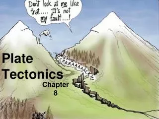
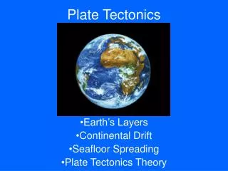
. Chapter 22: PLATE TECTONICS AND EARTH’S INTERIOR
This lecture will help you understand: • Seismic Waves • Earth’s Internal Layers • Continental Drift • Acceptance of Continental Drift • The Theory of Plate Tectonics • Continental Evidence for Plate Tectonics
Seismic Waves • When rock under Earth’s surface moves or breaks, energy travels in the form of seismic waves, which cause the ground to shake and vibrate—an earthquake. • Analysis of seismic waves provides geologists with a detailed view of Earth’s interior.
Seismic waves Study of seismic waves has led scientists to understand that Earth is a layered planet consisting of: • Crust • Mantle • Outer core • Inner core
Seismic Waves Two main types of seismic waves: • Body waves travel through Earth’s interior • Primary waves (P-waves) • Secondary waves (S-waves) • Surface waves travel on Earth’s surface • Rayleigh waves • Love waves
Seismic WavesBody Waves: Primary Waves • Primary waves are longitudinal: • They compress and expand the material through which they move. • Compression/expansion occurs parallel to the wave’s direction of travel. • Primary waves travel through any type of material—solid rock, magma, water, or air. • Primary waves are the fastest of all seismic waves—first to register on a seismograph.
Seismic WavesBody Waves: Secondary Waves • Secondary waves are transverse: • They vibrate the rock in an up-and-down or side-to-side motion. • Transverse motion occurs perpendicular to a wave’s direction of travel. • Secondary waves travel through solids—they are unable to move through liquids. • Secondary waves are slower than P-waves—second to register on a seismograph.
Seismic Waves: Surface Waves • Surface waves are the slowest seismic waves and the last to register on a seismograph. • Rayleigh waves have a rolling-type of motion: • They roll over and over in a tumbling motion, similar to ocean wave movement. • Tumbling motion occurs backward compared to wave’s direction of travel. • Ground moves up and down. • Love waves have similar motion to S-waves: • Horizontal surface motion is side to side. • Whip-like, side-to-side motion occurs perpendicular to the wave’s direction of travel.
Seismic Waves CHECK YOUR NEIGHBOR The most destructive earthquakes are caused by the passage of surface waves, because • they travel faster than other seismic waves. • they occur in the crust, the densest layer of the Earth. • they occur at the surface where the ground shakes up and down and from side to side. • they travel deep into the Earth’s interior.
Seismic Waves CHECK YOUR ANSWER The most destructive earthquakes are caused by the passage of surface waves, because • they travel faster than other seismic waves. • they occur in the crust, the densest layer of the Earth. • they occur at the surface where the ground shakes up and down and from side to side. • they travel deep into the Earth’s interior.
Seismic Waves: Earth’s Interior • Abrupt changes in seismic-wave velocity reveal boundaries between different materials within the Earth. • The densities of the different layers can be estimated by studying the various seismic-wave velocities.
Earth’s Internal Layers:Core–Mantle Boundary • In 1906, Richard Oldham observed that P-waves and S-waves travel together for a distance, then encounter a boundary where the S-waves stop and the P-waves refract. • He had discovered the core–mantle boundary.
Earth’s Internal Layers: Crust–Mantle Boundary ´ ˇ • In 1909, Andrija Mohorovicic observed a sharp increase in seismic velocity at a shallow layer within Earth. • Mohorovicic had discovered the crust–mantle boundary. • Earth is composed of a thin, outer crust that sits upon a layer of denser material, the mantle. ´ ˇ
Earth’s Internal Layers: Mantle-Core Boundary • In 1913, Beno Guttenberg refined Oldham’s work by locating the depth of the core-mantle boundary (2900 km). • When P-waves reach this depth, they refract so strongly that the boundary casts a P-wave shadow (where no waves are detected) over partof the Earth.
Earth’s Internal Layers: Mantle-Core Boundary • In 1926 Sir Harold Jeffries determined that the core, or part of it, must be liquid. • Taken together, the discoveries of Oldham, Mohorovicic, Gutenberg, and Jeffreys indicate that Earth is composed of three layers of different compositions: the crust, mantle, and core.
Earth’s Internal Layers: Inner Core-Outer Core • In 1936, Inge Lehmann observed that P-waves also refract at a certain depth within the core. • At this depth, P-waves show an increase in velocity, indicating higher density material. • Lehmann discovered the inner core. • The core has two parts: a liquid outer core and a solid inner core. • When added to earlier findings, Lehmann’s work completed the current picture of Earth’s internal layered structure.
Earth’s Internal Layers: The Core • The core is composed predominantly of metallic iron. • The core has two layers—a solid inner core and a liquid outer core. • The inner core is solid due to great pressure. • The outer core is under less pressure and flows in a liquid phase. • Flow in the outer core produces Earth’s magnetic field.
Earth’s Internal Layers: The Mantle • The mantle makes up 82% of Earth’s volume and 65% of Earth’s mass. • The mantle is Earth’s thickest layer—2900 km from top to bottom. • Mantle rock is rich in siliconand oxygen. • It also contains heavier elements, such as iron, magnesium, and calcium. • The mantle is divided into two regions—upper mantle and lower mantle.
The upper mantle has two zones:the asthenosphere and thelithosphere. • The lower part of the upper mantle is called the asthenosphere. • The asthenosphere is solid but behaves in a plastic-like manner, allowing it to flow easily. • The constant flowing motion of the asthenosphere greatly affects the surface features of the crust.
The upper mantle has two zones:the asthenosphereand the lithosphere. • The lithosphere includes the uppermost part of the upper mantle plus the crust. • The lithosphere is cool and rigid. • It does not flow but rides atop the plastically flowing asthenosphere. • Because of its brittle nature, the lithosphere is broken up into individual plates. • Movement of lithospheric plates causes earthquakes, volcanic activity, and deformation of rock.
Earth’s Internal Layers: The Lower Mantle • The lower mantle extends from a depth of 700 kilometers to the outer core. • The lower mantle is under great pressure, making it solid.
Earth’s Internal Layers: The Crust The Earth’s crust has two distinct regions • Oceanic crust is compact and averages about 10 kilometers in thickness. • It is composed of dense basaltic rocks. • Continental crust varies between 20 and 60 kilometers in thickness. • It is composed of less dense granitic rocks.
Isostasy • The word isostasy derives from Greek roots “iso” meaning equal and “stasis” meaning standing—equal standing. • Isostasy is the vertical positioning of the crust so that gravitational and buoyant forces balance one another. • Low-density crust floats on the denser, underlying mantle.
Why are continents high and oceans low? • Isostasy! Variations in surface elevations result from variations in the thickness and the density of the crust. • Areas of continental crust stand higher than areas of oceanic crust, because continental crust is thicker and less dense than oceanic crust.
Isostasy CHECK YOUR NEIGHBOR The Earth’s crust is thicker beneath a mountain, because • the roots of the mountain are heavier than the mountain at the surface. • mountains sink until the upward buoyant force balances the downward gravitational force. • mantle rock is weak beneath the mountain. • oceanic crust is thin.
Isostasy CHECK YOUR ANSWER The Earth’s crust is thicker beneath a mountain, because • the roots of the mountain are heavier than the mountain at the surface. • mountains sink until the upward buoyant force balances the downward gravitational force. • mantle rock is weak beneath the mountain. • oceanic crust is thin.
Continental Drift—An Idea Before Its Time • Alfred Wegener (1880–1930) • Continental drift hypothesis: • The world’s continents are in motion and have been drifting apart into different configurations over geologic time. • Proposed that the continents were at one time joined together to form the supercontinent of Pangaea—“universal land”
Continental Drift—An Idea Before Its Time • Wegener used evidence from many disciplines to support his hypothesis • Jigsaw fit of the continents • Fossil evidence • Matching rock types • Structural similarities in mountain chains on different continents • Paleoclimatic evidence
Continental Drift—An Idea Before Its Time • Despite evidence to support continental drift, Wegener could not explain how continents moved. • Without a suitable explanation, Wegener’s ideas were dismissed.
Acceptance of Continental Drift • Detailed mapping of the seafloor revealed: • Huge mountain ranges in the middle of ocean basins • Deep trenches alongside some continental margins • So, the deepest parts of the ocean are near the continents, and out in the middle of the ocean, the water is relatively shallow.
Acceptance of Continental Drift: Seafloor Spreading • Harry Hess’ hypothesis of seafloor spreading provided the mechanism for continental drift: • The seafloor is not permanent, it is constantly being renewed. • Mid-ocean ridges are sites of new lithosphere formation. • Oceanic trenches are sites of lithosphere destruction (subduction).
Seafloor Spreading Is Supported By:Magnetic Studies of the Ocean Floor • Lava erupted at the mid-ocean ridges is rich in iron. • Magnetite crystals align themselves to Earth’s magnetic field. • Earth’s magnetic poles flip—the north and south poles exchange positions—known as magnetic reversal.
Seafloor Spreading Is Supported By:Magnetic Studies of the Ocean Floor • The seafloor holds a record of Earth’s magnetic field at the time the rocks of the seafloor cooled. • The magnetic record appears as parallel, zebra-like stripes on both sides of mid-ocean ridges. • The age of the ocean floor and the rate of seafloor spreading could be determined.
The Theory of Plate Tectonics • Plate tectonics is the unifying theory that explains the dramatic, changing surface features of the Earth. • Earth’s lithosphere is divided into 8 large plates and some smaller ones. • The continents move because they are embedded within the drifting plates.
The Theory of Plate Tectonics • Plates are sections of Earth’s strong, rigid outer layer—the lithosphere. • Plates consist of uppermost mantle and overlying crust. • Plates overlie and ride atop the weaker asthenosphere.
The Theory of Plate Tectonics • Eight major lithospheric plates • Plates are in motion and continually changing in shape and size • Largest plate is the Pacific Plate • Several plates include an entire continent plus a large area of seafloor
The Theory of Plate Tectonics • Earth’s plates move in different directions and at different speeds. • Continental plates tend to move slowly. • Oceanic plates tend to move faster.
The Theory of Plate Tectonics CHECK YOUR NEIGHBOR Continental plates tend to move slower than oceanic plates, because • their roots extend deep into the mantle. • they are heavier. • they are convergent. • of gravity.
The Theory of Plate Tectonics CHECK YOUR NEIGHBOR Continental plates tend to move slower than oceanic plates, because • their roots extend deep into the mantle. • they are heavier. • they are convergent. • of gravity.
The Theory of Plate Tectonics • Interactions between plates occur along plate boundaries. • Creation and destruction of lithosphere occurs along plate boundaries. • Earthquakes, volcanoes, and mountains occur along plate boundaries—and sometimes along former plate boundaries.
The Theory of Plate Tectonics:Three Types of Plate Boundaries • Divergent Plate Boundaries • Magma generation and lithosphere formation • Convergent Plate Boundaries • Magma generation and lithosphere destruction • Transform Fault Boundaries • No magma generation, no formation or destruction of lithosphere
Divergent Boundary Features • Plates move away from one another • As plates move apart, asthenosphere rises and partially melts to form lava • New crust is formed as lava fills in the gaps between plates • In the ocean, seafloor spreading • Mid-ocean ridge • On land, continents tear apart • Rift valley • Shallow earthquakes
Convergent Boundary Features • Plates move toward each other • Oceanic crust is destroyed • Continental crust is deformed • Deep earthquakes
Types of Convergent Boundaries • Oceanic-oceanic convergence: • When two oceanic plates converge, older and denser plate descends beneath the other (subduction). • As plate descends, partial melting of mantle rock generates magma and volcanoes. • If the volcanoes emerge as islands, a volcanic island arc is formed (Japan, Aleutian islands, Tonga islands).
Types of Convergent Boundaries • Oceanic–continental convergence: • Denser oceanic plate subducts beneath the the less-dense continental plate. • As plate descends, partial melting of subducting rock and generates magma. • Mountains produced by volcanic activity from subduction of oceanic lithosphere and compression from convergence are called continental volcanic arcs (Andes and Cascades).
Types of Convergent Boundaries • Continental–continental convergence: • Continued subduction can bring two continents together. • Less dense, buoyant continental lithosphere does not subduct. • The result is a collision between two continental blocks. • The process produces mountains (Himalayas, Alps, Appalachians).
Continental–Continental Convergence • The continent to continent collision of India with Asia produced—and is still producing—the Himalayas • Sites of the deepest, strongest earthquakes
Transform-Fault Boundaries • Plates slide past one another and no new lithosphere is created or destroyed • Most transform faults join two segments of a mid-ocean ridge • Transform faults are oriented perpendicular to mid-ocean ridge • Permits plates to move from offset ridge segments • Shallow but strong • earthquakes
Transform-Fault Boundaries • Most transform fault boundaries are located within ocean basins. • A few transform fault boundaries, such as the infamous San Andreas Fault, cut through continental crust.
Plate Tectonics and Earthquakes • The plate tectonics model accounts for the global distribution of earthquakes. • About 80% of the world’s big earthquakes occur in subduction zones of the Ring of Fire.