Download
1 / 83
840 likes | 977 Vues
This review delves into the structure of the Earth, focusing on its three main layers: the crust, mantle, and core. It covers the historical development of theories such as continental drift and the methodologies used to explore the Earth's interior, including drilling records, volcanic activity, and seismic wave analysis. Notable drilling projects, including the Kola Superdeep Borehole, illustrate the challenges of penetrating deeper levels of the crust. The Mohorovicic Discontinuity, seismic wave behaviors, and high-pressure lab experiments provide insights into the composition and characteristics of Earth's inner layers.

E N D
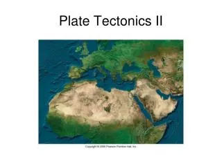
Plate Tectonics II Structure of the Earth
Quick Review • Historical Development • Continental Drift • Magnetic anomalies • Seismic Reflection and Refraction
Three Layers • Crust • Mantle • Core
How do we know what the Earth's Interior is like? • Drilling Wells drilled into Earth are mostly in the upper 7 km of the crust • Deepest well = Soviet (Russian) well in northern Kola Peninsula 20 year effort to drill a 12 km hole. Stopped in 1989. • History: 5 years to drill 7 km; 9 years to drill the next 5 km; got stuck at 12 km. • Target depth is 15 km. • Costs are more than $100 million. • Bottom hole temperature is 190 º degrees C • Current status??
How do we know what the Earth's Interior is like? • Deepest US well is next to San Andreas Fault (Cajon Pass) • Had reached 3.5 km in 1988 • Cost was $5 million ($1400 per meter) • Cost overruns and budget cuts suspended drilling in 1988 • Other deep holes are planned.
How do we know what the Earth's Interior is like? • Volcanic activity Materials are brought up from below. • Xenoliths = foreign rock (pieces of the mantle in lava) example: coarse-grained olivine (peridotite) xenoliths in basaltic lava • Only useful to depth of about 200 km
How do we know what the Earth's Interior is like? • High pressure laboratory experiments • Samples of the solar system (meteorites) • Study of seismic waves generated by earthquakes and nuclear explosions
Crust 1. Oceanic crust (basaltic; 3.0 g cm~3) a. Approximately 5-12 km thick b. Average density of 3.0 g/cm c. The upper mantle is the ultimate source for the lavas that formed the oceanic crust 2. Continental crust (granitic; 2.7 g cm3) a. thickest crust (average 35 km; 20 to 100 km) b. floats due to isostasy continents “float” higher on the denser mantle than the adjacent oceanic crustal segments
Crust Seismically defined as all of the solid Earth above the Mohorovicic discontinuity
Inner Layers of the Earth • Andrija Mohorovicic • born in 1857, was a scientist from Croatia who worked in the fields of meteorology and seismology • showed how the seismic waves of earthquakes spread through the Earth
Inner Layers of the Earth • What is the Mohorovicic Discontinuity? • The surface of the earth is called the crust, which is the uppermost part of the Lithosphere (which includes the upper portions of the mantle). The "Moho" is the boundary between the crust and upper mantle.
Inner Layers of the Earth • Mohorovicic discovered the discontinuity in 1909. The Moho separates crustal rocks with P-wave velocities of 6 to 7 km/s from underlying mantle rocks with P-wave velocities greater than 8 km/s
Divisions of Inner Space • Seismic Waves • Generated when rocks are suddenly disturbed they break or rupture • Vibrations spread out in all directions from the source of the disturbance they move outward in waves that travel at different speeds through materials that differ in chemical composition or physical properties
Divisions of Inner Space • Seismic Waves • Primary -p-waves • Compressional or P waves in which particle oscillate in the direction parallel to the direction of the wave propagation. P-waves are the fastest and most abundant therefore easiest to detect. • are the speediest of the three • travel through the upper crust of the Earth at speeds of 4-5 km/sec • near the base of the crust they speed along at 6-7 km/sec
Seismic Waves • Secondary or s-waves waves • travel 1-2 km/sec slower than p-waves • able to penetrate deep into the interior or body of the planet • s-waves cannot propagate through fluids • p-waves are markedly slowed through fluids
Seismic Waves • Reflection of seismic waves. These studies use the principle that as P-waves encounter internal boundaries in the earth some of the energy is reflected back to the surface. The energy source is usually man-made (air or water guns, dynamite) and is detected by geophones or hydrophones. The amount of energy returned is a function of the change in physical properties at that layer (acoustic impedance).
Seismic Waves • Acoustic impedance is the contrast of the density x velocity. This determines how much energy will be reflected or returned to the surface. • Function of the velocity and density differences
Seismic Waves • Refraction - as the seismic waves propagate through the earth the wave energy not reflected by at a boundary is refracted or bent. In general, where the wave velocity increases with depth, the waves are bent upwards.
Mantle • Average density is about 4.5 g/cm3 • 1. Stony composition (4.5 g cm~3) • a. oxygen and silicon predominate accompanied by iron and magnesium • b. the mineral peridotite approximates the kind of material inferred for the mantle appropriate for the mantle's density similar in composition to stony meteorites
The Core The Gutenberg Discontinuity is the boundary between the Core and the Mantle It is located ~2890 km from the surface of the Earth, or 3500 km from the center of the Earth.
The Core 1. Detected by P and S waves shadow zones Inferences from Body Waves a. The precise boundary of the core was determined by the study of earthquake waves b. The outer core barrier to s-waves results in an s-wave shadow zone on the side of the Earth opposite the earthquake - passed through a liquid medium c. Radius of the core is about 3500 km
The Core d. inner core is solid with a radius of ~1220 km e. evidence for the existence of a solid inner core is derived from the study of hundreds of seismograms a transition zone approximately 500 km thick surrounds the inner core with the same composition as the outer core Important for Latent Heat of Fusion
The Core 2. Average density 10.7 g/cm3 • The Earth had an overall density of 5.5 g/cm3 • the average density of rocks at the surface is <3.0 g/ cm3 rocks of the mantle have a density of about 4.5 g/cm3 QED: the average density of the core is about 10.7 g/cm3
The Core Composed mainly of Fe and Ni • Composed of 85% iron with lesser amounts of nickel as determined from the study of meteorites • consist of metallic iron allowed with a small percentage of nickel • abundance in the solar system suggests the existence of an iron-nickel core • additional evidence from the existence of a magnetic field produced by an electric current flowing through a wire 4. Radius: 3500 km
Plate Boundaries • Three types: • Divergent • Convergent • Transform
Divergent Plate Boundaries • In certain regions, plates are separating. At these divergent plate boundaries , new lithospheric crust is being created. In ocean basins this process is referred to as sea-floor spreading as magma wells up from the asthenosphere along mid-oceanic ridges , widening the ocean basin.
Divergent Plate Boundaries • In continents, along continental rift zones , huge land masses can be separated by new ocean basins. Both such regions are referred to as constructive plate margins because lithospheric formation is occurring. Perhaps the best example of this process is along the mid-Atlantic ridge.
Convergent Plate Boundaries • In other regions, tectonic plates are colliding. At these convergent plate boundaries , one plate is driven down under its neighbour in a process called subduction . Such regions are referred to as destructive plate margins because the advancing edge of one lithospheric plate is being re-absorbed into the mantle .
Convergent Plate Boundaries • A very good example of subduction is occurring along the western coast of South America, immediately west of the famous Andes mountains.