
Uploaded by
jensen
8 SLIDES
246 VUES
90LIKES
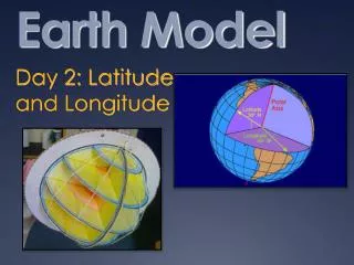
SEAM Earth Model
DESCRIPTION
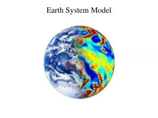
Geophysical Modeling for Studying Acquisition and Processing Methods in the Deepwater Gulf of Mexico RPSEA Project #07121-2001. SEAM Earth Model. Realistic Salt - 60 GOM Blocks. Structure and Stratigraphy. Stratigraphy defined on 20m grid. Seismic Properties rooted in Rock Properties.
Download
1 / 8
Télécharger la présentation 
SEAM Earth Model
An Image/Link below is provided (as is) to download presentation
Download Policy: Content on the Website is provided to you AS IS for your information and personal use and may not be sold / licensed / shared on other websites without getting consent from its author.
Content is provided to you AS IS for your information and personal use only.
Download presentation by click this link.
While downloading, if for some reason you are not able to download a presentation, the publisher may have deleted the file from their server.
During download, if you can't get a presentation, the file might be deleted by the publisher.
E N D
Presentation Transcript
Geophysical Modeling for Studying Acquisition and Processing Methods in the Deepwater Gulf of Mexico RPSEA Project #07121-2001
SEAM Earth Model Realistic Salt - 60 GOM Blocks
Structure and Stratigraphy Stratigraphy defined on 20m grid
Dataset Deliverables • Acoustic simulation (without sea surface multiples) • Gravity, EM, and MT simulations • Full elastic simulation


More Related