Download
1 / 19
190 likes | 271 Vues
Investigating Vertically Downward Saltwater Migration from Dredge Pond to Prevent Aquifer Contamination. Numerical modeling and monitoring used to assess dredging impact and groundwater containment. Case study in Florida, USA.

E N D
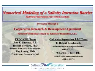
Modeling of the Potential for Vertically Downward Saltwater Migration from a Dredge Pond Peter F. Andersen1, Lisa M. Grogin1, and Ronald L. Bartel2 1GeoTrans, Inc., Roswell, Georgia, United States 2Northwest Florida Water Management District, Havana, Florida, United States
Problem Statement • Desire to deposit dredge materials from saltwater body into inland barrow pit • Two concerns: • Saltwater (from dredge slurry) will migrate vertically downward and contaminate a public supply well 1800 ft away (short-term + density dependent) • Dredge materials will migrate from sediments into aquifer (long-term + non-density dependent • Are current and future hydraulic gradients sufficient to contain the dredge materials and prevent contamination of the well and aquifer?
Conceptual Model of Question to be Answered Water Supply Well Stream Pond Dredge Pond To Stream? To Well?
Approach • Characterization of flow system • Time series analysis of hydraulic gradients • Numerical modeling to assess and demonstrate physics of flow • Development of metrics for: • Allowing dredging to begin • When dredge deposition would need to stop • Development of groundwater and surface water monitoring plans
Model Construction (Plan View) Dredge Pond Stream Ponds Water Supply Well
Model Construction: Vertical Jackson Branch South Pond North Pond
Model Details • SEAWAT-2000 • Calibration (steady state flow) • 17 heads, 3 multilevel wells • ME = 0.19 ft; MAE = 0.35 ft (7.8% of variation) • Predictive simulations • Lower head in pond from 3.7 ft to 2 ft • Concentration of saltwater in pond = 12,700 ug/L • Saltwater concentration active for 6 months • 10 weeks dredging • 16 weeks residence time • Various configurations of boundary heads to represent: • Regional water level changes • Well pumping
Scenarios Evaluated • Minimum Operating Conditions • Base case boundary heads • Conservative 0.5 ft upward head gradient at monitor well (1 ft required; 3-6 ft typical) • Explicit Inclusion of Pumping Well • Implicitly incorporated in BCs • Additionally included by superimposing Hantush-generated heads on BCs • Worst Case • 2 ft downward gradient occurs immediately • Lasts entire 6 months of dredging
Condition below which dredging could not commence: 2.5 ft NGVD in DW3 2 std dev below wet season high; 2 std dev above drought condition low Condition that dredging would stop: Upward gradient of < 1 ft at PZ-19 / DW3 monitor well Performance Metrics for Dredging
Postscript • Dredging finally commenced March 28, 2008 and was completed 3 weeks later
Postscript • An upward gradient between the Deep and Shallow system was present during the entire operation
Postscript • An estimated 200,000 cu yds of sediment was removed from Bayou Chico • Monitoring will continue for 3 years: • Groundwater levels • Groundwater concentrations • Surface water concentrations • Remediation could be triggered by exceeding of groundwater concentration limits
Conclusions (1) • An unusual saltwater intrusion problem! • Numerical model was useful to assess and demonstrate effects of scenarios • Model helped fill in gaps monitoring network • Only worst case scenario—a reversal of gradient—created a potential problem • Head and gradient metrics were established to prevent loss of containment from pond
Conclusions (2) • Example of use of modeling, time series analysis, and monitoring to ensure success • Actual result was positive and (so far) in line with model predictions • Length of dredging was overestimated: 10 weeks vs 3 weeks actual; another conservative modeling assumption
Questions? Pete Andersen GeoTrans, Inc. Roswell, Georgia, USA E-mail: pandersen@geotransinc.com Phone: 770 642 1000