Download
1 / 39
390 likes | 546 Vues
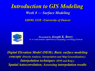
Presented by Joseph K. Berry W. M. Keck Scholar, Department of Geography, University of Denver. Introduction to GIS Modeling Week 8 — Surface Modeling GEOG 3110 –University of Denver.

E N D
Presented by Joseph K. Berry W. M. Keck Scholar, Department of Geography, University of Denver Introduction to GIS ModelingWeek 8 — Surface ModelingGEOG 3110 –University of Denver Digital Elevation Model (DEM); Basic surface modeling concepts (Density Analysis, Interpolation and Map Generalization); Interpolation techniques (IDW and Krig); Spatial Autocorrelation; Assessing interpolation results
Question 1 Access SURFER then enter Map Contour Map New Contour Map \Samples Helens2.grd Mount St. Helens dataset There are numerous websites that allow you to download a DEM and useSURFERto visualize …a generally useful procedure that you can use for lots of reports (Optional Exercise) Visualizing Terrain Surface Data (Exercise 8 – Part 1) (Berry)
Visualizing Map Surfaces (Exercise 8 – Part 1) Questions 2 and 3 Use SURFERto Create a 2D Contour map and a 3-D Wireframe map (Berry)
Spatial Analysis Traditional GIS Store Travel-Time (Surface) Forest Inventory Map • Cells, Surfaces • Continuous Geographic Space • Contextual Spatial Relationships • Points, Lines, Polygons • Discrete Objects • Mapping and Geo-query Spatial Statistics Traditional Statistics Spatial Distribution (Surface) Minimum= 5.4 ppm Maximum= 103.0 ppm Mean= 22.4 ppm StDev= 15.5 • Mean, StDev (Normal Curve) • Central Tendency • Typical Response (scalar) • Map of Variance (gradient) • Spatial Distribution • Numerical Spatial Relationships Map Analysis Evolution(Revolution) (Berry)
An Analytic Framework for GIS Modeling Surface Modelling operations involve creating continuous spatial distributions from point sampled data. See www.innovativegis.com/basis/Download/IJRSpaper/ (Berry)
Comparing Apples and Oranges(Elevation and Slope) ‘you can't compare apples and oranges’ Apples (Rosales) Oranges (Sapindales) and Elevation (Feet) Slope (Percent) and …particularly when it comes to map analysis — they’re totally different things, right? (Berry)
Comparing Apples and Oranges(SNV Normalization) Standard Normal Variable (SNV) Elevation (raw data) Slope (raw data) Oranges (Sapindales) Apples (Rosales) SNV “Mixed Fruit” Scale Normalize(SNV) SNV = ((mapValue - Mean) / Stdev)*100 Normalize(SNV) SNV Map 1 Normalized Distribution SNV Map 2 Normalized Distribution SNV Map 1 SNV Map 2 G#2 R#2 G#1= -100, R#1= -100 (-100) – (-100) = |0| G#1= -100, R#2= 0 (-100) – (0) = |-100| G#1= -100, R#3= 200 (-100) – (200) = |-300| G#1 G#3 R#1 R#3 …subtracting SNV maps and taking the absolute value to generate a map of the relative difference between the two maps at every map location Comparethe SNV maps by… Increasing differences in distribution matches 0 100 200 300 400 (Berry)
Comparing Apples and Oranges(SNV Difference) Slope (SNV normalized) Elevation (SNV normalized) …absolute difference between the SNV normalized Elevation and Slope maps …indicates that the two maps are fairly similar– 50% of the map area is .5 StDev or less along the two SNV distributions Grey = exactly the same position on the SNV distribution Blue tones = .5 StDev or less difference Median = 52 (Berry)
Linking Numeric & Geographic Distributions …aHistogramdepicts thenumeric distribution(Mean/Central Tendency/) …aMap depicts thegeographic distribution(Variance/Variability) …Data Valueslink the two views— Click anywhere on the Map and the Histogram interval is highlighted Click on the Histogram interval and the Map locations are highlighted …simply different ways to organize and analyze “mapped data” (See Beyond Mapping III, “Topic 7” for more information) (Berry)
Point Density analysis identifies the number of customers with a specified distance of each grid location MapCalc “ScanTotal” – ESRI GRID/Spatial Analyst “ZonalTotal” Surface Modeling (Point Density Analysis) Roving Window (count) (Berry)
Pockets of unusually high customer density are identified as more than one standard deviation above the mean MapCalc “Renumber” – ESRI GRID/Spatial Analyst “Reclassify” Identifying Unusually High Density (Berry)
Non-Spatial Statistics (Central Tendency; typical response) …seeks to reduce a set of data to a single value that is typical of the entire data set (Average) and generally assess how typical the typical is (StDev) (Berry)
Assumptions in Non-Spatial Statistics …uniformly distributed in geographic space (horizontal plane at average; +/- constant) (Berry)
Geographic Distribution (surface modeling) …analogous to fitting a curve (Standard Normal Curve) in numeric space except fitting a map surface in geographic space to explain variation in the data (Berry)
Adjusting for Spatial Reality (masking for discontinuities) …accounting for known geographic discontinuities or other spatial relationships (Berry)
Generating a Map of Percent Change (map-ematics) …maps are organized sets of numbers supporting a robust range of Map Analysis operations that can be used to relate spatial variables (map layers) (Berry)
Spatial Relationships (coincidence , proximity, etc.) …spatial relationships can be utilized to extend understanding (Berry)
Standard Normal Variable Map …relates every location to the typical response (Average and StDev) to determine how typical it is (Berry)
The Average is Hardly Anywhere Field Collected Data #15 87 = P2 sample value Arithmetic Average knows nothing of Geographic Space Arithmetic Average – plot of the data average is a horizontal plane in 3-dimensional geographic space with some of the data points balanced above (green) and some below (red) the “typical” value (uniform estimate of the spatial distribution) (Berry)
Surface Modeling(Map generalization) Arithmetic Average balances “half” of the data on either side of a Line— Line Plane Xavg Yavg Curved Plane Curved Line Spatial Average balances “half” of the data above and below a Horizontal Plane— Map Generalization – fits standard functional forms to the data, such as a Nth order polynomial for curved surfaces with several peaks and valleys (similar to curve fitting techniques in traditional statistics) (Berry)
Surface Modeling(Iterative Smoothing) The “iterative smoothing” process is similar to slapping a big chunk of modeler’s clay over the “data spikes,” then taking a knife and cutting away the excess to leave a continuous surface that encapsulates the peaks and valleys implied in the original field samples… …Spatial Interpolation techniques utilize summary of data in a roving window (Localized Variation) …repeated smoothing slowly “erodes” the data surface to a flat plane = AVERAGE Digital slide show SStat2.ppt (Berry)
Spatial Interpolation — “roving window” localized average Map Generalization — Mathematical Equation/Surface Fitting Thiessen Polygons Map Generalization — Geometric facets Surface Modeling Methods (Surfer) Inverse Distance to a Power — weighted average of samples in the summary window such that the influence of a sample point declines with “simple” distance Modified Shepard’s Method — uses an inverse distance “least squares” method that reduces the “bull’s-eye” effect around sample points Radial Basis Function — uses non-linear functions of “simple” distance to determine summary weights Kriging— summary of samples based on distance and angular trends in the data Natural Neighbor —weighted average of neighboring samples where the weights are proportional to the “borrowed area” from the surrounding points (based on differences in Thiessen polygon sets) Minimum Curvature — analogous to fitting a thin, elastic plate through each sample point using a minimum amount of bending Polynomial Regression — fits an equation to the entire set of sample points Nearest Neighbor— assigns the value of the nearest sample point Triangulation— identifies the “optimal” set of triangles connecting all of the sample points (Berry)
Surface Modeling Approaches (using point samples) Thiessen Polygons Map Generalization(Geometric Facets) — Triangulated Irregular Network (TIN) is a form of the tessellated model based on Triangles. The vertices of the triangles form irregularly spaced nodes and unlike the DEM, the TIN allows dense information in complex areas, and sparse information in simpler or more homogeneous areas. http://www.jarno.demon.nl/gavh.htm • Spatial Interpolation— these techniques use a roving window to identify Nearby Samples and then Summarize the Samples based on some function of their relative nearness to the location being interpolated. • Window Reach— how far away to reach to collect sample points for processing • Window Shape— shape of the window can be symmetrical (circle) or asymmetrical (ellipse) • Summary Technique— a weighted average based on proximity using a fixed geometric relationship (inverse distance squared) or a more complex statistical relationship (spatial autocorrelation) • Exacting Solution— exacting solutions result in the sample value being retained (Krig); non-exacting estimate sample locations (IDW) Map Generalization(Equation) — these techniques seek the general trend in the data by Fitting a Polynomial Equation to the entire set of sample data (1st degree polynomial is a plane). (Berry)
Spatial Interpolation (Mapping spatial variability) …the geo-registered soil samples form a pattern of “spikes” throughout the field. Spatial Interpolation is similar to throwing a blanket over the spikes that conforms to the pattern. …all interpolation algorithms assume 1) “nearby things are more alike than distant things” (spatial autocorrelation), 2) appropriate sampling intensity, and 3) suitable sampling pattern …maps the spatial variation in point sampled data (Berry)
Spatial Interpolation (Comparing Average and IDW results) Comparison of the interpolated surface to the whole field average shows large differences in localized estimates (Berry)
Spatial Interpolation (Comparing IDW and Krig results) Comparison of the IDW and Krig interpolated surfaces shows small differences in in localized estimates (Berry)
Create IDW Krig Compare IDW - Krig Creating and Comparing Map Surfaces Use SURFERto Create and Compare map surfaces (Exercise 8, Part 2) (Berry)
Inverse Distance Weighted Calculations Geometry determines weights (function of distance) …SUMwProducts / SumWeights = wAverage …Weight …weight * value = weighted Product …but first things first, how do you calculate a weighted average? (Berry)
Spatial Autocorrelation (Kriging) Tobler’s First Law of Geography— nearby things are more alike than distant things Variogram— plot of sample data similarity as a function of distance between samples Data relationships determine weights (function of distance and data patterns) …Kriging uses regional variable theory based on an underlying variogram to develop custom weights based on trends in the sample data (proximity and direction) …uses Variogram Equation instead of a fixed 1/DPower Geometric Equation (Berry)
Characterizes the spatial distribution by fitting a mathematical equation to localized portions of the data (roving window) Spatial Interpolation techniques use “roving windows” to summarize sample values within a specified reach of each map location. Window shape/size and summary technique result in different interpolation surfaces for a given set of field data …no single techniques is best for all data. AVG= 23 everywhere Inverse Distance Weighted (IDW) technique weights the samples such that values farther away contribute less to the average …1/Distance Power Spatial Interpolation Techniques (Berry)
Assessing Interpolation Results – Residual Analysis …the best map is the one that has the “best guesses” (See Beyond Mapping III, Topic 2 for more information) Spatial Interpolation(Evaluating performance) (Berry) AVG= 23
A Map of Error (Residual Map) …shows you where your estimates are likely good/bad Spatial Interpolation (Characterizing error) (Berry)
Point Sampling Design Concerns Stratification--appropriate groupings for sampling Sample Size--appropriate sampling intensity for each stratified group Sampling Grid--appropriate reference grid for locating individual point samples (nested best) (Berry)
Point Sampling Design Concerns Sampling Pattern-- appropriate arrangementof samples considering both spatial interpolation and statistical inference (Berry)
A map ofLocalized SAC Similaritycan be constructed by comparing “Adjacent Neighbors” (doughnut hole) value with the “Extended Neighbors” value (doughnut)— • Deviation for continuous data (gradient) • Proportion Similar for categorical data (discrete) • …you determine the size/configuration of the doughnut Assessing Spatial Autocorrelation(SAC indices) Geary’s C Geary’s CandMoran’s I —similarity among center cell and adjacent neighbors vs. center cell and average for the entire data set… Geary’s C= [(n –1) SUM wij (xi – xj)2] / [(2 SUM wij) SUM (xi – m)2] Moran’s I= [n SUM wij (xi – m) (xj – m)] / [(SUM wij) SUM (xi – m)2] where, n = number of cells in the grid m = the mean of the values in the grid xi = value of cell in group i and xj = value of cell in group j wij = switch set to 1 if the cells are adjacent; 0 if not (diagonal) Moran’s I Expect… 0 < C < 1 Strong Positive SAC I > 0 C > 1 Strong Negative SAC I < 0 C = 1 Random distribution I = 0 …for assessment of SAC in the entire data set See Beyond Mapping III, Topic 8, Investigating Spatial Dependency for more information (Berry)
Spatial Autocorrelation/Variogram Revisited The result is an equation that relates overall sample value Similarity and the Distance between sample locations “Nearby things are more alike than distant things” …but what about directional trends in the data? (Berry)
Dist= ( a2 + b2 ) .5 = ( (500-50)2 + (100-50)2 ) .5 = 452.77 Angle= ARCTAN ( opp / adj ) = ARCTAN ( (100-50) / (500-50) ) = 6.34 90 135 45 500 400 B A 300 200 100 Point Pair B 180 0 #2 (100,150) #3 (500,100) C a b #1 (50,50) 225 315 Geographic Space 270 Polar Variogram Polar Variogram(Similarity, Distance and Angle) For the three points shown below, the separation of the three pairs can be summarized as … Point Pair Dist Angle A (50,50), (100,200) 158.11 71.11 B (50,50), (500,100) 452.77 6.34 C (100,200), (500,100) 412.31 -14.04 …the position in the polar grid summarizes the distance and angle between pairs of points. The “average” difference between the values is computed for each polar sector– Polar Variogram (Berry)
Optional Opportunities Surfer Tutorials– experience with basic Surfer capabilities Interpolation Techniques– additional experience with griding tools Different Data Different Techniques Sampling Patterns– understanding alternative sampling pattern considerations (Berry)