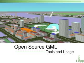
Exploring Open-Source UAV: Autonomous Flight with Paparazzi Autopilot
This project focuses on developing two different UAV configurations using Paparazzi autopilot for autonomous flight. In collaboration with two Aerospace Engineering teams, we aim to guide the creation of a comprehensive handbook for replicating this project. The UAVs include the Multiplex Funjet and Multiplex Minimag, each employing different flight controls. Key elements cover custom cable creation, sensor modifications, GPS integration, and ground control interface. The project demonstrates successful autonomous flights, highlighting teamwork and the contributions of engineers from Lockheed Martin.

Exploring Open-Source UAV: Autonomous Flight with Paparazzi Autopilot
E N D
Presentation Transcript
Introduction • UAV is an Unmanned Aerial Vehicle • Our goal is to setup two different plane configurations with Paparazzi autopilot and fly them autonomously • Do this in conjunction with two separate Aerospace Engineer teams • Create a handbook detailing simple recreation of this project BETTER PIC THAN THIS
The Planes • Multiplex Funjet • Elevons only for pitch/roll control • Other difference • Multiplex Minimag • Traditional rudder and elevators for pitch/roll control • Other difference
Paparazzi UAS IMPROVE THIS PICTURE
Cable Work • Creating proprietary cables • Bootloader cable: USB to 4-pin on Tiny • USB Programming cable: USB to 7-pin on Tiny • GPS Programming cable: I don’t even know • Power cables: As necessary
Sensor Modification • Autopilot supplies 3.3V instead of 5V expected by IR sensors • With a 3.3V source, the IR sensor gains are offset by ~1.5 • This presents saturation problems while in high IR contrast locations • Replace resistors for unity gain
GPS Setup and Functionality • U-blox software used for initial GPS setup • UAV software uses GPS for speed, location, elevation • Real ground level needed for altitude conversion from elevation • <screenshot>
Ground Control Station/Modem • GCS uses independent modem to interface with aircraft • GCS controls aircarft through notebook PC • Can be overridden by manual R/C control
Test Flights • Pictures and details of the more important test flights we held and their results
Summary • We got them both to fly autonomously? • Yes into a field… ROFL OMG LOL • Blah blah I have no idea what to say here
Our Team • Kevin Oberg • Dustin Douglas • Shuohan Wan
Acknowledgements • Special thanks to: • Lockheed Martin Corp. engineers Reid Plumbo and Todd Colton • AEM Professor Hammer • AEM project teams A & B