Download
1 / 16
160 likes | 262 Vues
Explore a new forecasting tool for small Oregon towns, addressing capacity needs, congestion, and community livability. Learn about its methodology, outcomes, and applications in transportation planning. Discover its unique approach and key findings.

E N D
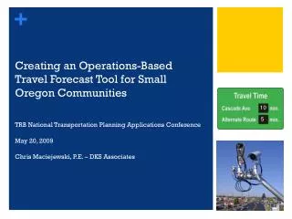
Creating an Operations-Based Travel Forecast Tool for Small Oregon Communities TRB National Transportation Planning Applications Conference May 20, 2009 Chris Maciejewski, P.E. – DKS Associates 10 5
Presentation Outline • Traditional Planning Issues / Shortcomings • Methodology Overview • Outcomes • Applications in Transportation Plans • Conclusions
Transportation Planning Issues in Small Communities State Highways Local Perspective • Capacity needs dominate system • More lanes • Couplet • Bypass • Reduced state funding capacity [how is this unique to small cities?] • Highway congestion 20-30 days per year • Limited matching funds for highways • Looking for solutions to protect community livability
Limitations of Traditional Methods for Travel Forecasts • Travel Demand Model Not Available • Manual Methods Exist… • Trend-line • Cumulative (TIS-style) • But They Cannot: • Consider operations • React to congestion • Evaluate multiple scenarios Unconstrained Trend-line? Congested Corridor? Volume Year
An Integrated Tool Needed to Meet All Study Requirements • Assess Corridor Management • Local Circulation Enhancement • Relief Valves For Seasonal Congestion • Balance Of Community Livability with Highway Capacity
New Elements Needed to Strengthen Forecast Process Weakness of Current Process Tool Features • Cannot dynamically assess route changes • Does not consider effects of congestion • Cost effective scenario testing • Develops trip tables to test circulation patterns • Uses node delays for assignments • Rapid Evaluation Of Alternatives
Key Methods Applied • Parcel Level Land Use • Use Of NAVTEQ Network Files • ITE Trip Rates • Simple Gravity Model • HCM Node Delays • Export Network/Volumes To Synchro/SimTraffic Forecast Process
It Looks a Model and Talks Like a Model, but it is a Forecast Tool
Quality Review Process • Calibration Exceeded Expectations • R2 = 0.98, slope = 1.03 • Reasonable turn-movements • Local circulation patterns captured • Simple Gravity Model Reasonable For Small Communities
Other Useful Results • Volume Difference Plots • Quickly summarize alternative effects • Useful to communicate changes in traffic flows • Conversion of VISUM file to Synchro/Simtraffic
Sample Application – Sisters, OR • Forecasts Responded to Corridor Congestion • Detailed Evaluation of Corridor Management Options • Visual tools facilitated participation from all interested parties • Led to City and ODOT consensus (first time in 20 years) • Corridor solution with seasonal ITS, City arterial corridor
Key Findings & Recommendations • Ability to rapidly/accurately test network changes • Graphic display tools help build consensus • Corridor Management = Fewer Unfunded Highway Projects • Most appropriate application for: • Small urban areas (less than 15,000 pop.) • Significant growth forecasts • Multiple scenarios need to be evaluated and tweaked for consensus building
What About Larger Urban Areas? • Integrate Operations Into a Travel Demand Model? • Sub-area plans • Corridor plans • Circulation studies • Utilize Travel Demand Model Trip Tables • Take Advantage of Operations-Based Assignments • Quasi-Mesoscopic Sub-Area Model Forecast Process
Next Steps • Can travel times in the forecast tool (including the HCM node delays) be utilized for greenhouse gas estimations? • VMT (by speed bin) x Emissions Rate = Greenhouse Gas? • Valid for relative comparison of alternatives?
Acknowledgements • DKS Associates Staff • Carl Springer • Garth Appanaitis • Mat Dolata • Brad Coy • Oregon Department of Transportation • Transportation Planning Analysis Unit (TPAU)