Tropical Storm Fay
70 likes | 243 Vues
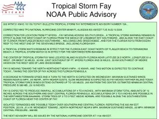
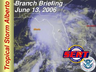
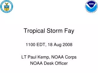
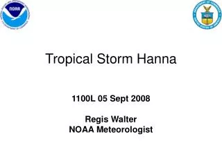
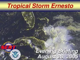
Tropical Storm Fay. 0800 EDT 20 Aug 2008 Al Mongeon NOAA Meteorologist. Radar Image Tropical Storm Fay. Windswath Forecast. CENTER OF FAY NEAR CAPE CANAVERAL.

Tropical Storm Fay
E N D
Presentation Transcript
Tropical Storm Fay 0800 EDT 20 Aug 2008 Al Mongeon NOAA Meteorologist
CENTER OF FAY NEAR CAPE CANAVERAL • At 800 am EDT...1200z...The center of tropical storm Fay was located near latitude 28.5 north...Longitude 80.6 west or very near Cape Canaveral Florida. • Fay is moving toward the north near 5 mph, 7 km/hr, and this motion is expected to continue today. A gradual turn toward the northwest is forecast during the next 12 to 24 hours and Fay is likely to remain near or over the east-central and northeastern Florida coast through Thursday. • Data from a reconnaissance plane and surface observations indicate that the maximum sustained winds have decreased to near 45 mph, 70 km/hr, with higher gusts. These winds are occurring mostly over water well to the east of the center. Some gradual restrengthening is possible during the next 24 hours before Fay moves back inland over northeastern Florida on Thursday. • Tropical storm force winds extend outward up to 140 miles...220 km from the center.
Rainfall, Storm Surge, Severe Weather • Latest minimum central pressure reported by an USAF reconnaissance aircraft was 994 mb...29.35 inches. • Fay is expected to produce rainfall accumulations of 5 to 10 inches over east-central and northeastern Florida...With maximum total amounts of 15 inches. Accumulations of 3 to 5 inches are possible in the northwestern Bahamas. • Storm tides of 1 to 3 feet above normal are possible along the east coast of Florida to the north of the center of Fay. • Isolated tornadoes are possible over portions of northeastern Florida.
Watches and Warnings • A tropical storm warning remains in effect from north of Jupiter Inlet Florida northward to Altamaha Sound Georgia. • A hurricane watch remains in effect from north of Flagler Beach Florida to Altamaha Sound Georgia. • A tropical storm watch remains in effect from north of Altamaha Sound to the savannah river.