Satellite Training and Education
240 likes | 272 Vues
Improve your forecasting accuracy with updated satellite training! Learn about evolving technology, feedback from users, and maximizing NOAA resources for improved performance. Join tailored courses for meteorologists, hydrologists, and more. Discover how the program works and its impact on various forecast types.

Satellite Training and Education
E N D
Presentation Transcript
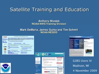
Satellite Training and Education Anthony Mostek NOAA/NWS/Training Division Mark DeMaria, James GurkaandTim Schmit NOAA/NESDIS GOES Users VI Madison, WI 4 November 2009
Key Points for Training • The Satellite Training Community • Satellite Activities & Results • Evolving Technology & Operations • Feedback/Issues from Users • Prepare for Break Outs
NOAA Training Community • Dedicated NWS Training Division • Many Partners in NOAA • NESDIS Cooperative Institutes & Programs • International • EUMETSAT, WMO Space Programme Virtual Laboratory, Canada/MSC, Centres of Excellence, Focus Groups, …
NOAA/EUMETSAT Bilateral Program VISIT (CIRA/CIMSS) UCAR/COMET NWS Training Division WMO (VL & FG) NOAA – COMET – EUMETSAT - WMOWorking Together for Satellite Training Env Satellite Resource Center Users & Developers
Goal of Training Impact Performance of Staff • Tornado Warning - Lead Time • Tornado Warning - Accuracy • Tornado Warning – False Alarm Ratio • Flash Flood Warning – Lead Time • Flash Flood Warning – Accuracy • Winter Storm Warning – Lead Time • Winter Storm Warning – Accuracy • Hurricane Track Forecasts (48 Hrs) • Hurricane Intensity Error (Knots) • Aviation Forecast – Accuracy • Aviation Forecasts – False Alarm Ratio • U.S. Seasonal Temperature – Skill • Precipitation Forecast – Day 3 Accuracy • Marine Wind Speed – Accuracy • Marine Wave Height - Accuracy Reach ALL NOAA Forecasters, Hydrologists, Scientists & Managers Aviation, Climate, Decision Support, Fire WX, Hydrology, NWP, Ocean, Tropical, Tsunami, Winter Wx, International, …
How Does Training Program Work? Implementation Plan: Design/Develop Training Analyze Needs thru Workshops Evaluate Track via NOAA LMS
Primary Training funds from Forecasts & Warnings Training funding & requirements from Other Programs Challenge: Training Resources from Many Programs
Satellite HydroMeteorology (SHyMet) Course Dedicated to Operational Satellite Users Funded by NESDIS (GOES) with Assistance from NWS Training Division
SHyMet Course Tracks • SHyMet for Interns (Bernie Connel et al Poster) • Basic Training • SHyMet for Forecasters • Development nearing completion • Hydrology, moisture, precipitation, aviation, future… • SHyMet for Tropics • Satellite Interpretation in the Tropics. • SHyMet for Hydrologists • Hydrology content focus • Currently in planning • Some early development available
2007/09 NOAA LMS Statistics* • Over 13,000 Registered Users • 400+ NOAA Developed Custom Courses • COMET, VISIT & NWS Training Division • Another 1000+ Off-the-shelf Courses • Over 70,000 certificates (passed Quiz) • OPM requires monthly reports – NOAA Leads! *New LMS started June 07
2007/09 MetEd/COMET Statistics* Over 100,000 registered users Total Countries 200+ Over 425,000 module sessions 91,000+ quizzes attempted (80,000+ certificates) Over 41,000 modules downloaded NOAA LMS + MetEd = 150,000+ Completions! *Registration system started February 07
Feedback Satellite Training May 2009 Workshop • Ease of AWIPS interrogation - Currently, several step process to get POES & GOES sounder data. - Should be click-and-go process. - Need an interactive sampling capability (similar to today’s pop-up SkewT…) - Especially true of GOES sounder data. • Quick turnaround from research-to-operations - Can be cumbersome/time consuming process to get new data on AWIPS. - GOES Proving Ground and AWIPS2 may be very beneficial.
Big Issue:Increased Data Flow – Fire Hoses & Changing Operations
Breakouts - Food for Thought • Rapid Changes in Technology & Operations: • How can NOAA improve how it prepares for new satellites? • How to get Products & Services to more NOAA Users? • How can Training Program work most effectively with Proving Ground to connect Development & Operations Communities?
Contact Information Anthony.Mostek@noaa.gov VISIT - rammb.cira.colostate.edu/visit/visithome.asp COMET METED- meted.ucar.edu NOAA LMS - https://doc.learn.com/noaa/nws Proving Ground – cimss.ssec.wisc.edu/goes_r/proving-ground.html
Current Status:Increased Data Flow – Hose to Trickle? • Over 2 gigabytes of satellite now • Major processing/comms challenges • Difficult to add obs/products into operations • Opportunities to improve before launch!
Proving Ground & Training Evolving NOAA Operations Decision Support Services - DSS
GOES-R Proving GroundPartners Green Bay, WI WFO Sullivan, WI WFO Cooperative Institute for Meteorological Satellite Studies Madison, Wisconsin Sterling, VA WFO Cheyenne, WY WFO Cooperative Remote Sensing Science and Technology Center New York, NY Cooperative Institute for Research in the Atmosphere Fort Collins, Colorado La Crosse, WI WFO NWS Headquarters;Cooperative Institute for Satellite Climate Studies; Center for Satellite Applications and Research; Office of Satellite Data Processing and Distribution;GOES-R Program Office; University of Maryland Baltimore County Maryland Boulder, CO WFO Eureka, CA WFO EPA Research Triangle Park, NC NWS Central Region Kansas City, MO Melbourne, FL WFO NASA Kennedy Space Center NWS Alaska Region Anchorage, Alaska NWS Pacific Region Honolulu, Hawaii NCEP Tropical Prediction Center Joint Hurricane Testbed Miami, Florida (Planned for FY2010) NCEP: National Centers for Environmental Prediction NWS: National Weather Service WFO: Weather Forecast Office NCEP Storm Prediction Center; Norman, OK WFO; National Severe Storms Laboratory; University of Oklahoma; Cooperative Institute for Mesoscale Meteorological Studies Norman, Oklahoma Hazardous Weather Testbed- Experimental Forecast and Warning Programs Huntsville, AL WFO University of Alabama Huntsville NASA Short-term Prediction Research and Transition Center Huntsville, AL
Training Succeeds Most When You Receive Stakeholder Buy-In • Stakeholder Support For Training • AA, Office Directors, etc... • All NOAA Offices – NESDIS is getting Onboard!
