Download
1 / 26
260 likes | 404 Vues
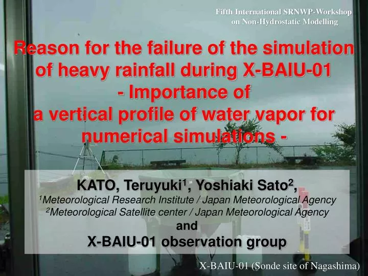
Fifth International SRNWP-Workshop on Non-Hydrostatic Modelling. Reason for the failure of the simulation of heavy rainfall during X-BAIU-01 - Importance of a vertical profile of water vapor for numerical simulations -. KATO, Teruyuki 1 , Yoshiaki Sato 2 ,

E N D
Fifth International SRNWP-Workshop on Non-Hydrostatic Modelling Reason for the failure of the simulation of heavy rainfall during X-BAIU-01 - Importance of a vertical profile of water vapor for numerical simulations - KATO, Teruyuki1, Yoshiaki Sato2, 1Meteorological Research Institute / Japan Meteorological Agency 2Meteorological Satellite center/ Japan Meteorological Agency and X-BAIU-01 observation group X-BAIU-01 (Sonde site of Nagashima)
Background / Motivation In 2001, a special field observation (X-BAIU-01) was conducted in western Japan during the rainy season, and a 5km-horizontal resolution nonhydrostatic model was operated twice a day to support this observation. 5km-NHM usually predicted rainfalls successfully, but it failed to predict the heavy rainfall observed in the morning of 23 June. In this study, by inspecting the reason of this failure it is examined what is significant for the formation of heavy rainfall over the Baiu frontal zone.
Content ・Characteristics around the Baiu frontal zone (Mean field analysis produced from GANAL) ・ Heavy rainfall observed on 23 June 2001 ・ Numerical simulations ・ Comparison with observations ・ Sensitive experiments using the modified initial field and 4DVar method ・ Trace back of an air inducing a heavy rainfall ・ Conclusion
Westerly wind Baiu frontal zone Baiu frontal zone Moist tongue Pacific high S-SWS-lies S-SWS-lies Averaged fieldsduring intense convective activity phase over the Baiu frontal zone
45N Moist tongue 15N 45N 130E 15N Subsidence of Pacific high Westerly wind Moist tongue Moist tongue Pacific high Baiu frontal zone Baiu frontal zone Baiu frontal zone 15N 15N 45N 45N Vertical cross sectionsduring intense convective activity phase over the Baiu frontal zone
Characteristic features of the Baiu frontal zone in Japan Tropopause Region with strong convective activities Subsidence of Pacific high Continental cold and dry air mass Moist tongue (from China or East China Sea) Depth ~ 1.5km S-SWS-lies Westerly wind Relative humidity ~ 100% South North Baiu frontal zone Heavy rainfalls often occur at the southern edge of moist tongue. Baiu front, water vapor front, is usually analyzed here
Precipitation intensityobserved by JMA radar10 JST 23 June Time cross section in a S-N direction At 04 JST a MCS suddenly formed over sea southwest of Kyushu Is., and then rapidly developed. After 08 JST MCS almost stagnated.
700hPa weather map Moist tongue Subsidence of Pacific high Surface weather map09 JST 23 June 2001 Baiu front crossed over Kyushu Is. Typhoon
Cloud systems suddenly formed in the area without clouds where the subsidence of Pacific high could dominate. Infrared imagery(GMS-5)
5km-NHM:Nonhydrostatic model (MRI/NPD-NHM, Saito et al, 2001) Precipitation scheme: Cold rain, predicting the mixing ratios of water vapor, cloud water, cloud ice, snow, and graupel. Resolution: 5km,Grids: 150 x 150 x 38 Numerical models RSM: JMA regional spectral model Precipitation scheme: Large scale condensation + Moist adjustment + Arakawa-Schubert Resolution: 20km,Grids: 325 x 257 x 40 750km
Reproduction of the heavy rainfall by numerical models Radar-AMeDAS 5km-NHM
Heavy rainfall failed to be reproduced. RSM Reproduction of the heavy rainfall by numerical models Radar-AMeDAS 5km-NHM
"Observation of Baiu front over East China Sea and Kyushu in 2001"(X-BAIU-01) Observation period: 7 June – 8 July 2001 Aerosonde
Atmosphere below 1km in 5km-NHM initial/boundary conditions is considerably drier than it is in reality. 5km-NHM failed to reproduce the southerly inflow of humid air below 1 km. Prediction between 1km-1.5km well corresponds with observation. Low-level water vapor fields after the MCS formedComparison betweenpredictionof5km-NHM and observation by AEROSONDE12JST 23 June
TPW: Small Low-level water vapor: Small GSM IR-image Subsidence of Pacific high could exist in this area (no cloud). Large (Wet) TPWSmall (Dry) Before MCSs formedComparison betweenTPWpredictedby5km-NHMand those derived by TRMM TMI data03JST 23 June 5km-NHM TRMM
00 03 06 09 12 15 18 21 24 ● ○ ○ ○ ○ ○ ○ ○ ○ ↓ ↓ ↓ ↓ ↓ ↓ ↓ 00 03 06 09 12 15 18 ○○○○○○○○○○○○○○○○○○○ Low-level atmosphere is humidified to the south of Baiu frontal zone. Modification 1.5km Baiu frontal zone 15N 45N 100% Sensitive experiments with the modified initial field of 5km-NHM Forecast hour(t) ●:Regional Analysis ○:Output ↓:Supply of data RSM Forecast hour(t) 5km-NHM This is improved by the following two methods. 4DVar with TMI-retrieved TPW Modification of low-level water vapor 4DV: MOD: Modification
CNTL Forecast results Observation MOD 4DV Valid time: 10JST 23 June
South North South North Improvement of low-level water vapor field Initial time : 03JST 23 June CNTL MOD
No convection forms, insofar as no strong upward motion exists Convection can form over the region with weak updrafts, i.e., in the south side of the Baiu frontal zone. Lifting condensation level (Left)Level of free convection(Right) Initial time : 03JST 23 June CNTL MOD South South North North South North South North
Water vapor is not concentrated below 1.5km. No strong convective instability. Heavy rainfall can not occur. CNTL Modification of low-level water vapor field MOD Initial time : 03JST 23 June 4DVAR South North South North
Air with low TPW passed between two upper-air sounding sites, Ishigaki and Naha. x Naha Ishigaki x TRACE BACKof the areawithunderestimated TPW(RSM forecasts)
Upper–air observation by sonde 40N Occurrence of heavy rainfall ×Upper-air sounding points 110E 30N Open space Inflow of low-level humid air Airs pass the open space 20N Special observation for the low-level and assimilation of satellite data are necessary. 120E 10N 130E 140E
To reproduce heavy precipitation systems well, accuracy of vertical water vapor analysis is very significant. Conclusion Future issues for four-dimensional assimilation When TPW in the first guess is smaller than the observation, 4DVAR is not necessary to humidify the lower atmosphere. To use TPW data effectively, dense observations of upper-air sounding are necessary in the spatial and temporary.
Analysis of water vapor field The estimation of a water vapor field among upper-air sounding points is difficult due to its being a passive tracer, while dynamical fields such as temperature and wind can be reasonably interpolated by 4DV. Modification of water vapor profile by assimilating TPW with 4DV in areas without rain. This modification can be used only for such a case as the present event. Modification without weight function Modification with weight function 1.5km 1.5km 100% 100%