Advanced Weather Radar Techniques Research Team
150 likes | 279 Vues
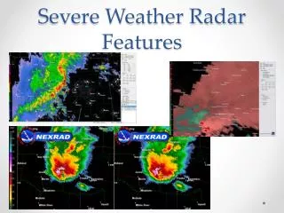
The Advanced Weather Radar Techniques Research Team (AWRT) led by Kim Elmore focuses on improving algorithms for meteorological data processing, utilizing Level II radar data for enhanced weather products. Through collaboration with organizations like NSSL, NCAR, and MIT, the team has developed a range of high-resolution, rapid update products to enhance safety and operational efficiency in weather forecasting. This includes innovative techniques for turbulence detection and improved precipitation analysis, while also integrating Canadian radar data for better coverage.

Advanced Weather Radar Techniques Research Team
E N D
Presentation Transcript
Advanced Weather Radar Techniques Research Team Lead: Kim Elmore – NSSL/CIMMS Alternate Leads: Greg Meymaris – NCAR/RAL David Smalley – MIT/LL
History • Started as the NEXRAD Enhancements PDT • Most work focused on algorithms to go into the RPG • But, advent of the ORPG and direct access to Level II data meant that “products” needn’t be limited to only those available from RPG or ORPG • Also, work with prototype radars meant that we had progressed beyond only the WSR-88D (e.g., WSR-88D is not yet polarimetric) • NEXRAD Enhancements PDT becomes Advanced Weather Radar Techniques RT
Remote Sensing Hydro- meteor Physics Radar QC Programs, Budgets and Requirements FAA AWRP mgmt JPDO NWS, DoD, NOAA, OHD Operational Products and Facilities Applied Research Industry Linkages AWRT RT Universities products Inputs for algorithms Algorithms (Pol and Non-pol) Mosaic Products: CIP, NTDA, Model Init, FZDL, Winter QPE, NEXRAD, vendors… CWF Turbulence MD&E C and V IFI } Wx Tech Impl. Tech Transfer for RTs Output
Current AWRT RT Tasks • Polarimetric mixed-phase cloud identification • High-Resolution Rapid Update National 3D Radar Mosaic • NCAR turbulence detection algorithm (NTDA) implemented on 3D gridded mosaic
3D Gridded Radar Mosaic • Enhance safety and capacity by providing seamless access to QC gridded radar data independent of individual ORPG ports • Some RT products can be directly gridded: turbulence (’07) and non-pol freezing drizzle (’08) • Include Canadian radar data for better coverage across Great lakes and border. • Rapid update independent of individual radar volume scan start and stop • Uses radar data characteristics to help fill data voids. • Helps in initialization of numerical models
3D Gridded Radar Mosaic • Gridded NTDA • Allows for rapid update (~ 5 min) • Combines data from several radars and so provides 3D spatial extent • Current Status • Test product (EDR and confidence) completed • Future • Include the confidence field in the mosaic process • Implement an experimental/prototype real-time 3-D EDR mosaic for a regional domain around Chicago • Develop “ingester” for level-3 NTDA products (available operationally next year via ORPG) • Implement experimental real-time national (CONUS) 3-D EDR mosaic (hardware permits) and facilitate the transfer to operational environment
3D Gridded Radar Mosaic • Canadian Radar Inclusion • Enhances low-altitude coverage over Great Lakes and border area, improving safety and capacity • Current Status • Sample Canadian radar data ingested and placed on 3D grid • Future • Gain access to all border radars and include data into overall CONUS grid
Radar Mosaic with Canadian Data Horizontal cross sections at 0.5 (col 1), 1.0 (col 2), 3.0 (col 3), and 5.0 (col 4) km above mean sea level from the 3-D mosaic grid with KDLH and KMVX only (upper row) and from the 3-D mosaic grid with KDLH, KMVX, XWL, XDR, and XNI (lower row)
3D Gridded Radar Mosaic • Vertical gap-filling • Used to infer reflectivity values below the lowest radar beam • Current Status • Generated within separate grid; generally available • Works for both stratiform and convective weather • Future • Develop geographically-tuned techniques (mountains and plains require different techniques) and better identification of specific weather types
1250m MSL 1250m MSL 1250m MSL KDYX refl after gap-filling KSJT refl for Validation KDYX refl before gap-filling 3D Gridded Radar Mosaic
Polarimetric Radar Winter Precipitation Discrimination and Quantitative Estimation • Discrimination of winter precipitation type and estimation of quantity can improve safety and capacity by: • Detecting icing conditions aloft • Enhance ground de-icing efforts by detecting winter precipitation type and quantity before it affects the terminal area SNOW CLUTTER CHAFF
Polarimetric Radar Winter Precipitation Discrimination and Quantitative Estimation Freezing Level Detection Algorithm & Freezing Drizzle Detection Algorithm • Both potentially provide additional useful information for IFIRT’s CIP/FIP, for determining icing conditions aloft • 2 flavors: non-polarimetric and polarimetric (available when NEXRAD is upgraded to polarimetric) • Allows for rapid updates (about every 5 minutes) • Provides 3D spatial map • Current Status • Both non-polarimetric and polarimetric algorithms have performed well on test cases. • FY08 work • Continue to evaluate in conjunction with IFIRT. • Begin work on real-time implementation
NEXRAD Turbulence Detection Algorithm (NTDA) NTDA • Detects in-cloud turbulence using NEXRAD Doppler data, with careful attention to data quality control • Developed under Turbulence RT with the goal of enhancing Graphical Turbulence Guidance • Implemented for NEXRADs by AWRT RT • Current Status • Version 1 software approved and delivered for NEXRAD deployment in summer 2008 • NWS OSIP “Gate 1” approved for NTDA data dissemination via AWIPS WAN • NTDA 3D mosaic under development in collaboration with NSSL • NTDA-2 under development to improve coverage (including lower levels) and accommodate NEXRAD data changes • FY08 Plans • NTDA-2 implementation & initial approvals • Continued development & testing of NTDA 3D mosaic • Continued consulting on NEXRAD ORDA changes that could impact Doppler data Sample NTDA eddy dissipation rate (EDR) output
JPDO and NextGen • AWRT products consistent with the JPDO Consolidated Storm System Algorithm and the 4D data cube (3D/4D grid provides an authoritative, unified, standardized data source) • AWRT products pivotal to NextGen success