Download
1 / 45
450 likes | 693 Vues
Watershed Assessment. Eve Brantley Alabama Cooperative Extension System. Watershed Assessment. A comprehensive survey of: Geography Land and water uses Potential and actual pollution sources History of the waterbody and its watershed. Watershed Assessment. Simple (windshield survey)

E N D
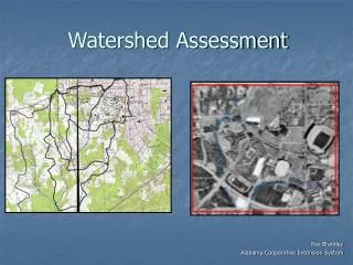
Watershed Assessment Eve Brantley Alabama Cooperative Extension System
Watershed Assessment A comprehensive survey of: • Geography • Land and water uses • Potential and actual pollution sources • History of the waterbody and its watershed
Watershed Assessment Simple (windshield survey) Highly Technical
Watershed Assessment Catchment (small) River Basin (large)
Watershed Assessment • Requires little equipment • Needs to involve stakeholders throughout the watershed & process
Watershed Assessment Once completed, the assessment may be used to: • Screen for pollution problems • Identify potential sources of pollution • Identify sites for monitoring • Interpret biological and chemical data • Give volunteers and residents a sense of the value of the stream or watershed • Educate volunteers and community about potential pollution sources and the stressors affecting the stream and its watershed • Provide a blueprint for protection, conservation and restoration efforts
What Are Your Questions? Scientific Social Historical
Scientific Questions • Where is the stream’s headwaters? • What is its length? • Where is the outlet? • What is the land area of the watershed? • What are the land uses in the watershed? • Point source discharges to the stream? • What chemical, biological, physical data are available for the stream?
Social Questions • What are the political jurisdictions that may impact the watershed? City, county, state government? • Who lives in the watershed? Population and communities? • What is the percentage of watershed land area in each town or jurisdiction? • Who uses the stream? • How do they use it? Recreation, fishing, drinking water, irrigation?
Historical Questions • What is the history of the watershed land uses? • What is the history of the waterbody?
Set Assessment Goals & Define Objectives What is happening to our resource? What is bringing us together? • Streams that are listed as impaired • Water quality problems • Watershed rapidly urbanizing • Loss of habitat
Set Assessment Goals & Define Objectives What is causing the problem? What needs to be done? An assessment can help answer these questions …
Example Overall Goals • Protect fully supporting resources • Prevent further degradation of partially supporting resources • Restore resources that do not support their intended use
Example Objectives Specific Goal - Improve fish habitat • Objective 1 – Improve water temperature by replanting buffer, increasing shade • Objective 2 – Stabilize streambanks to minimize erosion into stream • Objective 3 – Work with local landowners to implement best management practices along stream corridor
Next Steps … • Once you know the questions, you can more efficiently seek the answers • Stakeholder involvement is key! • Bring them to the table in the beginning and they are partners – leave them out and they may be opponents
High Potential to Impact Streams • Hydrologic modifications (dams, bridges, pipes, man-made waterfalls)
High Potential to Impact Streams • Length of stream affected by: • Culverts • Channelizing / dredging • Concrete bottom / bank • Rip-rap / gabion banks • Cattle crossings
High Potential to Impact Streams • Extent of vegetative buffer along banks – width and type of vegetation
High Potential Impact for Protection • Wetlands • Riparian corridors • Headwater streams • Steep slopes
What’s out there?Existing Studies and Data Maps and aerial photos are your tools: • Watershed boundaries • Political jurisdictions • Streams, Lakes, Water Features • Roads
Land Cover Mobile and Baldwin Counties, Alabama Forested and Wetland Open and Agriculture Residential Commercial Water Sarah Johnston, WBNERR
Land Use • Past, existing and future land use is a key factor to current and future water quality and quantity • Different land uses have different impacts on water quality Urban – hydrocarbons & metals Suburban – nutrients & pathogens Transitional – excessive sediment Agriculture – nutrients & stream bank erosion
Aerial Photos Provide information on • major land uses and development • vegetation • changes over time that may have contributed to current degradation
Topographical maps • use to define the watershed area • assist in determining drainage patterns • slope information can be used to determine development potential • Note major features that may be pollutant source - areas such as cities, landfills, mines, highways Find topo maps in outdoor stores, www.topozone.com, state gazetteers
Gaging Stations Urban Area Gravel Pit
Soils • Soils data needed for hydrologic analysis • Hydric soils potential indicator of wetland sites • Well drained soils may provide potential BMP sites
Soil Surveys Natural Resources Conservation Service has soil surveys for most counties • vegetation • infiltration • groundwater storage • runoff • slope stability • erosion • hydric soils
National Wetland Inventory • Information on the characteristics, extent,and status of the Nation’s wetlands and deepwater habitats • Fish and Wildlife Service, http://wetlands.fws.gov/
Geologic maps, USGS General geologic information Significant features in watershed Land Use / Ownership Local government Identify potential partners
Endangered Species • Those species in danger of extinction throughout all or significant portion of their range. • Threatened species are likely to become endangered within the foreseeable future Cultural Resources • Historical or cultural artifacts • State Historic Preservation Officer
Water Quality & Quantity Data • Flow description (gaging stations) • USGS National Hydrography Dataset (NHD) 1:100,000 (GIS) • Designated use – (supporting, 303(d) listed) • TMDLs • Water quality data • Gov’t Agencies • University • Volunteers
Stream Morphological Assessment Data • Longitudinal profile • Cross-sections • Bank Erodibility Hazard Index • Pebble count • Riparian condition
Data Collection & Compilation • Protected Lands • Green Infrastructure • Wetlands • Soils • Topography • Streams Streams Land Use Topography Facilities Soils GIS Themes
Piece data together You start to see trends and ways to arrange information: Example: Ecological Stressors • Type (chemical, physical, biological) • Intensity (concentration or magnitude) • Duration (short or long term) • Frequency (one time, episodic, continuous) • Timing (relative to seasons, life cycles) • Scale (extent, spatial heterogeneity) EPA 1992
What is missing? • Are there gaps in information you need to accurately assess a current or potential problem? • Locate additional sampling sites and data requirements
What does this tell us? Areas to target for • Protection • Conservation • Restoration
Watershed Assessment Framework Revisit Initial Goals Integrate data into database (GIS) Develop list of priority actions Identify data gaps and future assessment needs Create prioritization criteria using goals Develop layers with data of interest
What do we want to do and who will do it? • Sort through assessment to develop watershed strategies that list out: • What • Where • When • Who • Potential Funding
What do we want to do and who will do it? • Example: • What – Stream restoration project • Where – Auburn University • When – Spring 2006 • Who – AL Cooperative Extension System, Auburn University, AL Dept. of Environmental Management, EPA • Potential Funding – EPA 104(b), ADEM 319, Auburn University
Prioritization Framework Establish common ground between stakeholders by selecting priority projects that: 1) Address common goals 2) Rely on separate funding sources Once framework is established: • Data can be updated regularly • New goals can be established and prioritized within the flexible framework • As funding becomes available the projects “next on the list” can be addressed
Revision Time Frame Depends on your purpose … • Annual – may be necessary in rapidly changing areas, gets new stakeholders oriented, updates land use changes • At least every 3-5 years revisit & refine
Use It! • Don’t let the assessment sit on a shelf • Too much time and effort will go into the document to just let it collect dust • Keep the public engaged and eager to move forward with watershed management strategies they have outlined • Tackle some easy projects to build momentum
Alabama Water Watch is a statewide, citizen volunteer water quality monitoring program. Training resources, certification workshops, data management, and analyses. http://www.alabamawaterwatch.org
Acknowledgments • Georgia Adopt-A-Stream, Getting to Know Your Watershed • EPA Online Watershed Academy